Good Morning! Our weather this week has been dry and uneventful. Our dry, quiet pattern will continue. Our high temperature yesterday was 62, which is near normal. We should be back to the low 60’s today, and our weather will be dry through Friday. Showers return to the forecast this weekend, as a Gulf storm system develops. This will be a harsh storm system for Florida and the US East Coast, but here in Alabama, we’ll be on the edge of the main action. The better Rain chances will be east of I-65. Winds will be brisk. Here’s my brief forecast discussion, from Punta Cana, Dominican Republic.
TODAY: Much like yesterday. Mostly sunny and cool. High 63. Breezy. Brisk easterly wind 10 to 15, gusting to 20-25 mph. Partly cloudy and chilly tonight. Low 38.
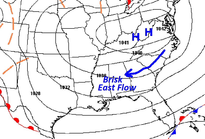
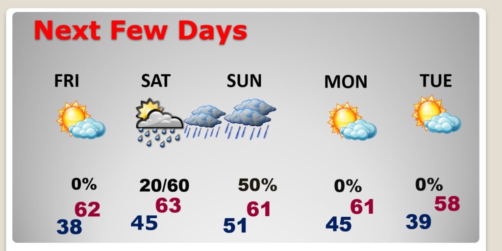
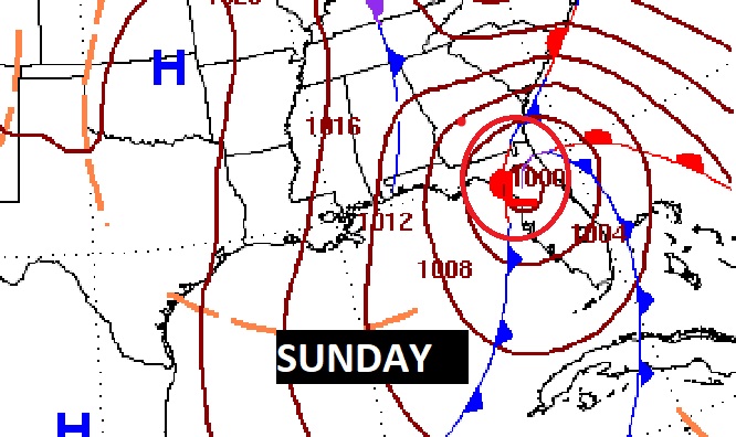
NEXT FEW DAYS: Temperatures will be fairly reasonable for the next few days. We’ll be dry through Friday. Showers return to the forecast this weekend, as a Gulf storm system develops. This will be a harsh storm system for Florida and the US East Coast, but here in Alabama, we’ll be on the edge of the main action. The better Rain chances will be east of I-65. Winds will be brisk.
This will be a particularly harsh storm system for Florida and the US East Coast.
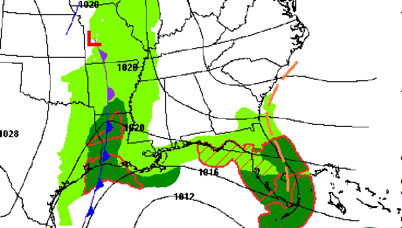
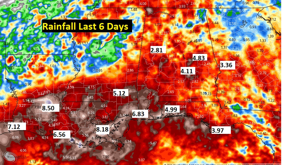
WOW. Look at this map. Here’s the expected rainfall. The better Rain chances will be east of I-65. Amounts up to 2” are certainly possible. Look at Florida and East Coast. Just wow….
Thanks for reading this Blog this morning! I’m going to be on vacation for a few days for Caribbean getaway in the Dominican Republic. My updates to you through Sunday will be rather brief. Have a great day! (PICTURES BELOW)
–Rich
Here’s the view from my room at the Hyatt Zilara Cap Cana in Punta Cana, Dominican Republic.
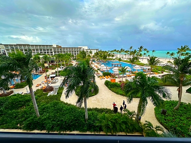
Simply fabulous resort.

I ate at the Asian Hibachi restaurant last night. Always a fun experience.
Meanwhile, Chase is back in Montgomery vacationing with his cousin Briscoe.