
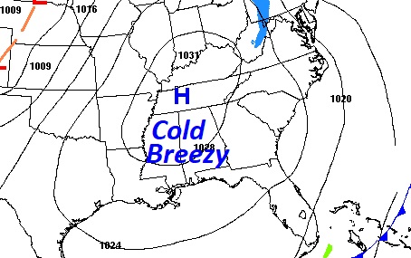
Good Morning! Today will be a rather cold, raw December day. Our high may barely reach 50. Low tonight in the upper 20’s again. Much below normal temperatures will continue. Wednesday will be very chilly, again. Wednesday night will be sub-freezing ,again. Temperatures will moderate a bit late week. Dry weather continues through Friday. A small chance of widely scattered showers return to the forecast by Saturday night and Christmas Eve Sunday. Christmas day looks wet and potentially stormy, but mild.
TODAY: A COLD December day. Sunshine. Raw. High barely 50. North wind 6 to 12. Mph. Clear and cold, again, tonight. Low 29.
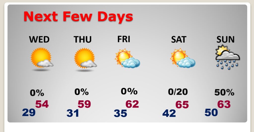
NEXT FEW DAYS: Much below normal temperatures will continue. Wednesday will be very chilly. Wednesday night will be sub-freezing again. Temperatures will moderate a bit late week. Dry weather continues through Friday. A small chance of widely scattered showers return to the forecast by Saturday night and Christmas Eve Sunday. .
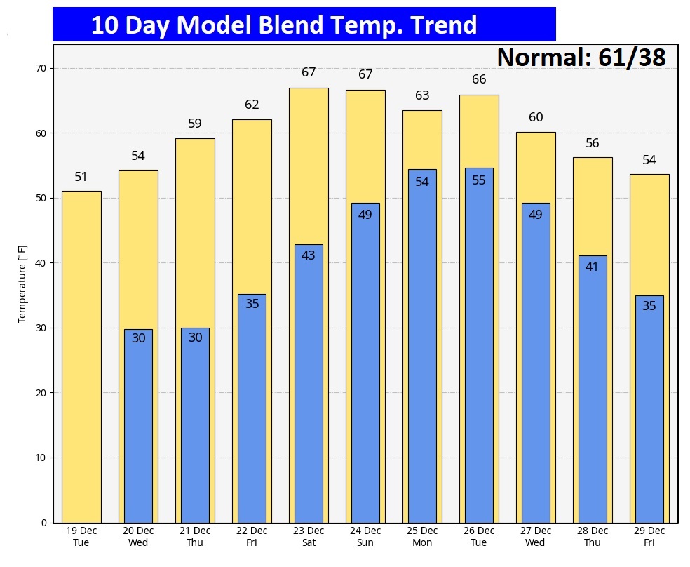
Here’s the 10 Day Model Temperature Trend. Last year Christmas Week was BITTERY COLD with bursting pipes. This year will be much milder.
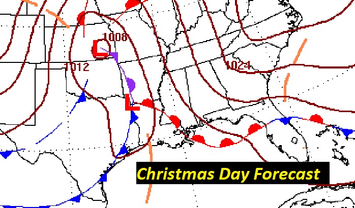
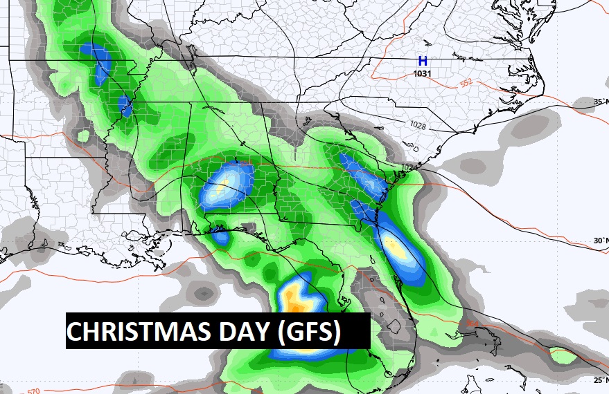
CHRISTMAS FORECAST:
Still looks like we may be dealing with a Christmas Day storm system. Showers and thunderstorms likely. Mild. Morning low 53. Afternoon high 65. Low Christmas night 55.
However the details of this storm system varies widely on the long range models. No agreement in the details whatsoever. Stay tuned.
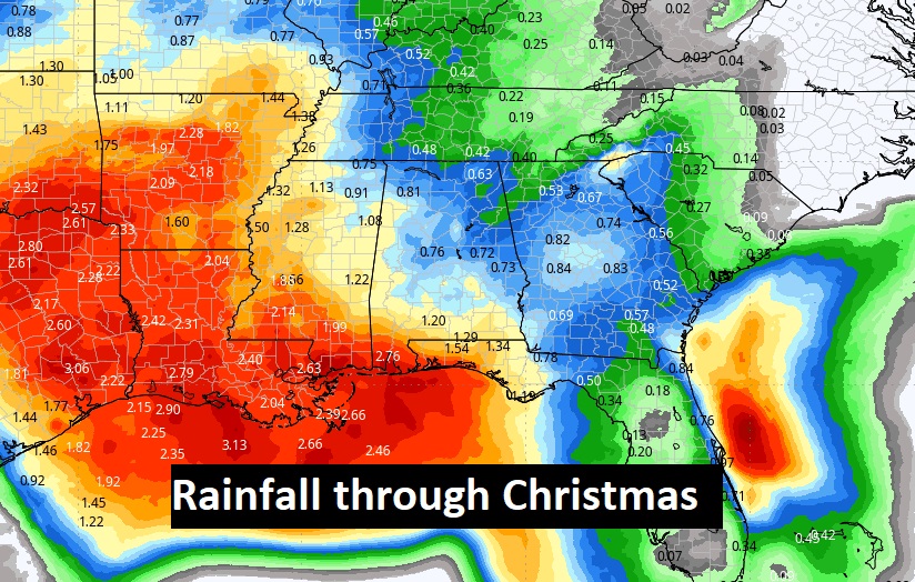
Here’s your expected rainfall through Christmas Day.
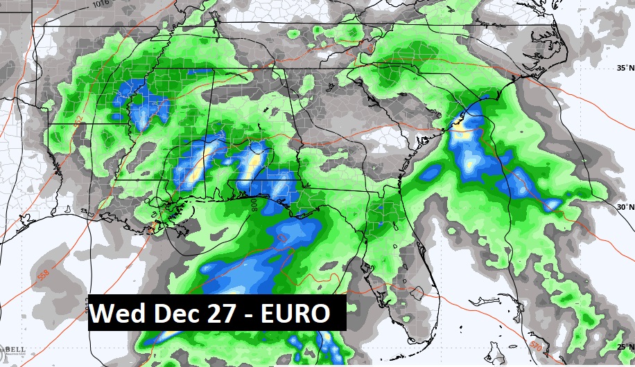
The models are suggesting possibly a two part Christmas week storm system. Here’s the EURO on Wednesday, December 27th.
Thanks for reading this Blog this morning! I’m headed back to work today after my Tropical Getaway
Today we’ll be LIVE on the radio from 6 to 9 on NewsTalk 93.1.
–Rich