
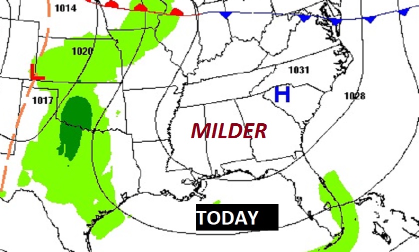
Good Morning! Welcome to Winter. Today is the first full day of Winter. Our chilly temperatures are starting to moderate. Today we’ll be closer to “normal” for late December. Tonight will not be as cold as the previous nights. And, we’re in for a nice Christmas Weekend warm-up. Highs Saturday and Sunday will aim for the upper 60’s. Not bad, considering the bitter cold days we had last year on Christmas week. Dry weather continues through Saturday. A small chance of widely scattered showers return to the forecast by on Christmas Eve Sunday. Rain become likely Sunday night. Rain and possibly thunderstorms will dominate the Christmas forecast. At least it will be mild this year, unlike last Christmas. After the Christmas storm system, we’re dry for the rest of the year. Here’s my brief forecast discussion.
TODAY: Partial sunshine. (lots of high cloudiness will obscure the sun at times) Not as cool. High near 60. East wind 6 to 12 mph. Mostly cloudy, not as cold tonight. Low 37.
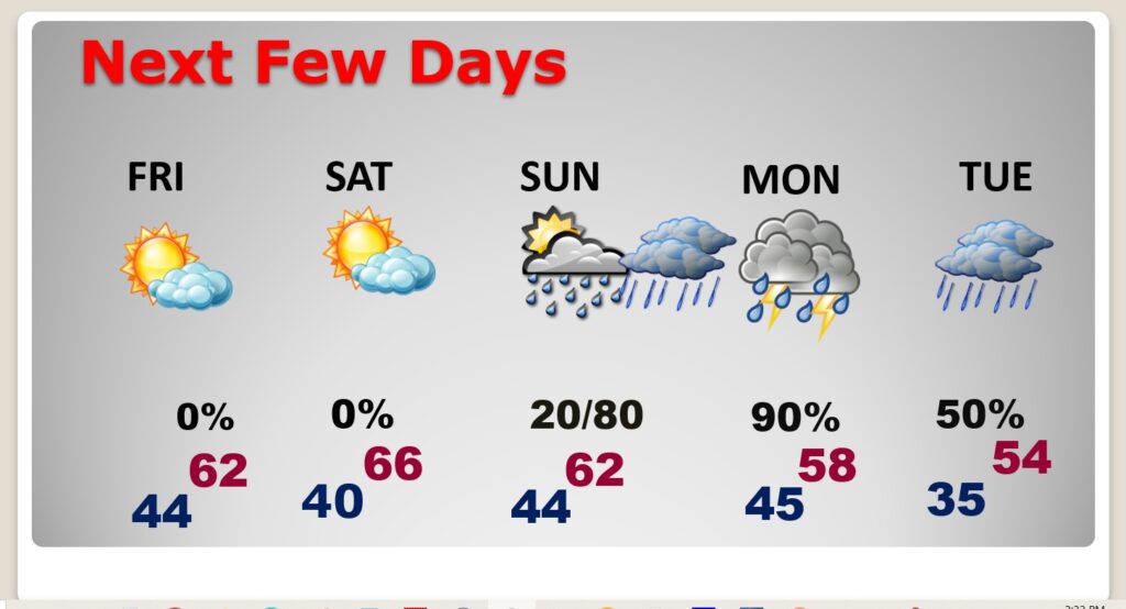
NEXT FEW DAYS: We’re in for a very nice Christmas Weekend warm-up. Highs Saturday and Sunday will aim for the upper 60’s. Mid 60 on Christmas Day. Dry weather continues through Saturday. A small chance of widely scattered showers return to the forecast by on Christmas Eve Sunday. Rain become likely Sunday night. Rain and possibly thunderstorms will dominate the Christmas forecast. Looks like some lingering showers are possible Tuesday.
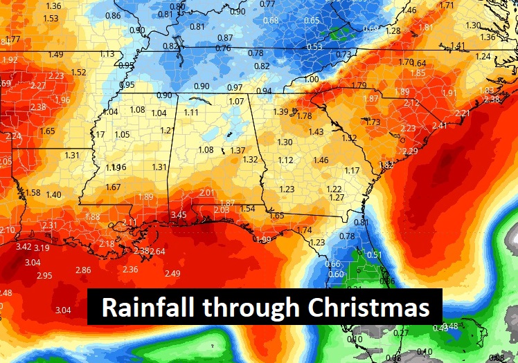
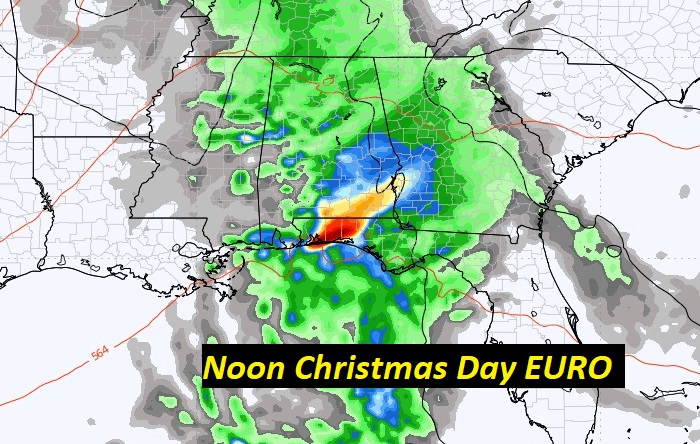
Here’s the expected rainfall through Tuesday. We could see some soaking rain on Christmas. Notice the heavier rainfall totals are down on the coast.
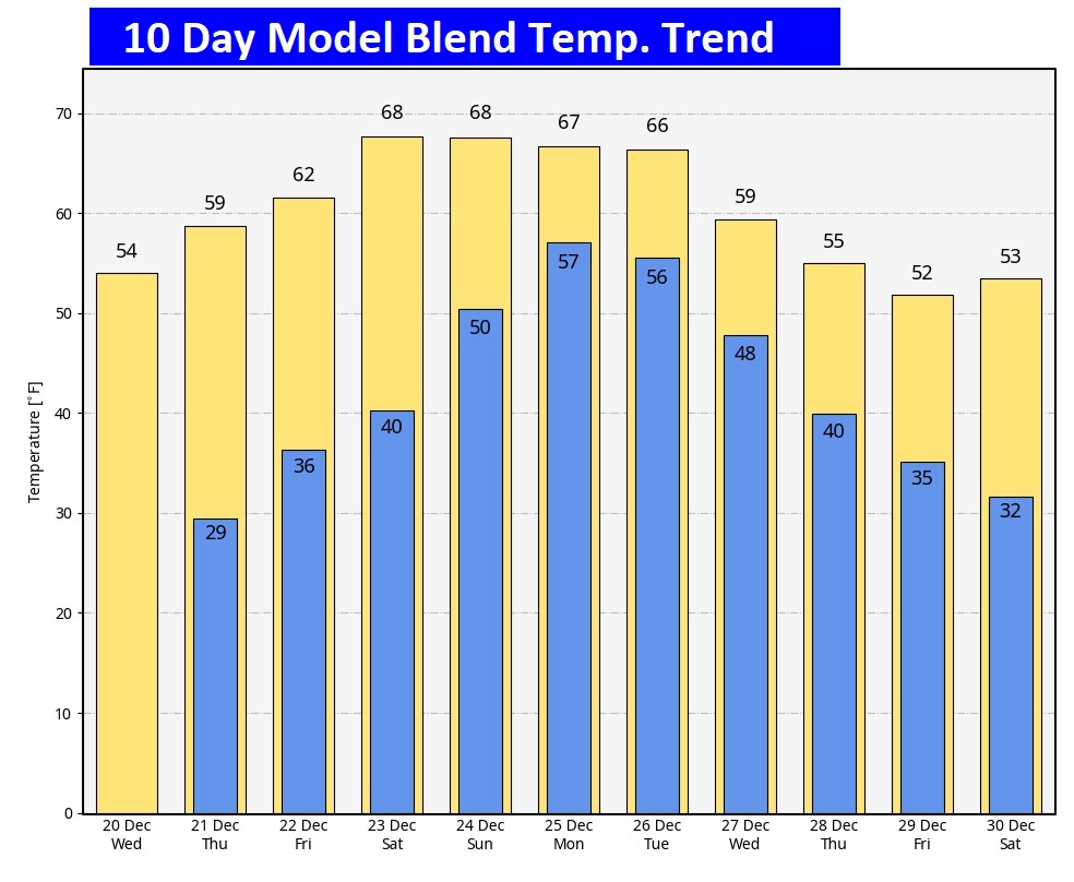
Here’s the 10 Day Model Temperature Trend. What a turnaround from last year. This year will be much milder. Much of Christmas week will be mild. It will turn colder late week, towards New Years Weekend.
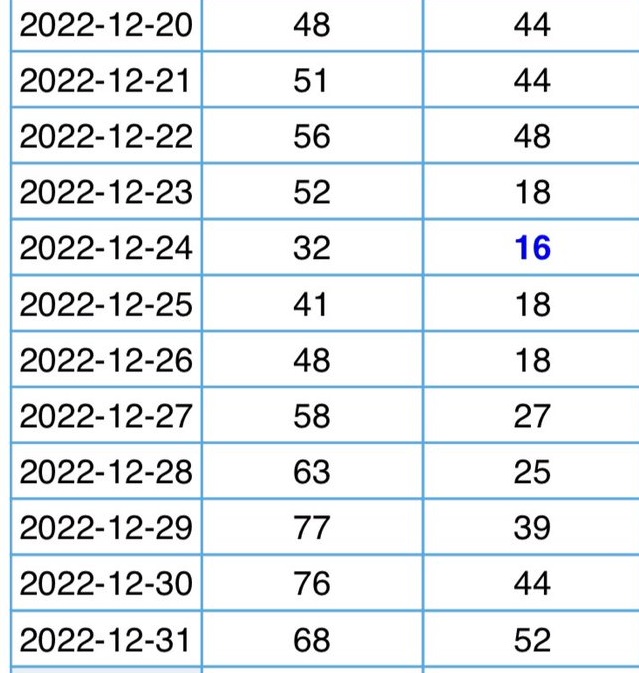
CHRISTMAS PAST: Do you remember Christmas Week last year? I’m trying to forget. It was bitterly cold with pipes bursting all over town. Look at the numbers. W O W .
CHRISTMAS FORECAST:
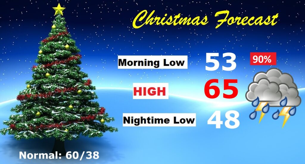
Looks quite wet starting Sunday night and continuing Christmas Day and Christmas Night. Rain and a few thunderstorms likely. Mild. Morning low 58. Afternoon high 65. Low Christmas night 56.
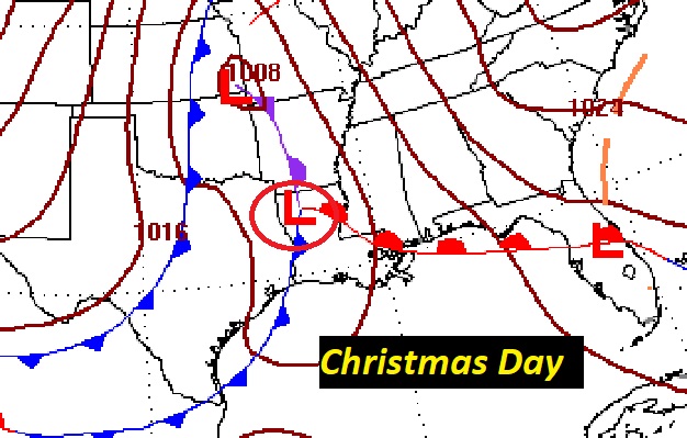
Potent storm system will drench the Gulf states on Christmas. No Severe weather is expected.
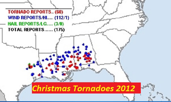
Fortunately no severe weather this Christmas. I still have vivid memories on that major Christmas Day tornado outbreak. There were 31 tornadoes across the Gulf South, including two EF-3’s. Here in Alabama there were 18 tornadoes incuding several here in central Alabama. Read more here:
https://en.wikipedia.org/wiki/Late_December_2012_North_American_storm_complex
Thanks for reading this Blog this morning! This morning everything is normal, including Live on the radio on NewsTalk 93-1. There will be another Blog update in the morning.
–Rich