
Good Morning! Today we should make it above normal for the first time in several days. Again today, high cloudiness will be extensive. We’re in for a nice Christmas Weekend warm-up. Highs Saturday and Sunday are headed for the upper 60’s. It’s a far cry from the bitter cold days we had last year on Christmas week. Dry weather continues through Saturday. A small chance of widely scattered showers return to the forecast by on Christmas Eve Sunday. Rain become likely Sunday night. Rain and possibly thunderstorms will dominate the Christmas forecast. That might be the last rain we have this year. The outlook for New Years weekend looks cool and dry. Here’s my brief forecast discussion.
TODAY: Lots of high cloudiness will dominate. Milder. High in the mid 60’s. East wind 5 to 10 mph. Partly cloudy, not as cold tonight. Low 41.
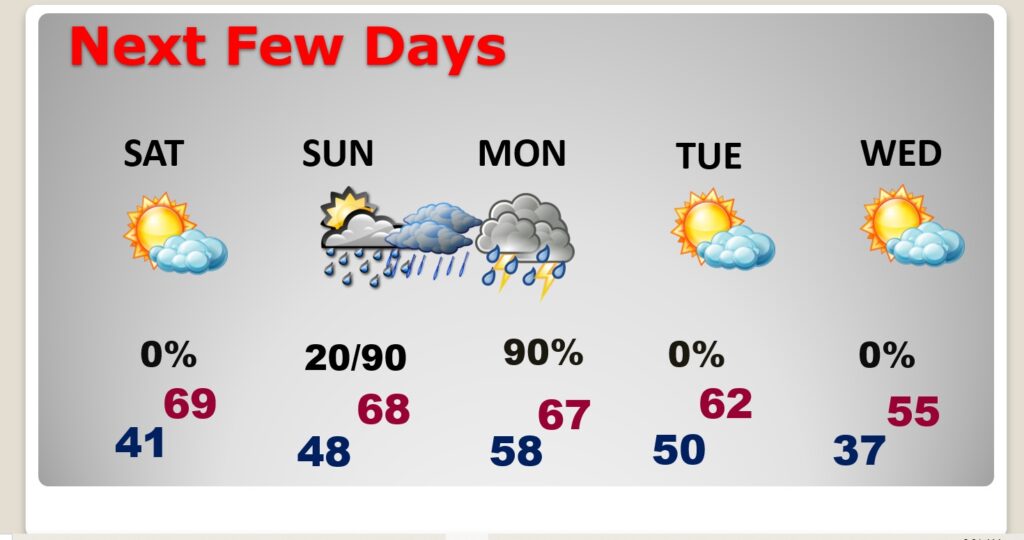
NEXT FEW DAYS: Most of Christmas weekend looks pretty good! Highs Saturday and Sunday will be in the upper 60’s. Mid to upper 60s on Christmas Day. (Normal: 60/38) Dry weather continues through Saturday. A small chance of widely scattered showers return to the forecast by on Christmas Eve Sunday. Rain become likely Sunday night. Rain and possibly thunderstorms will dominate the Christmas forecast. Tuesday through the end of the year looks dry.
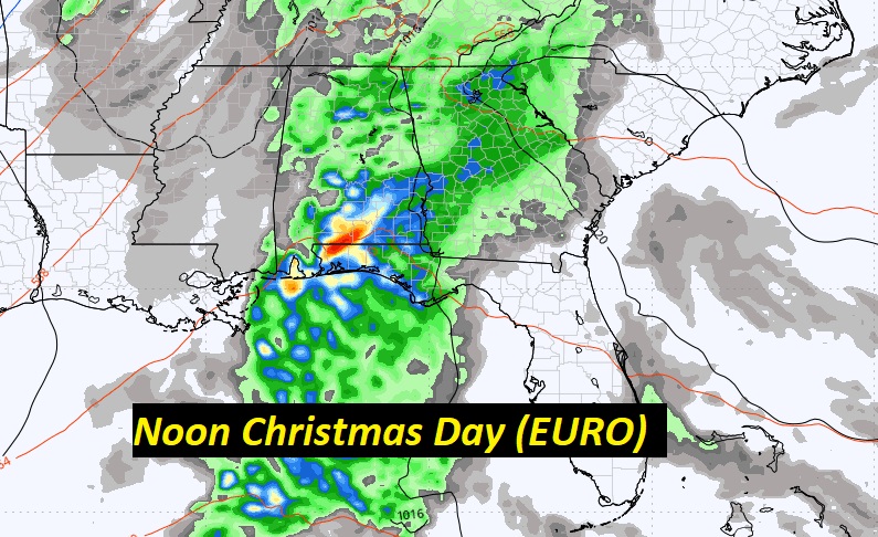
Here’s the expected rainfall through Tuesday. We could see some soaking rain on Christmas. For instance, if you average out the models, Montgomery’s rainfall could average 1.80”. Heavier amounts are expected closer to the coast.

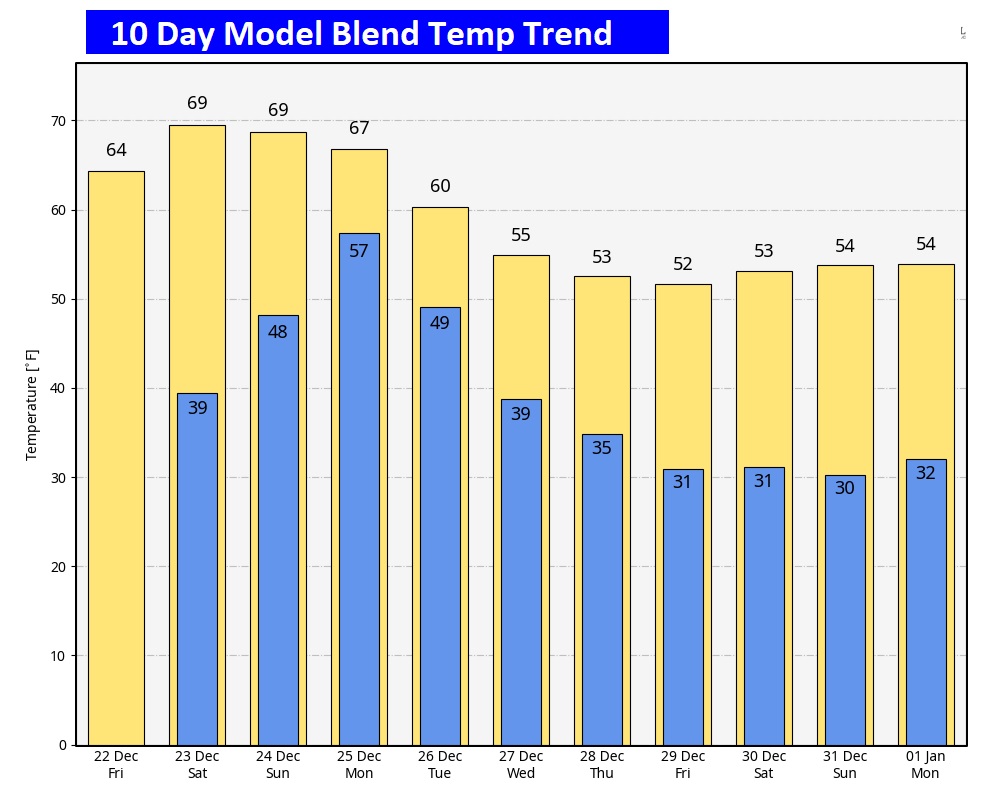
Here’s the 10 Day Model Temperature Trend. What a turnaround from last year. This year will be much milder. Much of Christmas week will be mild. It will turn colder late week, towards New Years Weekend. I don’t see anything shocking. But, stand by. We’re starting to see clues of a potential January shocker.
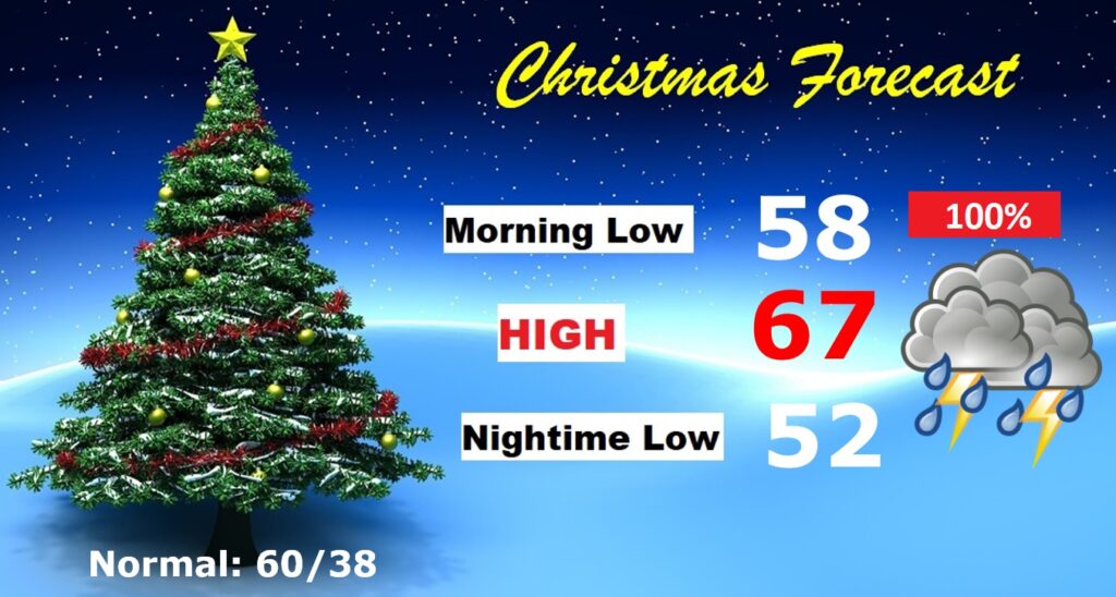
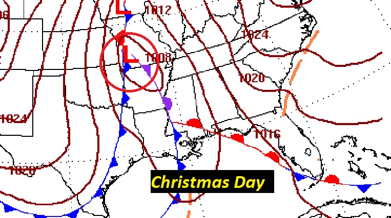
CHRISTMAS FORECAST:
Looks quite wet starting Sunday night and continuing Christmas Day and Christmas Night. Rain and a few thunderstorms likely. Mild. Morning low 58. Afternoon high 67. Low Christmas night 52.
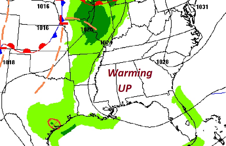
Potent storm system will drench the Gulf states on Christmas. No Severe weather is expected.
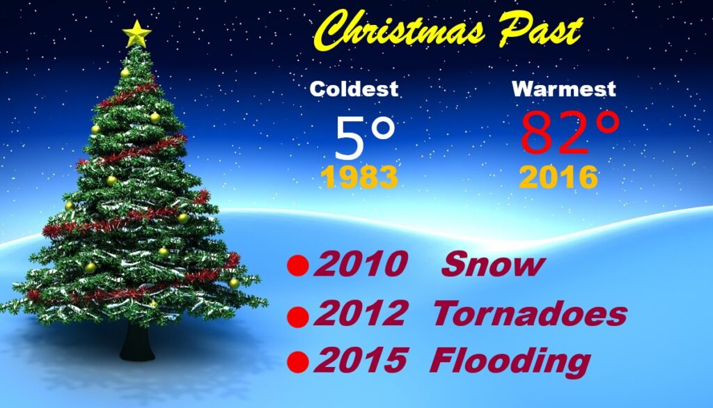
CHRISTMAS PAST: This year will be the 46th Christmas I have covered for you. From 5° in 1983 to 82° in 2016. Most of us saw snowflakes in 2010, some towns even had enough to whiten the ground. And, there was the Tornado Christmas in 2012 with 18 tornadoes here in Alabama.
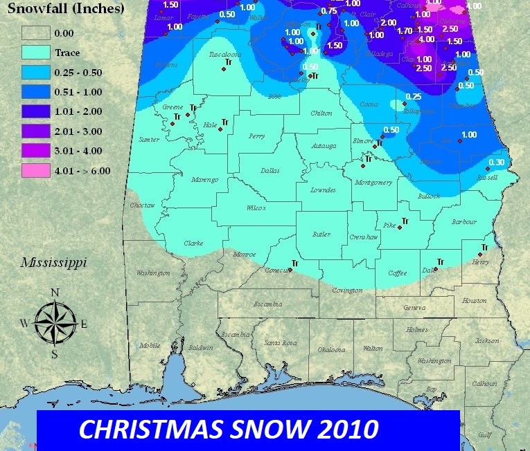
Here’s the 2010 Christmas Snowfall map. Accumulating snow was generally across the northern half of the state. Notice 1” at Auburn. That officially qualifies as a White Christmas. Montgomery has never had a White Christmas. Records go back to 1872.
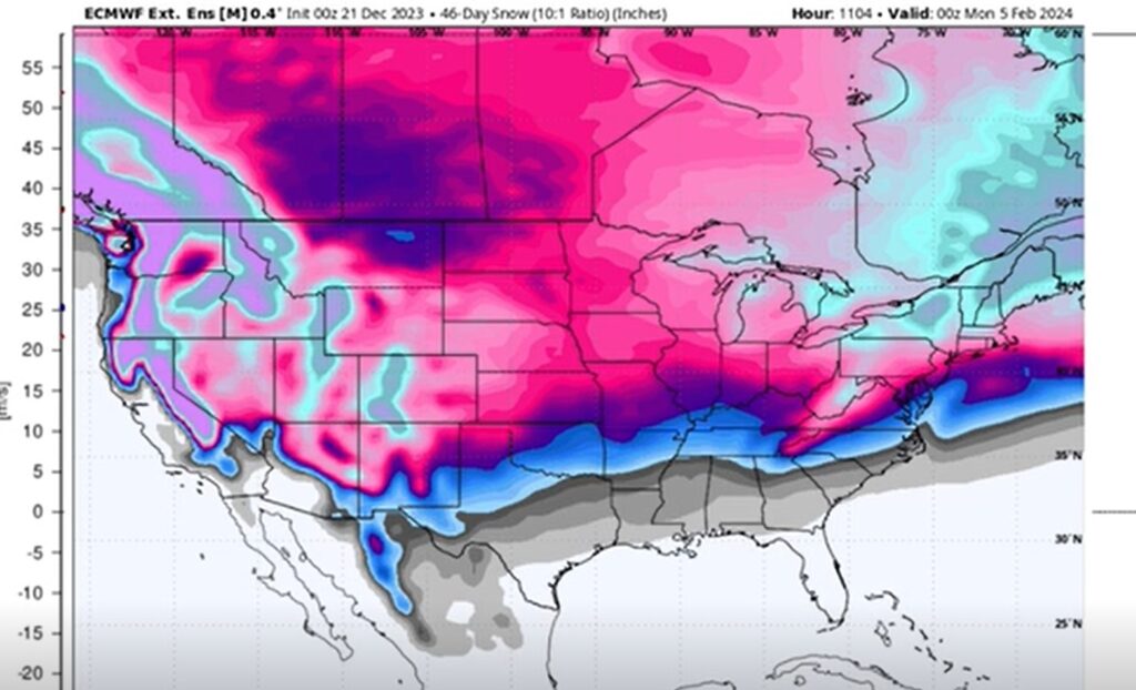
NO White Christmas this year for most of America, BUT, the EURO 46 Day snowfall forecast looks interesting.
Thanks for reading this Blog this morning! This morning everything is normal, including Live on the radio on NewsTalk 93-1. There will be another Blog update in the morning.
–Rich