
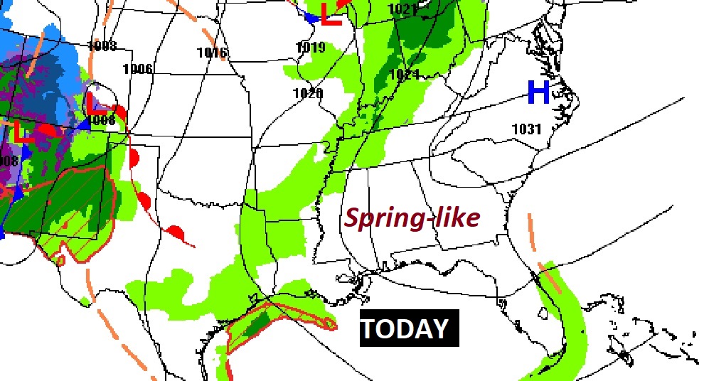
Good Morning! It’s Christmas Weekend, but today will feel more like Spring. Today and Christmas Eve Sunday, are headed for the upper 60’s. It’s a far cry from the bitter cold days we had last year on Christmas week. Dry weather continues today. A small chance of widely scattered showers return to the forecast by on Christmas Eve Sunday. Rain become likely Sunday night. Rain and possibly thunderstorms will dominate the Christmas forecast. That might be the last rain we have this year. It will turn much colder toward New Years Weekend.
TODAY: A good bit of sunshine mixed with high clouds. The warm-up continues. High 68 to 70. Southeast wind 5 to 10 mph. Partly cloudy, not as cold tonight. Low 50.
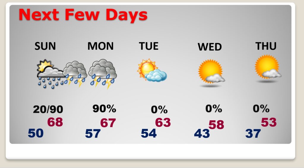
NEXT FEW DAYS: Comfortable temperatures continue. Again Christmas Eve Sunday, Highs will be in the upper 60’s. High on Christmas Day near 67. (Normal: 60/38) A small chance of widely scattered showers return to the forecast by on Christmas Eve Sunday. Rain become likely Sunday night. Rain and possibly thunderstorms will dominate the Christmas forecast. Tuesday through the end of the year looks dry. It will turn much colder toward New Years Weekend.
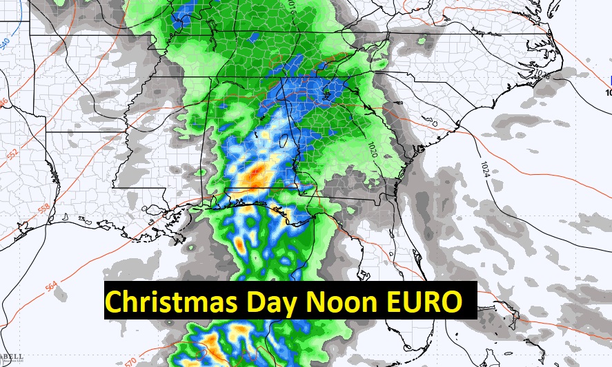
Here’s the expected rainfall through Tuesday. Heaviest rain will be Sunday night and Christmas Day. Most of us could see 1 to 1.5 inches. Heavier amounts are expected closer to the coast.

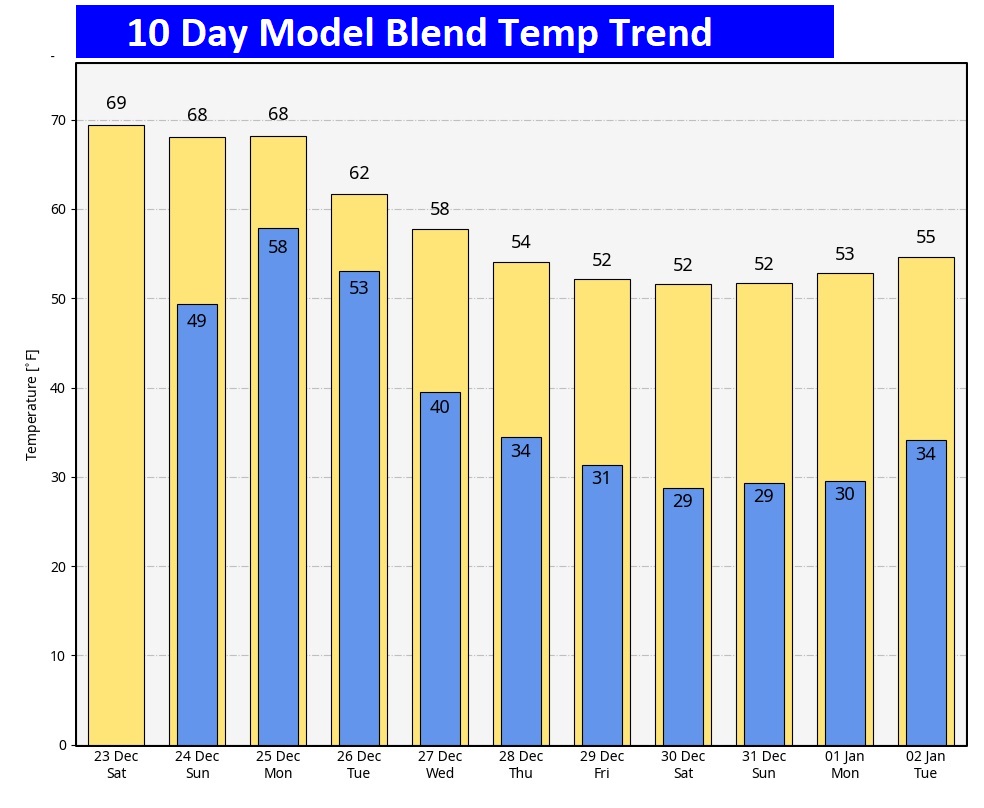
Here’s the 10 Day Model Temperature Trend. What a turnaround from last year. Much of Christmas week will be mild. It will turn colder late week, towards New Years Weekend. I don’t see anything shocking, yet.
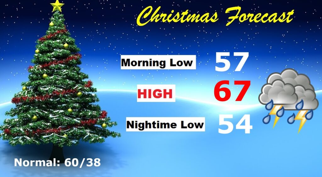
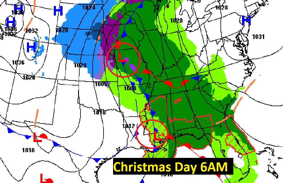
CHRISTMAS FORECAST:
Looks quite wet starting Sunday night and continuing Christmas Day and Christmas Night. Rain and a few thunderstorms likely. Mild. Morning low 57. Afternoon high 67. Low Christmas night 54.
A Potent storm system will drench the Gulf states on Christmas. No Severe weather is expected.
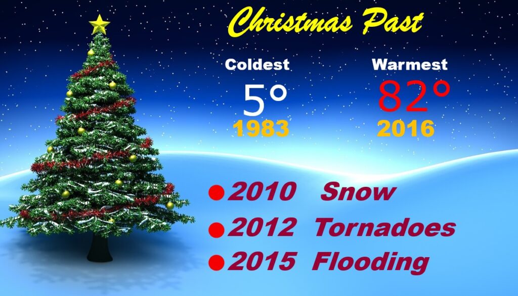
CHRISTMAS PAST: This year will be the 46th Christmas I have covered for you. From 5° in 1983 to 82° in 2016. Most of us saw snowflakes in 2010, some towns even had enough to whiten the ground. And, there was the Tornado Christmas in 2012 with 18 tornadoes here in Alabama.
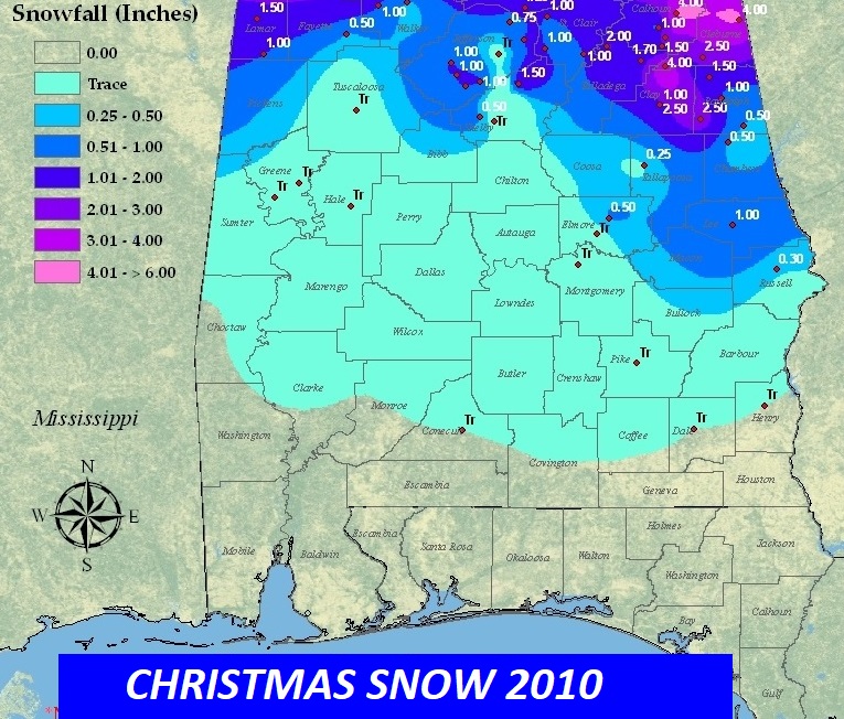
Here’s the 2010 Christmas Snowfall map. Accumulating snow was generally across the northern half of the state. Notice 1” at Auburn. That officially qualifies as a White Christmas. Montgomery has never had a White Christmas. Records go back to 1872.
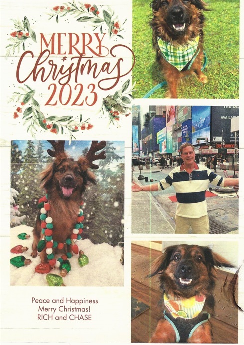
MERRY CHRISTMAS FROM ME AND CHASE! I hope you have a wonderful holiday. Thanks for your loyalty for all these many, many years.
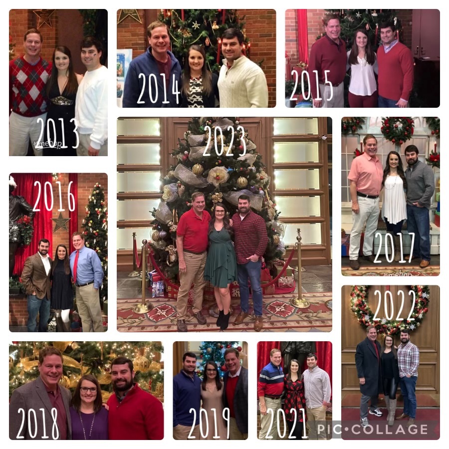
A wonderful 11 year Christmas tradition continues! (Brief COVID 2020 interruption). “A Christmas Carol” at ASF. My friends and I, Drew and Destiny, really enjoyed the new production.! Merry Christmas 🎄🎁!
Thanks for reading this Blog this morning! Have a great Christmas Weekend. MERRY CHRISTMAS!
–Rich