Good Morning! After a very mild Christmas Day, we have a pretty decent string of days ahead of us. (The Christmas high temp. was 70° at MGM) Today will feature a lot of high cloudiness, but our temperatures remain rather comfortable for December. Bright sunshine returns starting Wednesday. Late week temperatures will turn much colder, especially Thursday and Friday. Expect freezing temperatures on Friday and Saturday mornings. Looks like we’ll be storm-free and dry through the rest of 2023 with cool days and cold nights.
TODAY: Patchy fog this morning. Still just a bit above normal. A good bit of cloudiness Today & tonight. High 62. Northwest wind 5 to 10 mph. Low tonight 41.
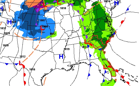
Attention Holiday Travelers: A big snowstorm is moving east out of the Rockies and the Plains states into the Heartland, This will put a strain on air travel, causing a ripple effect and several delays.
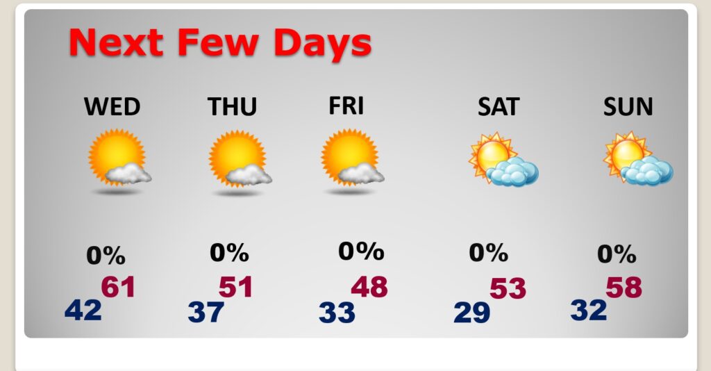
NEXT FEW DAYS: Uneventful. Dry and storm-free for the rest of the year. Turning much colder Thursday and Friday. On Friday we may not make it out of the 40’s.
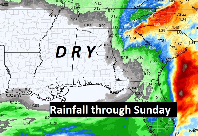
Here’s the expected rainfall through the rest of the year. We should be dry at least through Sunday. The Euro brings in more rain on New Years Day.
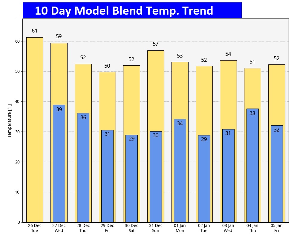
Here’s the 10 Day Model Temperature Trend. Gradually, by late week, we’ll be getting into an extended pattern of COLDER weather.
Thanks for reading this Blog this morning! Have a great day. Tomorrow, everything is back to normal, including a video forecast discussion and Back LIVE on the radio on NewsTalk 93.1
–Rich
Santa was very good to Chase ! I hope you had a wonderful Christmas!