
Good Morning! Today will be rather gray again. Patchy morning fog. But, at least for today, highs will be near “normal”. Colder is on the way for tonight and Thursday. Bright sunshine returns starting Wednesday. Late week temperatures will turn much colder, especially Thursday and Friday. Expect freezing temperatures on Friday and Saturday mornings. Looks like we’ll be storm-free and dry through the rest of 2023 with cool days and cold nights. January could be quite a chilly month in the Southeast US. Here’s my brief forecast discussion.
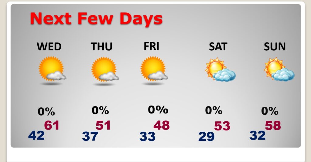
TODAY: Patchy fog this morning. Still just a bit above normal. A good bit of cloudiness Today & tonight. Limited sunshine High 60. West wind 5 to 10 mph. Low tonight 37.
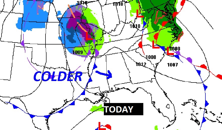
A cold front is on the way. We will be COLDER behind the front tomorrow.
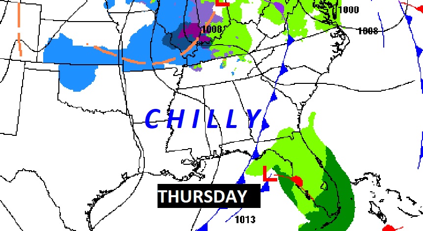
NEXT FEW DAYS: Uneventful. Dry and storm-free for the rest of the year. Turning much colder Thursday and Friday. On Friday we may not make it out of the 40’s.
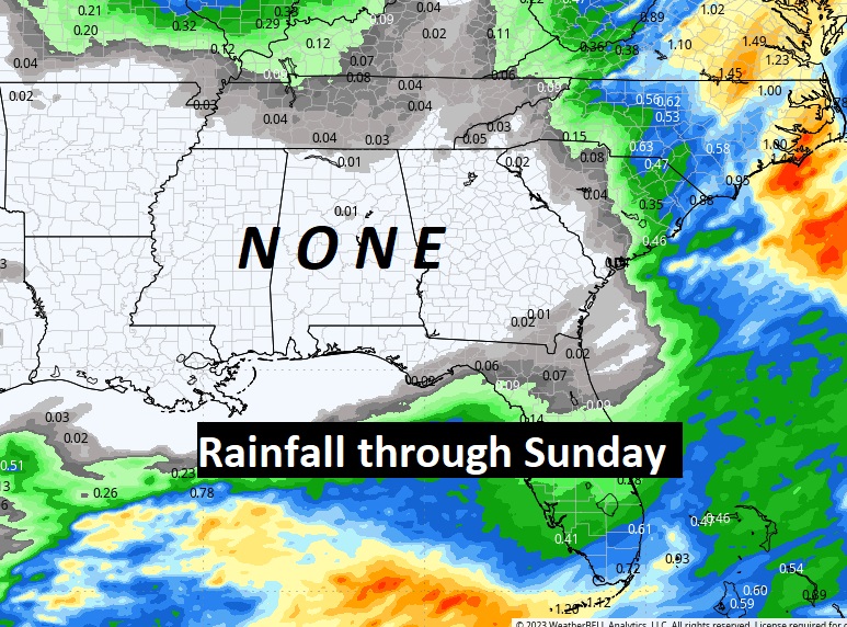
Here’s the expected rainfall through the rest of the year. We should be dry at least through Sunday. The models bring in the risk of showers on New Years Day.
Here’s the 10 Day Model Temperature Trend. Gradually, by late week, we’ll be getting into an extended pattern of COLDER weather. If you take the numbers literally, we could see freezing temperatures at least 6 of the 10 days.
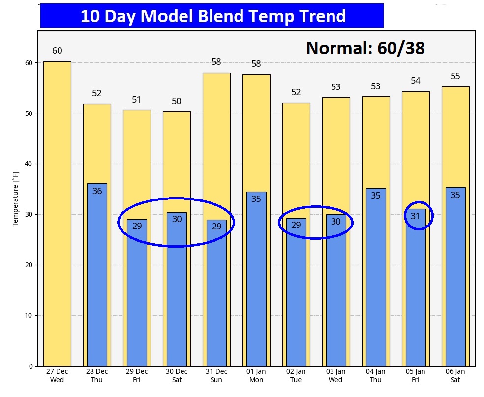
The month of January could be quite chilly here the Southeastern US. Most of the rest of America will be ABOVE normal except for US,
Thanks for reading this Blog this morning! Have a great day. Tomorrow, everything is back to normal, including a video forecast discussion and Back LIVE on the radio on NewsTalk 93.1
–Rich