
Good Morning! It’s cold. Today’s high may not reach 50. A few “novelty” spotty snow flurries may dot the radar screen this evening, mainly from Birmingham northward. We’re headed to freezing, again, for the next two nights. Sunshine will dominate the New Years weekend, but it will be chilly. The next chance of showers arrives New Years Day. Another storm system will bring more rain next Wednesday. Here’s my brief forecast discussion.
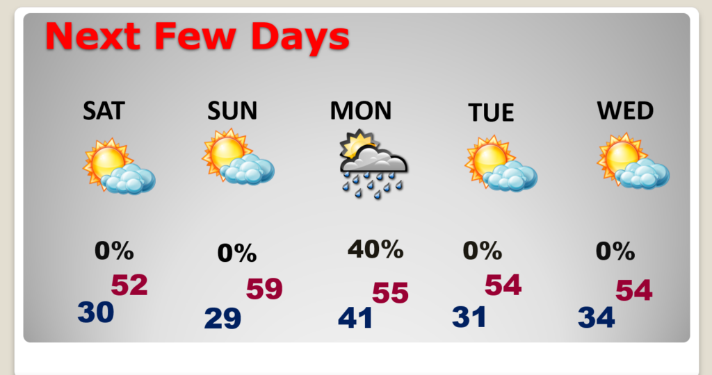
TODAY: Sunshine, but breezy & very chilly. High will struggle to reach the 50. West wind 10 to 15 + MPH. Clear and cold tonight. Low near 28.
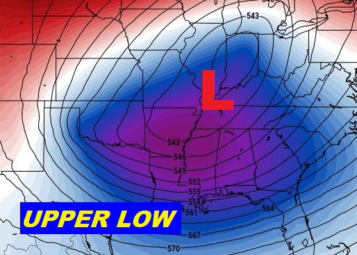
An upper low up at 20,000 feet will help promote the colder weather. The very cold air aloft will mix down to the surface.
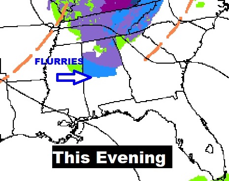
A few “novelty” spotty snow flurries may dot the radar screen this evening, mainly from Birmingham northward.

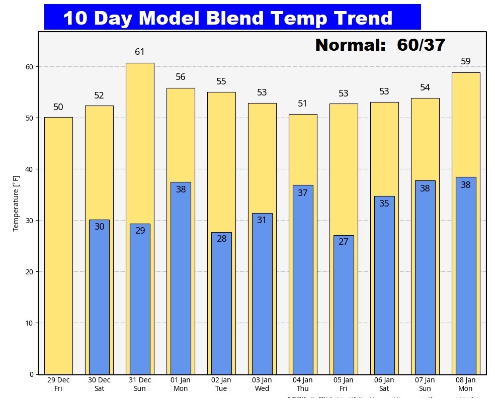
NEXT FEW DAYS: Dry and storm-free for the rest of the year. Chilly days and cold nights. . Sunshine will dominate the final weekend of 2023. It will continue well below normal, with highs in the 50’s and lows in the 30’s. The next chance of showers arrives New Years Day. The second storm system brings more rain to the forecast next Wednesday the 3rd. Temperatures will stay below normal.
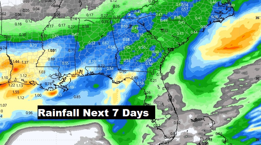
Here’s the expected rainfall through the next 7 days. The models bring in the risk of showers on New Years Day. The second storm system brings more rain to the forecast next Wednesday the 3rd.
Here’s the 10 Day Model Temperature Trend. We’re into an extended pattern of Chilly weather. We could see a freeze 5 of the next 10 mornings.
Thanks for reading this Blog this morning! There will be another blog – The Weekend Edition – in the morning. Have a nice final weekend of 2023.
–Rich