Good Morning! Yesterday was dismal. Cold and wet, high 44°. Today, after some morning fog, sunshine will return with mid 50’s. Enjoy this brief break between storm systems. Next in the pipeline, expect round of rain and thunderstorms Friday night, exiting early Saturday morning. The rest of the weekend should be dry, before the next storm system approaches Monday PM. . The Late Monday/Early Tuesday storms system is the Biggest Deal, by far, with heavy rain and thunderstorms. However, so far, it appears the Severe Threat with that Monday PM system will stay near the coast. We’re watching it closely. Stay tuned. Here’s my brief forecast discussion.
TODAY: Patchy “freezing” fog, especially near bodies of water until 8AM.
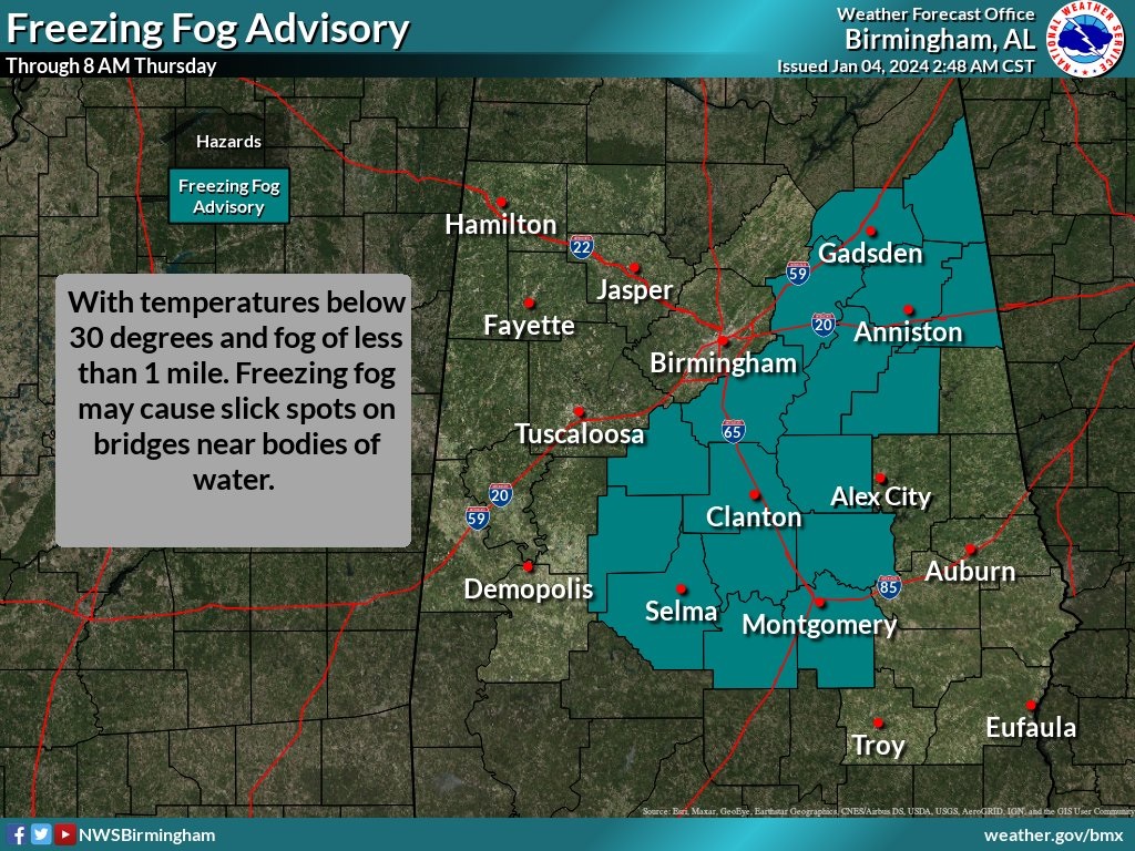
Otherwise, sunshine returns today. Not a cold. High in the mid 50’s. North wind at 5 to 10. Mostly clear and cold tonight. Low 33.
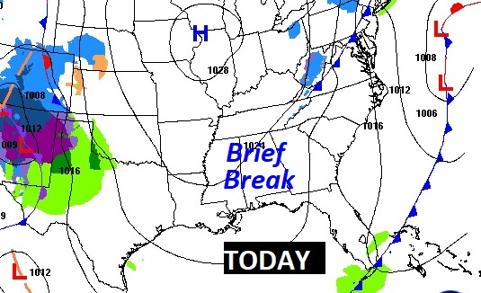
NEXT FEW DAYS: The brief break between storm systems won’t last long. There’s more wet weather on the way. Showers and thunderstorms are a good bet by Friday night into Saturday AM . Much of the weekend will be dry. But, there’s another storm system on the way. That Late Monday/Early Tuesday storms system is the Biggest Deal by far with heavy rain and thunderstorms.
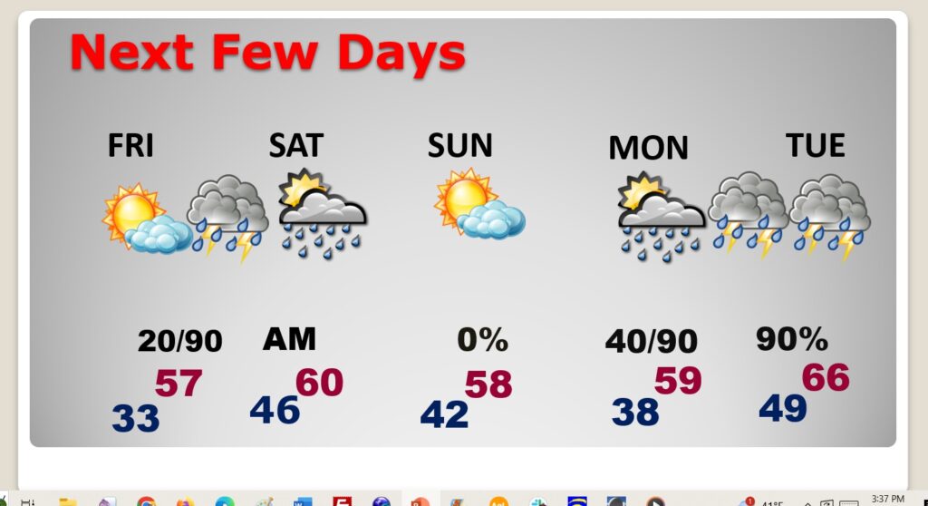
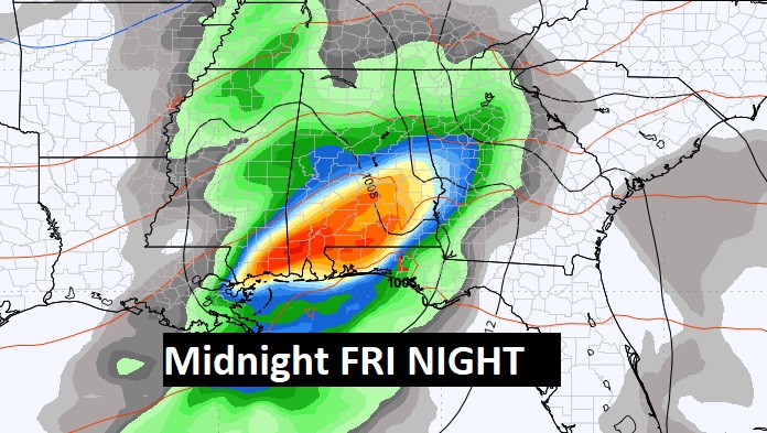
The next storm system will bring a round of rain and storms Friday night, exiting the area early Saturday AM.
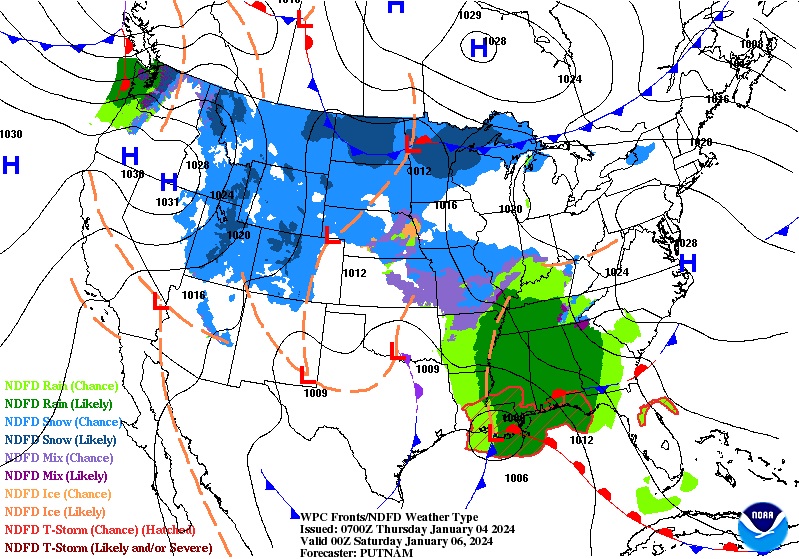
The Late Monday/Early Tuesday storms system is the Biggest Deal by far with heavy rain and thunderstorms. But, it looks like the main severe weather threat will be closer to the Gulf Coast. However we are still closely monitoring the potential Severe Weather Threat.
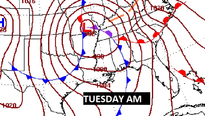
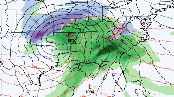
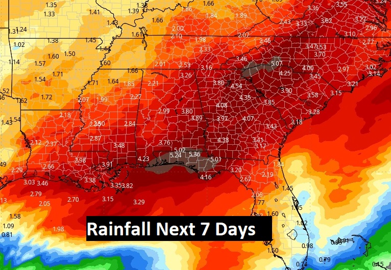
Rainfall amounts could be locally excessive, especially with storm system #3 Monday night/Tuesday.
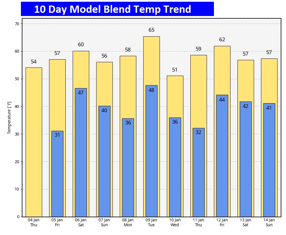
Here’s the 10 Day Model Temperature Trend. Lots of ups and downs in between storm systems.
This morning everything is normal including Live on the radio 6 to 9AM on NewsTalk 93.1 WACV. There will be another Blog update and Forecast Video in the morning.
–Rich
