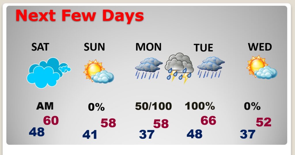
Good Morning! Today will be a pretty decent Friday. Sun/clouds, Dry. High near 60. But, the weather will go down hill quickly this evening. Expect widespread rain and a few thunderstorms overnight tonight. This is a fairly fast moving system. It should clear much of the area before sunrise. The weekend is dry. Saturday is mild. Sunday’s a pretty nice day. The Late Monday/Early Tuesday storms system is the Biggest Deal, by far, with heavy rain and thunderstorms. However, right now, it appears the Severe Threat with that Monday PM system will stay near the coast. We continue to watch it closely. Total rainfall from the 2 storm systems could be significant. Here’s my brief forecast discussion.
TODAY: Pretty good day. Sun/cloud mix. Mild. High near 60. BREEZY. East wind 12 to 16+ mph. Showers during the evening, Then widespread rain and a few storms overnight, especially 10PM-4AM. Rainfall up to an inch. Windy. gusts 30 to 35 mph. Low 48.
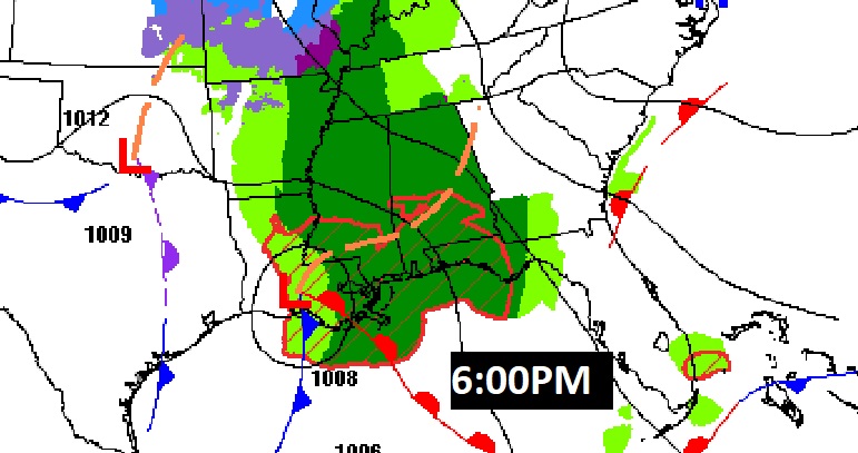
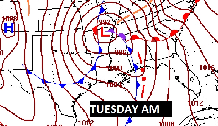
Here’s the map set up at 6:00PM. Note the low along the LA coast. The warm air sector stays south. The best Severe Weather Threat will hug the coast.
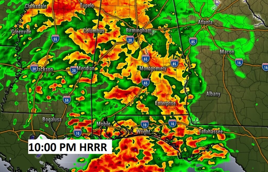
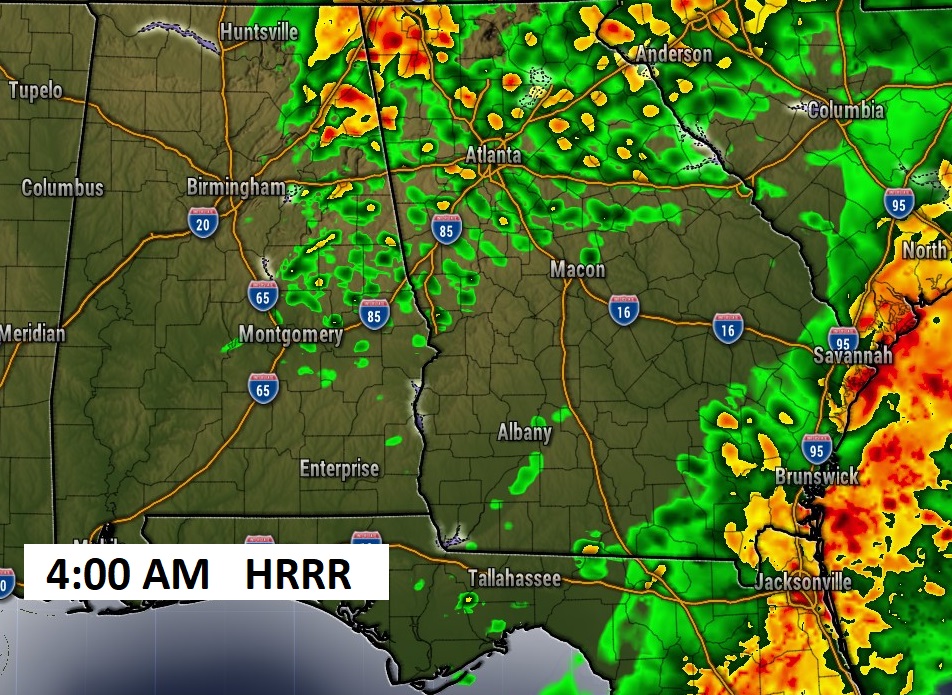
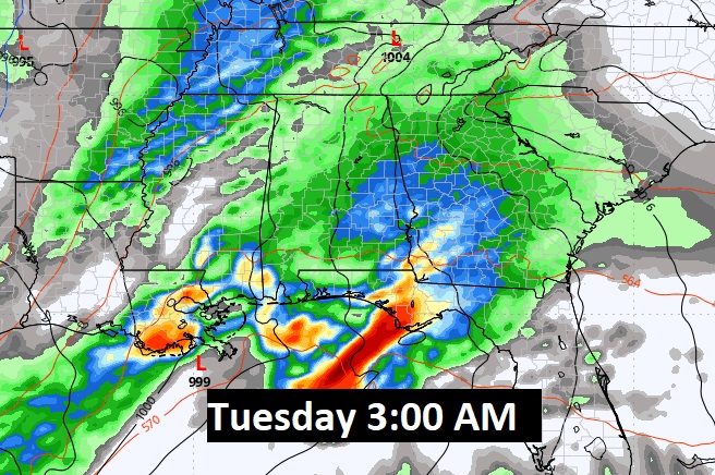
A couple of Future Radar snapshots: at 10:pm and 4:AM. You get the idea. Widespread rain. Locally heavy.
Also NWS says:
NWS – Birmingham – Jason Davis 4:27 AM
We’re continuing to watch a system moving through Monday night and Tuesday. What we can say for certain is that it will be windy with potential for wind gusts unrelated to thunderstorms of 35 to 40 mph, and a wind advisory will probably be needed. Whether we get any flooding or severe storms will be dependent on a lot of expected storms that will be located along the coast that could limit instability/rainfall amounts in our area.
NEXT FEW DAYS: The storm system exits the state early Saturday morning. Much of Saturday cloudy but mild. High near 60. Lots of sun on Sunday. Seasonable. High upper 50’s. Risk of showers begins Monday afternoon. Widespread locally heavy rain and thunderstorms Monday night in through at least mid-day Tuesday. Back to dry, chilly weather behind the storm on Wednesday.
The Late Monday/Early Tuesday storms system is the Biggest Deal by far with heavy rain and thunderstorms. But, it looks like the main severe weather threat will be closer to the Gulf Coast.
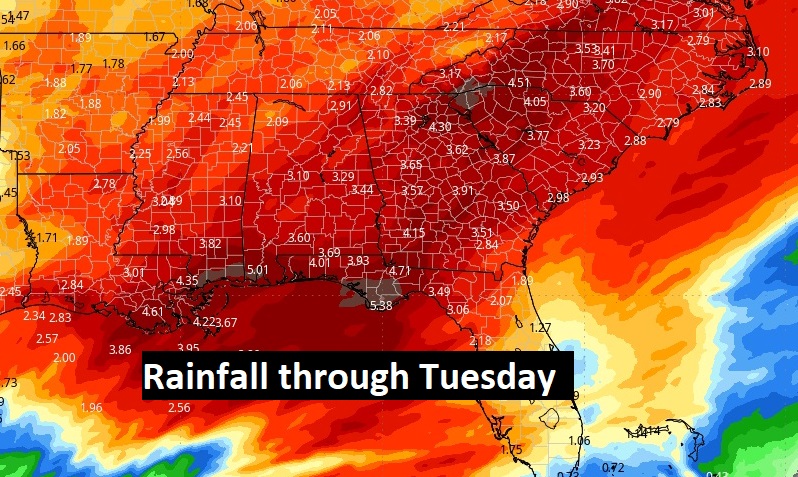
Rainfall amounts could be locally excessive. Take a look at this map. Heaviest rainfall amounts will be near the Gulf Coast.
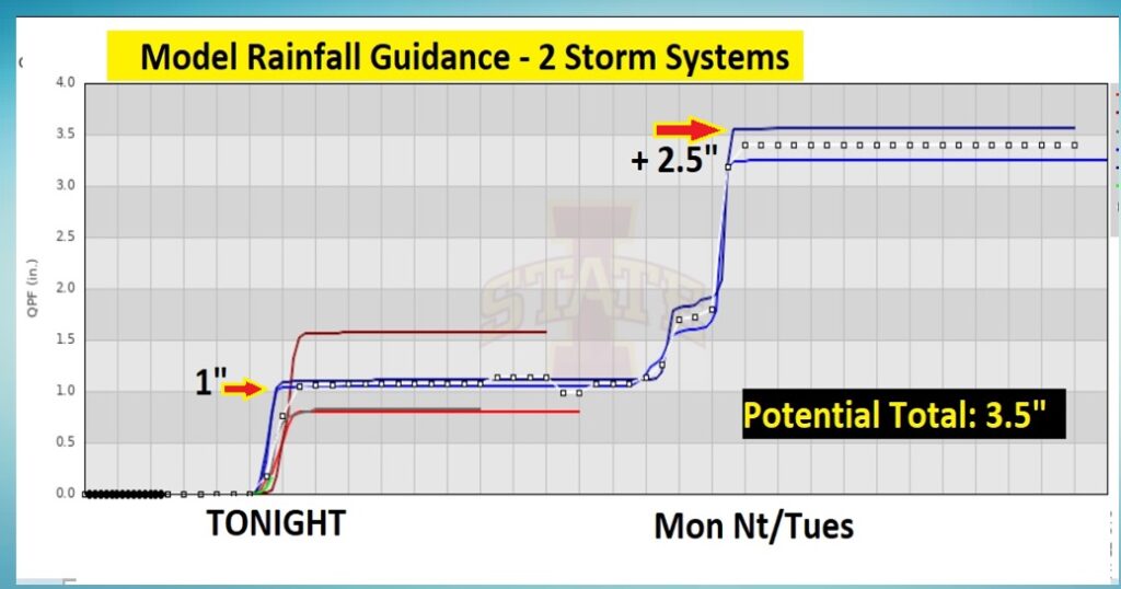
Here’s the model blend rainfall guidance centered on Montgomery. If you take the average literally, we could see about an inch overnight tonight. Perhaps around 2.5” with the Monday night/Tuesday storm system. So, again, when you average the models together, perhaps 2.5”. (Heavier near the coast)
Here’s the 10 Day Model Temperature Trend. Nothing shocking yet.

This morning everything is normal including Live on the radio 6 to 9AM on NewsTalk 93.1 WACV. There will be another Blog update in the morning.
–Rich
“I just had my Gypsy Poodle bath!”