
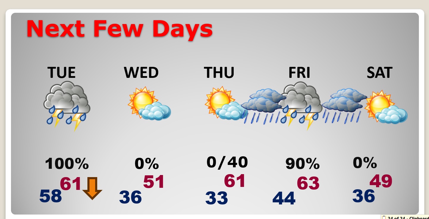
Good Morning! By now, you’re probably pretty aware that we have significant storm system on the way. There could be showers by late afternoon, but most of the action will be in the overnight hours tonight. A line of strong storms will move through in the wee hours of the morning. Some storms could be severe with damaging wind gusts the main threat. Southwest AL has an Enhanced Risk for strong Tornadoes) Even non thunderstorm winds could easily gust to 45+ mph which could bring down small trees. Rainfall amounts could be significant. Some spots could see 3-4+”. The rain risk continues first half of the day Tuesday. Windy with falling temperatures. Another big deal storm system will affect us by Friday. Here’s my brief forecast discussion.
TODAY: Cloudy, becoming windy today. Hi 56. Scattered showers could arrive by late afternoon, but most of the action will be in the overnight hours tonight. A line of strong storms will move through in the wee hours of the morning. Some storms could be severe with damaging wind gusts the main threat. Even non thunderstorm winds could easily gust to 45+ mph which could bring down small trees. Rainfall amounts could be significant. Temperatures will be in the upper 50’s through much of the overnight hours. Tuesday’s high of perhaps 61, will occur in the morning before falling temperatures later in the day.
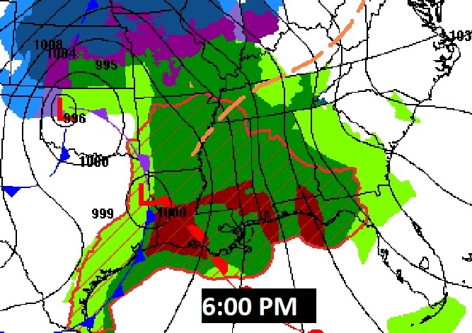
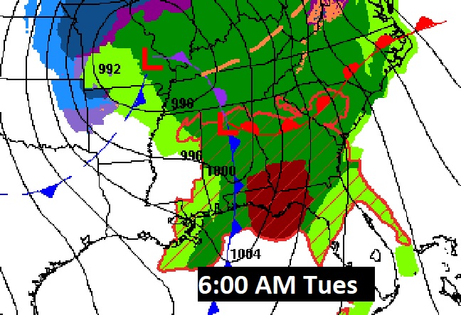
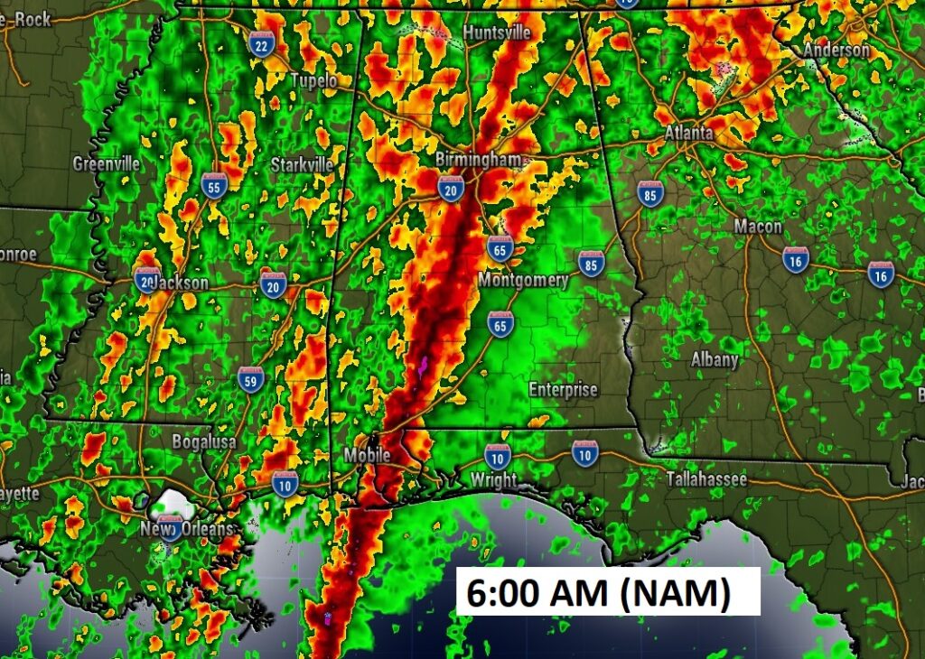
Here’s the map set up at 6:00 pm tonight and Tuesday morning at 6:00 AM.
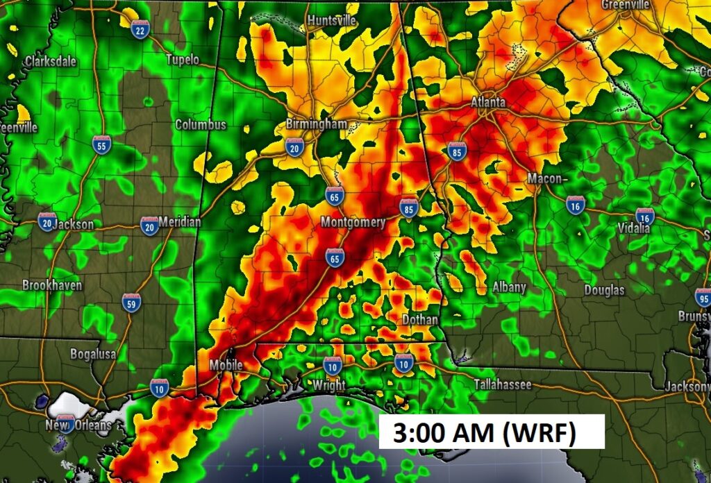
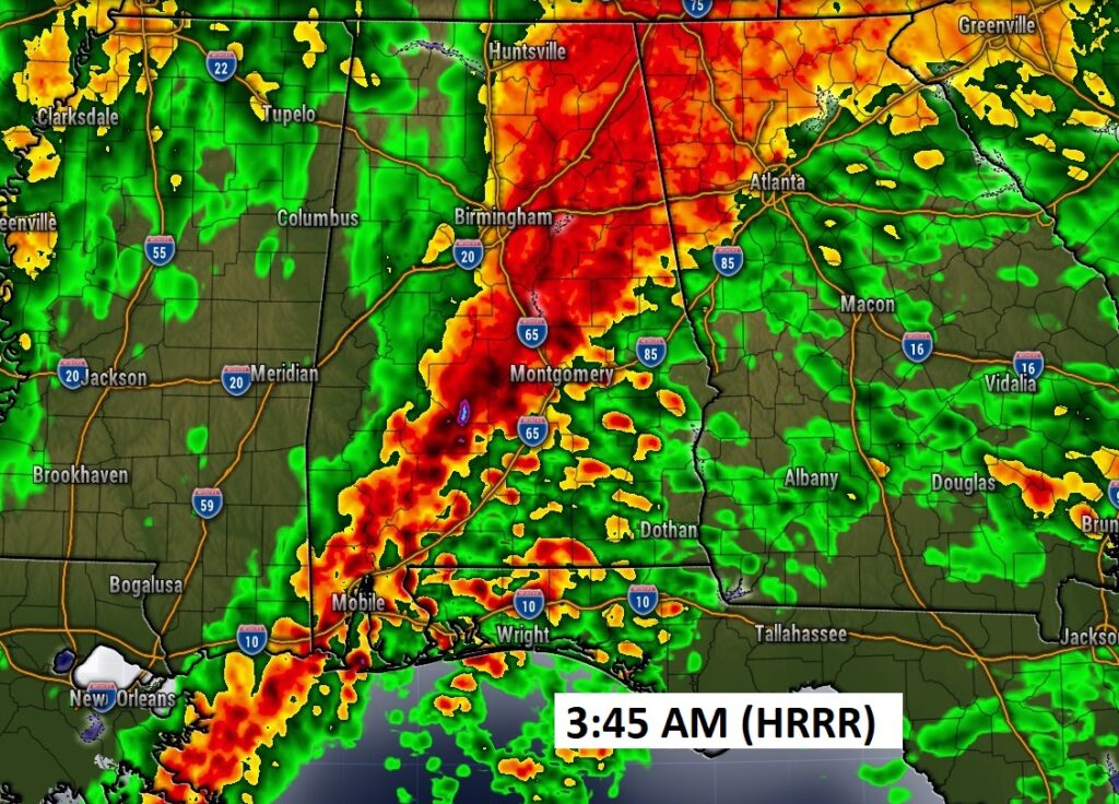
Future Radar hi-res examples: Here’s three different hi-res models to give you an idea on potential timing for the main line of storms. The WRF is fastest. The NAM is slower. But, you get the idea. Reaching the main I-65 corridor possibly as early as 3:00AM, but perhaps a little later.
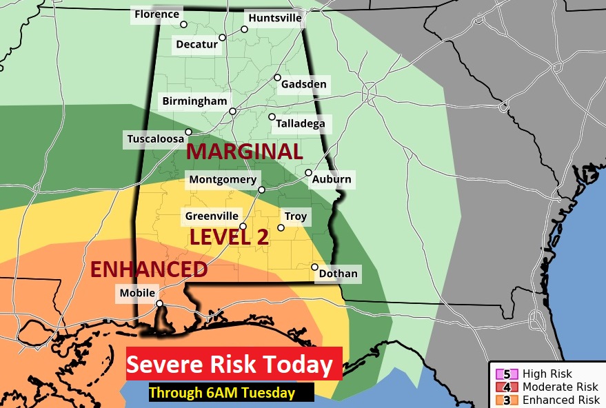
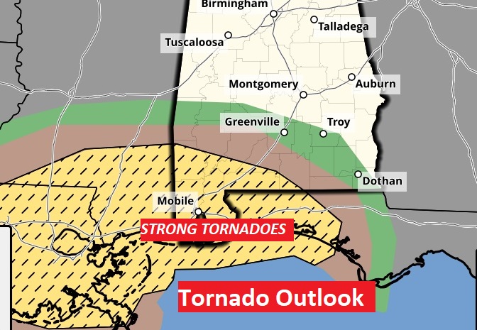
SEVERE WEATHER RISK: The MARGINAL RISK is as far north as a Tuscaloosa/Tuskegee line. Damaging wind gusts are the main threat. Tornado risk slightly higher in the Level 2 area SW of a Selma/Troy line. The ENHANCED risk in SW Alabama is where the greatest risk of strong tornadoes exists. (EF-2+). This outlook ends at 6AM Tues.
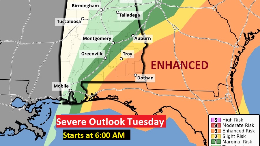
Starting at 6AM Tuesday, the risk shifts to southeast Alabama, Florida and Georgia. Much of the SE US is in for a potentially dangerous tornado threat Tuesday.
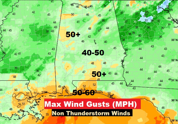
WIND ADVISORY: One of the bigger threats with is potent storm will be the strong (Gradient) non-thunderstorm maximum wind gusts. Much of the area will see gusts in the 40-50 mph range overnight tonight and into the day Tuesday. Some places over 50 mph. I chose the map with the most reasonable numbers. The GFS model has just crazy numbers, and I opted not to even show it. Some trees will come down. There will be power outages. Secure loose objects in the yard ahead of the storm.
NEXT FEW DAYS: The rain risk continues first half of the day Tuesday. Windy with falling temperatures. Another big deal storm system will affect us by Friday. Back to dry, chilly weather behind the storm on Wednesday. Temperatures rebound on Thursday ahead of the next storm system. Here comes another Big Deal storm system Friday with more rain and thunderstorms. Another severe weather threat? Don’t know yet.
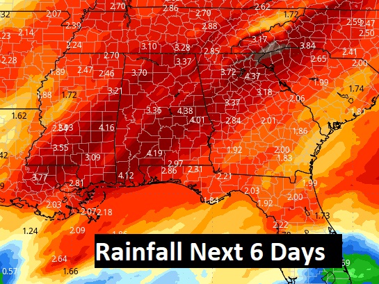
Rainfall amounts could be locally excessive with the next storm two storm systems. The numbers on this map are impressive.
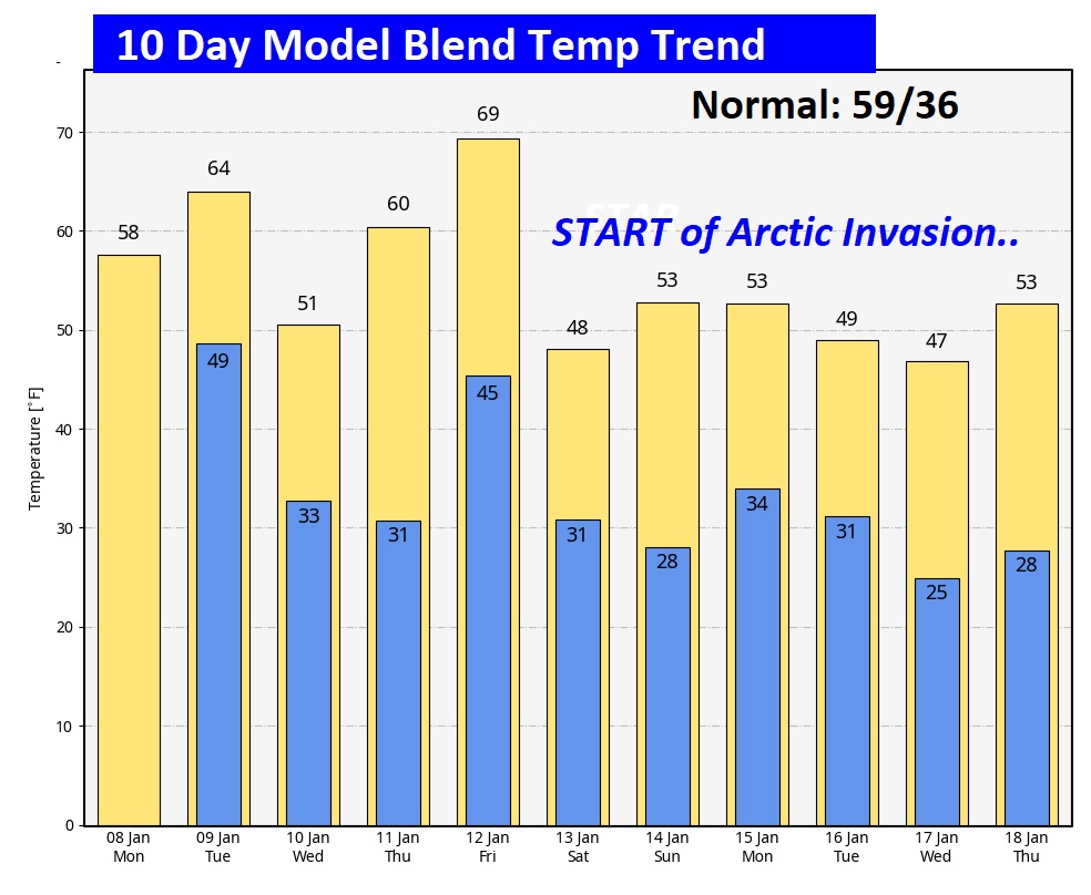
The Global Models have been hinting for weeks about a potential Big Deal Mid January Arctic Invasion. Now, the evidence is becoming even clearer. We don’t have time this morning to get into this part of the story. Let’s deal with the storm first. Here’s the 10 Day Model Temperature Trend.
This morning everything is normal including Live on the radio 6 to 9AM on NewsTalk 93.1 WACV. I’m not sure about a BLOG update tomorrow morning, because we’ll be in an ongoing severe weather situation. Certainly not a traditional Blog update. We’ll play in by ear. I’ll be a very busy guy.
–Rich