
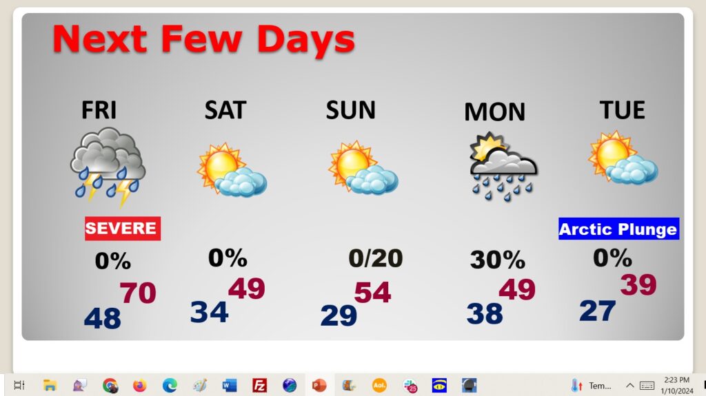
Good Morning! We continue to enjoy a brief break in between Mega Storm Systems. Today will be warmer than yesterday. But, approaching is potentially strong Friday storm system, including a significant Tornado Threat. Most of us are in an ENHANCED Level 3 out of 5 risk. but The main action will be on Friday, and especially Friday afternoon. Scattered strong to severe storms. Wind advisory for 40-45 mph non-thunderstorm wind gusts. Then, are you ready for some Cold Air? We have some arctic air in our future. Stage one of Colder air arrives over the weekend. But, the main Arctic Temperature Crash arrives Tuesday. It’ll be the coldest air since Christmas Week 2022. Here’s my brief forecast discussion.
TODAY: Mostly Sunny and milder. High 54. Southeast wind 5 to 10 mph. Increasing clouds tonight, Low 48.
.
NEXT FEW DAYS: Thursday looks like the best day of the week. Mostly sunny. Temperatures rebound on ahead of the next storm system. Here comes another Big Deal storm system Friday with more rain and thunderstorms and a particularly dangerous tornado threat. Then, get ready for the start of an arctic invasion starting over the weekend. It’s going to be a shock to the system and it’ll be around for several days.
DANGEROUS FRIDAY STORM SYSTEM: Here we go again. Yet another Mega Storm system. Looks absolutely massive and multi-faceted like the system much of the country dealt with Monday and Tuesday.
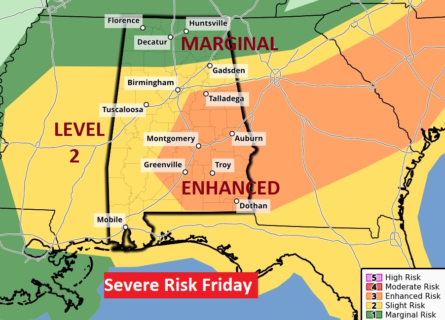
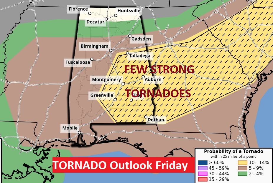
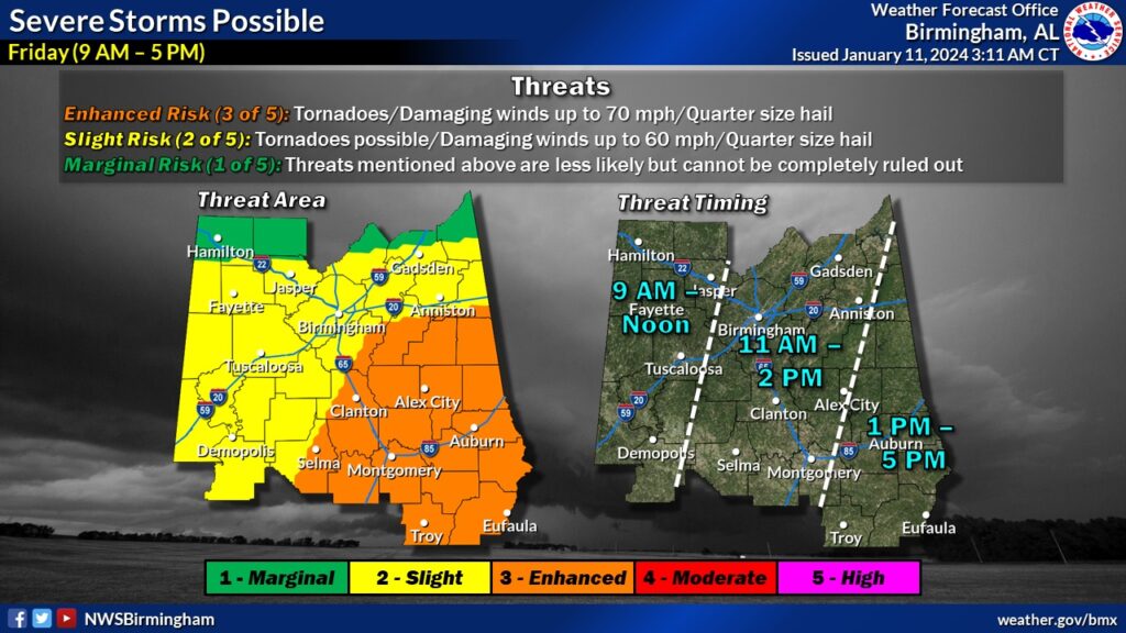
Friday’s Severe Weather Outlook from The Storm Prediction Center is disturbing. It includes a Level 3 Enhanced Level 3 out of 5 Severe Weather Risk. All modes of severe weather are on the table. But, the map on the right is particularly concerning. Whenever, SPC adds hatched lines on the Tornado Risk map, it suggests the threat of Strong long-lived tornadoes (EF-2+). Fortunately, this time it won’t be in the middle of the night. The main time window will be from about 9AM in the far west to 5PM in the far eastern counties. Greatest tornado threat in the eastern counties from Noon to 5PM.
We have a nice day today to prepare. Ironically, Friday is the one year anniversary of TWO Big Tornadoes last year. Downtown Selma. Plus, the Autauga county tornado which killed seven and injured many.
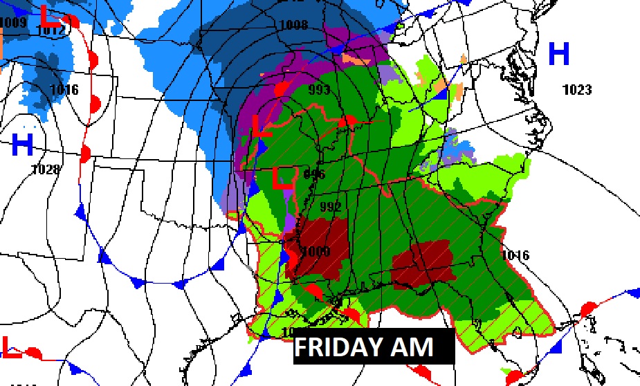
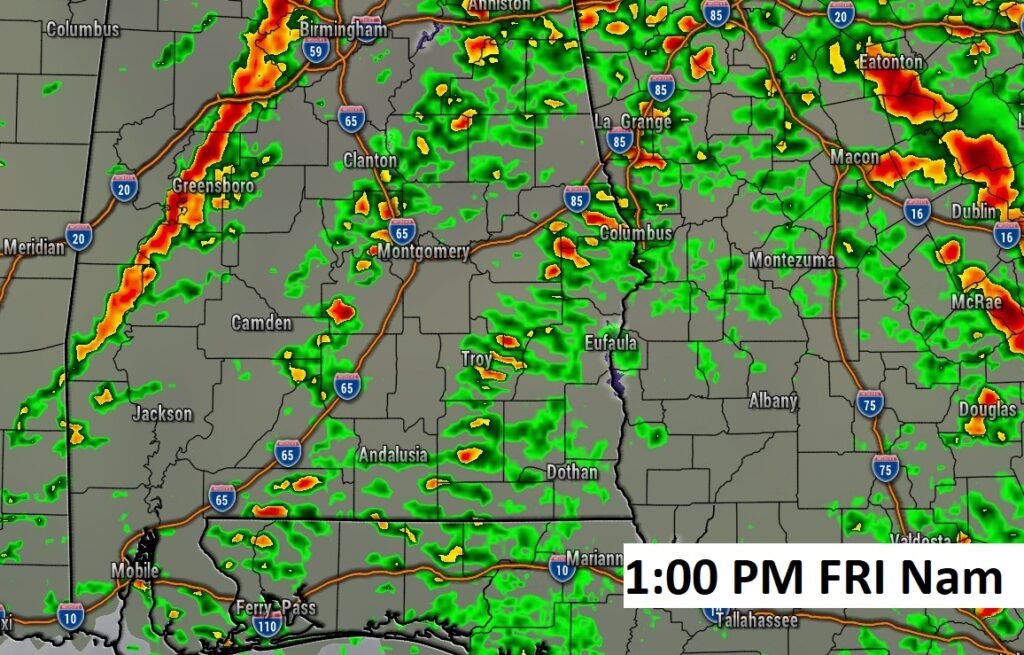
Future Radar on the NAM model at 1PM Friday. You see a line of storms in west Alabama. But, in central and east Alabama there will be discrete Supercells all by themselves. Some of these cells will start rotating and drop tornadoes. The cellular mode is the much more dangerous than the linear mode.
I like this updated Friday Severe Weather Timeline from NWS. Enhanced Level 3 Rick for much of central and east Alabama. Tornadoes (possibly strong), scattered wind gusts to 70+ MPH, Quarter size hail.
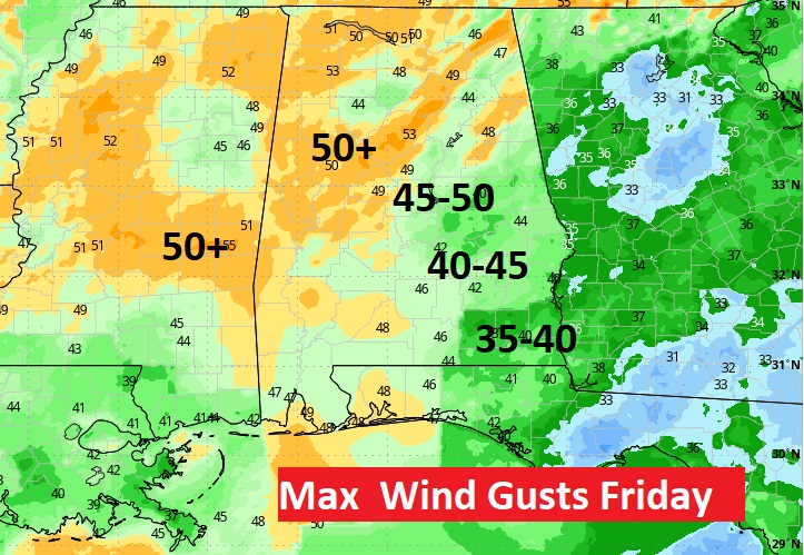
WIND ADVISORY: On Friday, non-thunderstorm winds could gust to 4o to 45 mph.
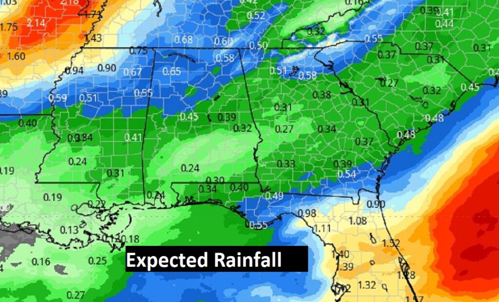
Rainfall won’t be as heavy with this storm….but, the rivers and streams are very high.
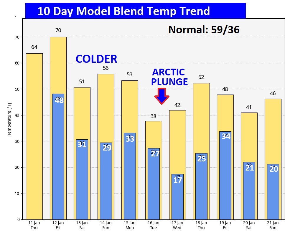
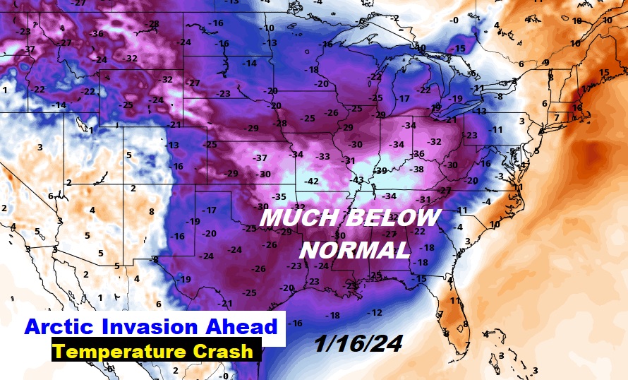
The Global Models have been hinting for weeks. A potential Big-Deal Mid-January Arctic temperature crash. Here’s the 10 day Model Blend. The heart of the arctic air invasion arrives by Tuesday and Wednesday. Then, another shot the weekend of January 20th. Coldest air here since Christmas week 2022.
This morning everything is normal including Live on the radio 6 to 9AM on NewsTalk 93.1 WACV. There will be another Blog update in the morning.
–Rich