
11:00 AM UPDATE:
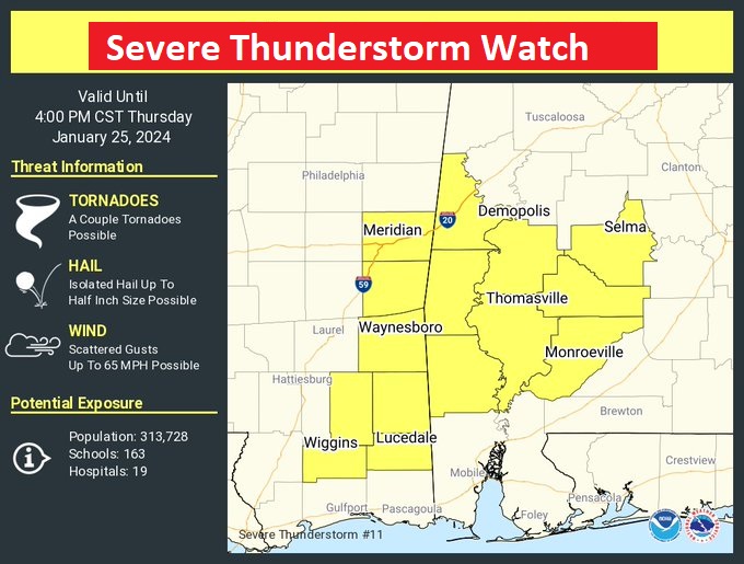
SEVERE THUNDERSTORM WATCH now covers west central AL until 4:00 PM. Damaging wind gusts to 65 mph, hail up to a half inch in diameter is possible. A couple of tornadoes are possible. The watch is as far east as Dallas & Wilcox.
EARLY MORNING UPDATE:
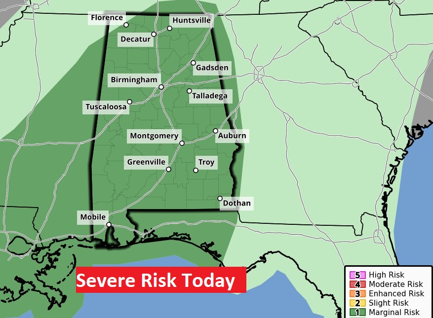
Good Morning! Our remarkable Springlike Warmth in January continues. Meanwhile the parade of storm systems continues. There are more wet and stormy days through Saturday. Periods of showers and thunderstorms will dominate our forecast today through Saturday. Rainfall amounts will be locally very heavy. As of early this morning, the MGM Airport has had well over 2”. Additional rainfall through Saturday could exceed 4”. There is a Marginal Severe Risk on Thursday. Another stronger system arrives Saturday, with heavy rain and strong/severe storms. There is a LEVEL 2 severe threat Saturday for many of us. Cooler air moves in Sunday and Monday, but no arctic air. Here’s my brief forecast discussion.
TODAY: Showers and Thunderstorms today & tonight. Locally heavy rainfall amounts. Marginal Severe Risk. High 75. South wind 10 to 20 mph gusting to 25. Low tonight 63
Today’s storms system will be a little stronger and wetter. Not only that. Marginal Severe Weather Risk. Damaging winds are the main threat.
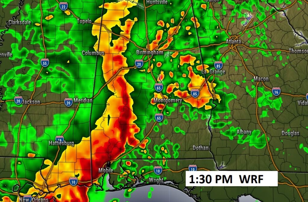
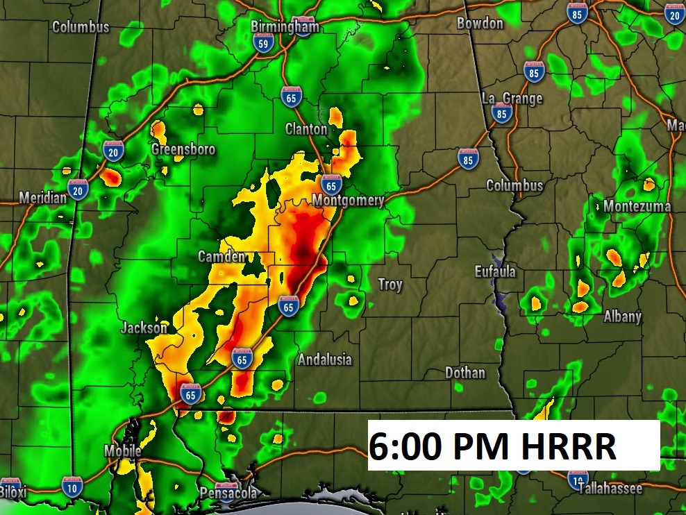
Future Radar. Showers and storms will be widespread today.
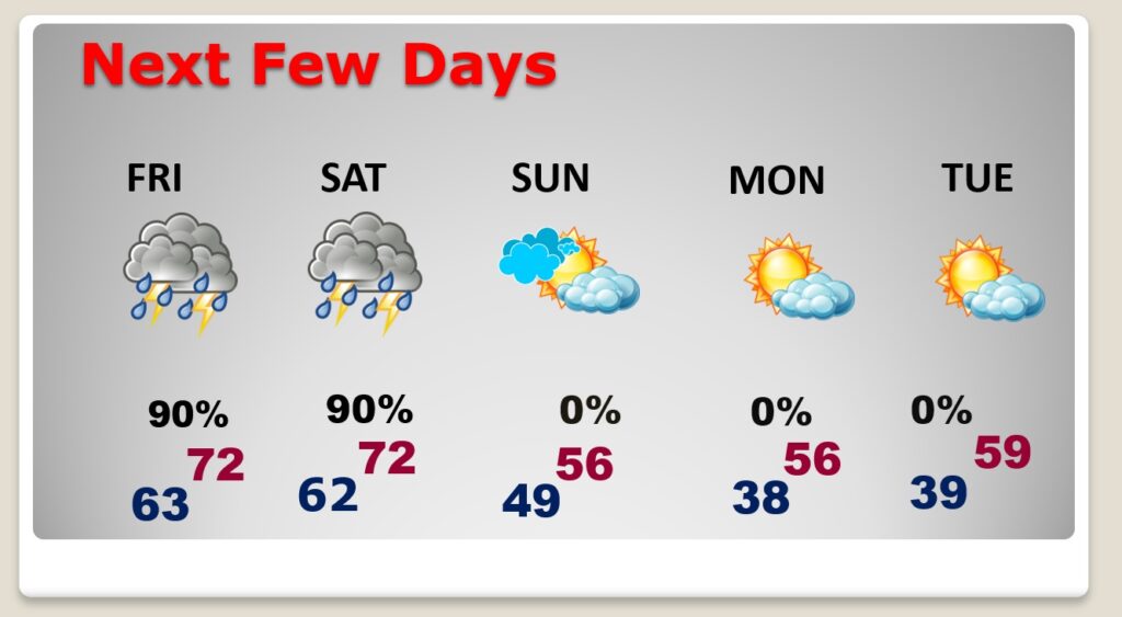
NEXT FEW DAYS: Flood Watch continues through Saturday. Rain and thunderstorms likely, at times, through Saturday. Periods of showers and thunderstorms will dominate our forecast Today through Saturday. Rainfall amounts will be locally excessive. Another stronger system arrives Saturday, with heavy rain and strong/severe storms. There is a LEVEL 2 severe threat Saturday for many of us. Cooler air moves in Sunday and Monday, but no arctic air.
.
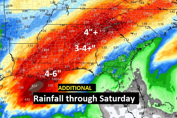
Rainfall amounts could be quite excessive in spots this week. Some of us have already had 2”+. Additional rainfall could easily top 4” more by Saturday.
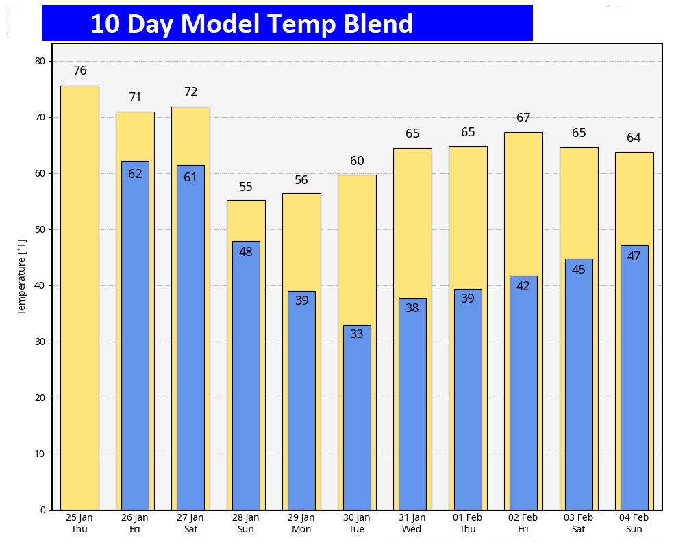
Here’s the 10 day Model Blend Temperature trend. There will be a bit of a set-back Sunday through Tuesday, but then, temperatures will recover again next week.
Here’s the EURO model 16 days out. Fingers crossed. The Arctic Flood gates are close for now.

This morning everything is normal including Live on the radio 6 to 9AM on NewsTalk 93.1 WACV. There will be another Blog update in the morning.
–Rich