
Good Morning! Our remarkable Springlike Warmth in January continues. Our parade of storm systems continues. Today, the greatest rain threat will be in the southern half of the state. Showers and Thunderstorms by this afternoon and into the evening. The Saturday storm system is stronger. Level 2 Severe Risk for central Alabama. Damaging wind gusts and perhaps a tornado or two. . Locally heavy rainfall. Much cooler Sunday and Monday with highs in the 50’s. Coldest morning will be Tuesday. Temperatures will start to recover by mid-week. Here’s my brief forecast discussion.
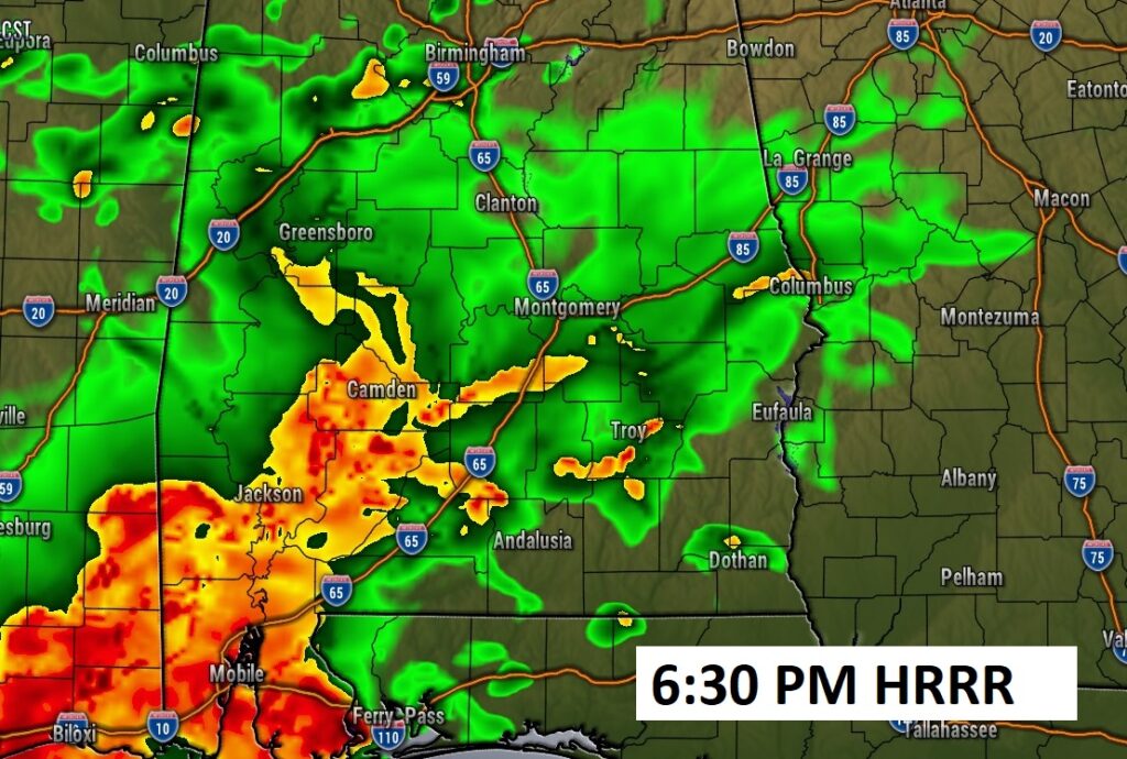
TODAY: The greatest rain threat will be in the southern half of the state. Showers and Thunderstorms by this afternoon and into the evening. By 9PM most of the activity will be done. High 72. SE wind 6 to 13 mph. Low tonight 62.
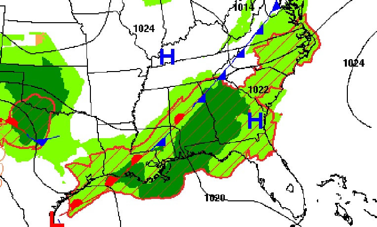
Here’s the set-up today. The best rain chance will be this afternoon and this evening.
NEXT FEW DAYS: Flood Watch continues through Saturday. Rain and thunderstorms, at times, through Saturday. The Saturday storm system is stronger. Level 2 Severe Risk for central Alabama. Damaging wind gusts and perhaps some tornadoes. Locally heavy rainfall. Much cooler Sunday and Monday with highs in the 50’s. Coldest morning will be Tuesday. Temperatures will start to recover by mid-week.
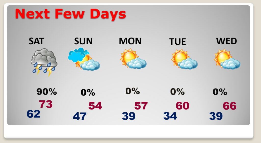
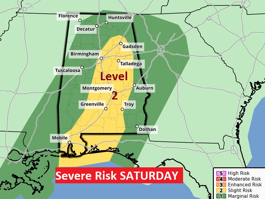
Saturday is the final storm system and the strongest. Level 2 Severe Risk for central Alabama. Damaging wind gusts and perhaps some tornadoes. Locally heavy rainfall.
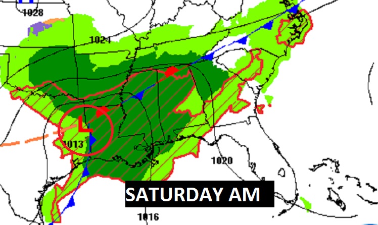
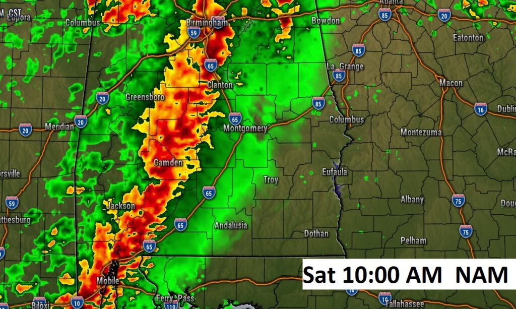
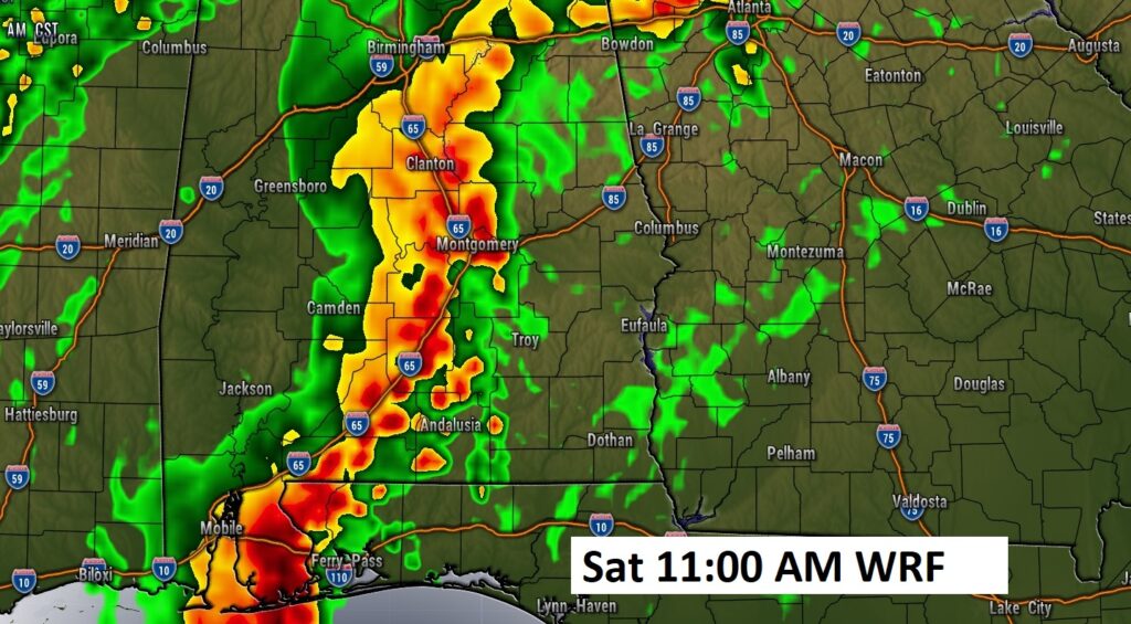
Saturday Future Radar. The main action will be along a strong “squall line” (QLCS). And, the action could start early. Late morning. This is WAY ahead of the main front. More storms are possible along the front itself by late afternoon.
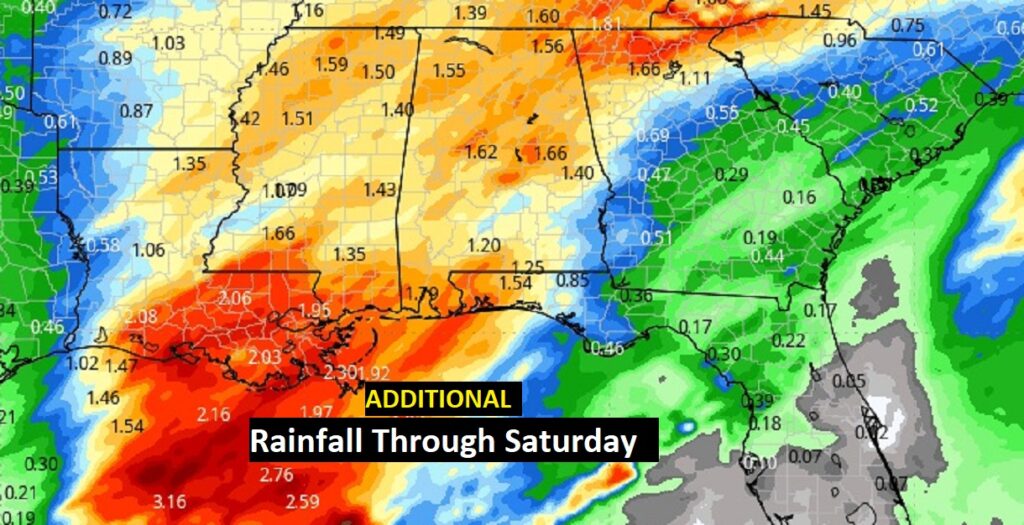
Here’s the expected additional rainfall through Saturday. Flood Watch continues.
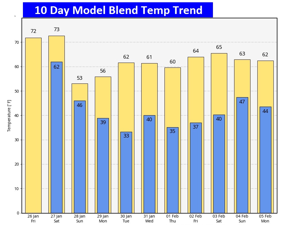
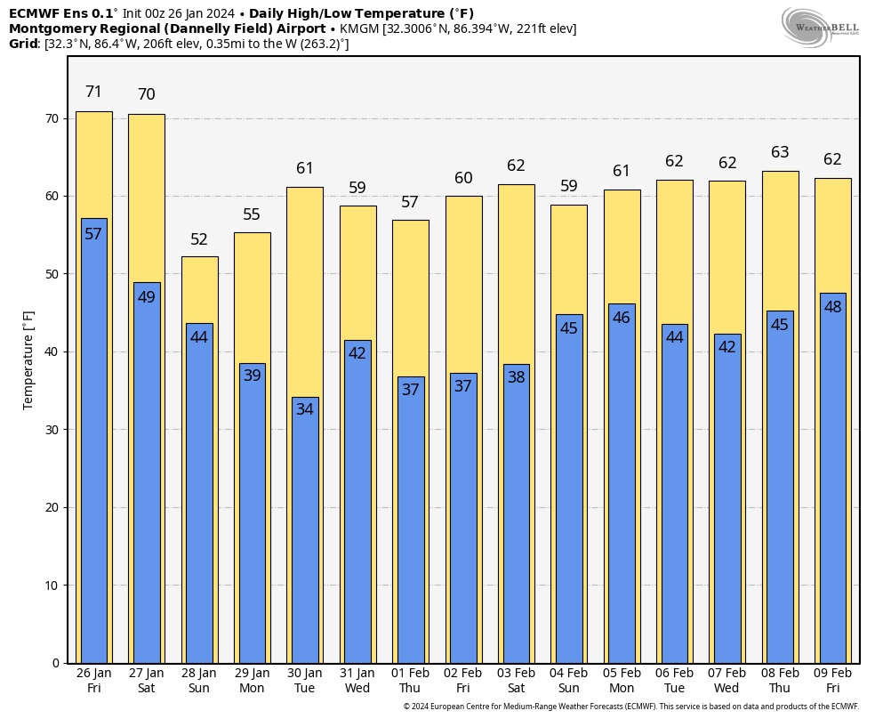
Here’s the 10 day Model Blend Temperature trend. There will be a bit of a set-back Sunday through Tuesday, but then, temperatures will recover again next week.
Here’s the EURO model 16 days out. The Arctic Flood gates are close for now.
This morning everything is normal including Live on the radio 6 to 9AM on NewsTalk 93.1 WACV. There will be another Blog update in the morning.
–Rich