
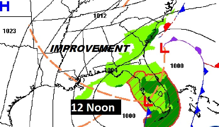
Good Morning! Sunday was simply awful. Cold, Wet & Windy. Our weather is about improve in a big way. As the storm system departs, the risk of rain ends early this morning. Clouds today will give way to sunshine later. It’ll be breezy and cool today. Most of the week ahead will be storm-free and dry. We’ll be back in the 60’s starting tomorrow. We’ll be in the middle 60’s by Thursday. Spotty showers arrive Friday. Scattered showers and thunderstorms become more likely Saturday. Also on this Blog we’ll look way ahead. Are we in for an Arctic Blast later in the month? Here’s my brief forecast discussion.
RECORD RAINFALL: Yesterday was truly awful. Montgomery (MGM) had 2.07”. That’s a record for Feb. 4th. There’s been more rain after Midnight. The Storm total is now 2.15” as of 3AM. Temperatures hovered in the mid 40’s. Winds gusted to 30+ mph.
TODAY: Risk of showers ending very early in the morning. Cloudy, but gradual improvement. Becoming mostly sunny later. High 58. Gusty northwest wind at 10 to 20 mph. Mainly clear tonight. Chilly. Low 38.
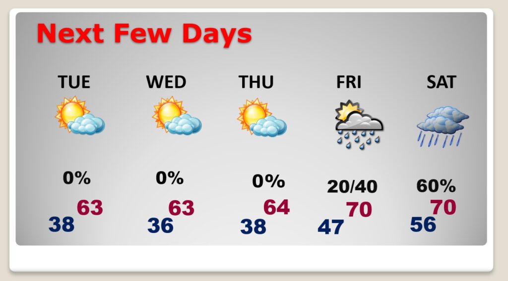
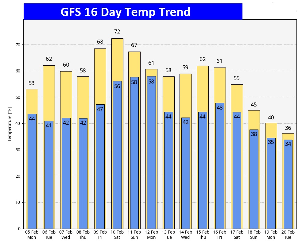
NEXT FEW DAYS: We’ll be dry through at least Thursday night. By Tuesday, highs return to the lower 60’s. We’ll be in the middle 60’s by Thursday. Spotty showers arrive Friday. Scattered showers and thunderstorms become more likely Saturday.
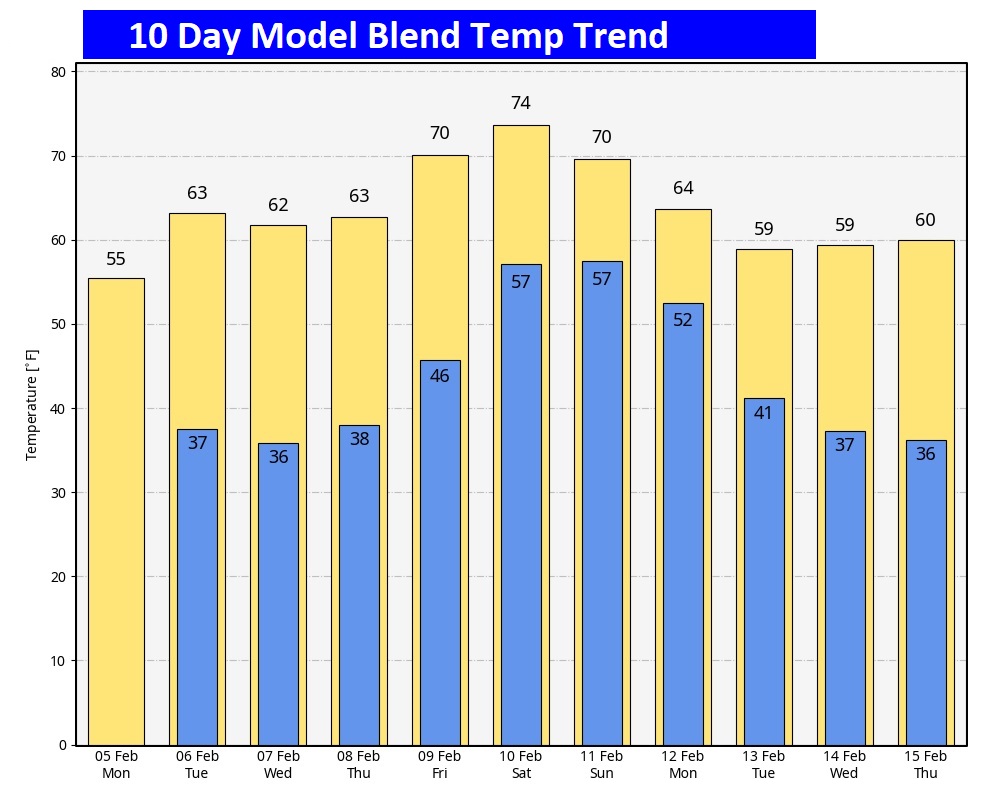
Here’s the 10 day Model Blend Temperature trend. No Arctic Air right away.
BUT HANG ON. For nearly 3 weeks now, we’ve been hinting at a potential significant future Arctic Blast, sometime between Feb. 15 and March 15. Potentially, long duration. The extreme record cold in Alaska has to go somewhere soon. Seeing more and more model clues.
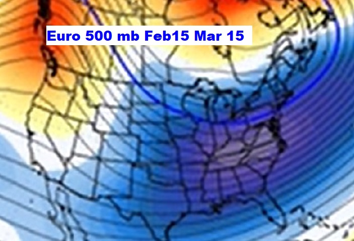
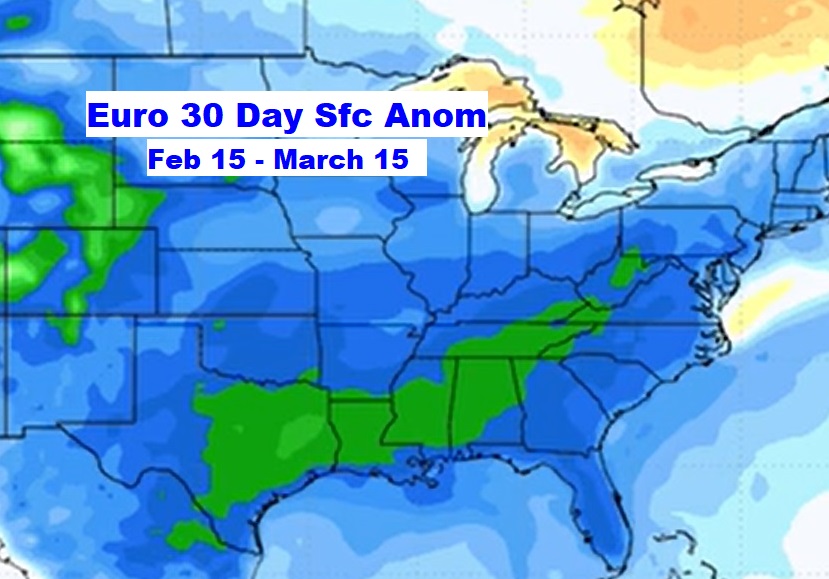
Here’s the GFS Operational Model out 16 days. Sometime around February 16/17, it starts to show the BEGINNING of what could be a rather harsh Artic Temperature crash. Stay tuned. As we get closer and closer we’ll know more about the intensity and possible duration.
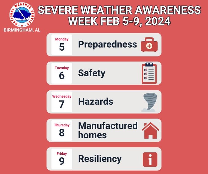
SEVERE WEATHER AWARENESS WEEK: This is Severe Weather Awareness Week! Why now vs. during the spring? It’s about being proactive! We can have severe weather any time of the year but our guard increases further heading into spring. Follow us along each day this week. Make sure you are informed and prepared!
Thanks for reading the blog. There will be another complete Blog update and video forecast discussion tomorrow morning. This morning, everything is normal including LIVE on the Radio from 6 to 9AM on NewsTalk 93.1 – WACV. Have a great day.
–Rich