
Good Morning! Today should be another great day. There will be extensive high cloudiness, but our mild pattern continues. We should reach the middle 60’s again. Expect low 70’s on Friday, and still dry. Weekend highs will be in the low 70’s. Dry through Friday. Spotty showers arrive Friday night Scattered showers and thunderstorms become more likely Saturday into Monday. A few strong storms are not out of the question Sunday night. The main event will likely be Sunday night into Monday morning. Total rainfall amounts over the weekend could be impressive in spots. Here’s my brief forecast discussion.
.
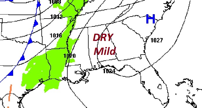
TODAY: Extensive high clouds. Limited sunshine. A mild day. High 65. (Normal 63/39) Southeast wind 6 to 12 mph. Mostly cloudy, not as cold tonight. Low 49.
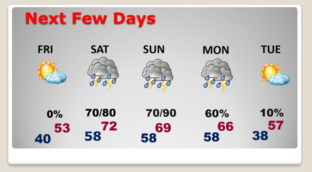
NEXT FEW DAYS: We’ll be dry through at least through Friday. Expect the low 70’s on Friday. Scattered showers and thunderstorms become more likely Saturday into Monday. The main event will likely be Sunday night into Monday morning.
We are in cycle of Weekend Storm systems. In fact, there’s yet another one the following weekend, February 17/18th.
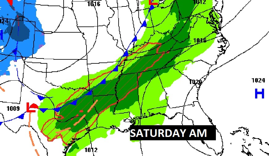
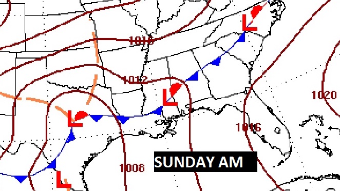
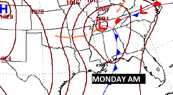
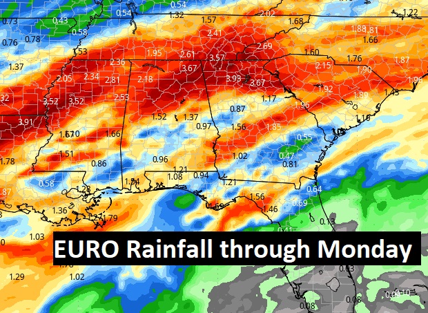
Here’s the potential rainfall through Monday. The storm system will come in two parts, with the main event Sunday night. Heaviest rainfall amounts are likely across the northern half of the state.
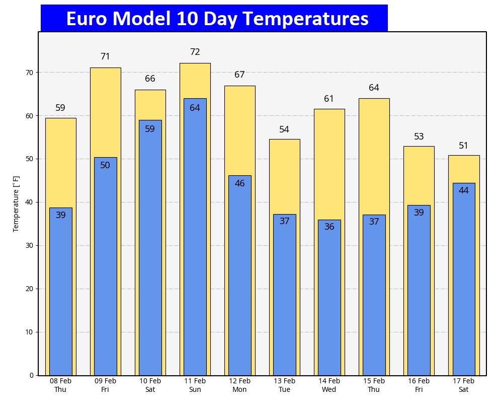
Here’s the 10 day EURO Model Temperature trend. Still, No Arctic Air right away.
Thanks for reading the blog. There will be another complete Blog update and video forecast discussion tomorrow morning. This morning, everything is normal including LIVE on the Radio from 6 to 9AM on NewsTalk 93.1 – WACV. Have a great day.
-Rich