
Good Morning! Today will be very Spring-like, again. Friday’s high was 75. We’ll be in the low to mid 70’s today and Sunday. It will be a wet and stormy weekend across the Gulf States with a stalled front draped across north Alabama back to coastal Texas. Several Low pressure impulses will ride along the front, bringing in waves of showers & storms today through Monday morning. The main event will be overnight Sunday night through Monday morning. Most of us are in a Level 2 Severe threat, particularly in the wee hours of Monday morning through mid morning. While damaging wind gusts are the main threat, tornadoes are certainly possible. Storm total rainfall amounts could reach 1-3” in the US 80/I-85 corridor with heavier amounts in the north. Sunshine returns Tuesday, with cooler temperatures.
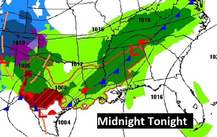
The Map Set-up. Low pressure storm systems will ride along that stalled front like a train track. The main event will be the final Low overnight Sunday night through Monday morning. Locally heavy rain and a Severe Weather Threat.
.
TODAY: Risk of scattered showers, mainly after Noon. Hi 73. South wind 6 to 12 mph. Scattered showers and thunderstorms becoming likely, especially late in the overnight hours. Low 62. Gusty south wind at 10 to 20 mph.
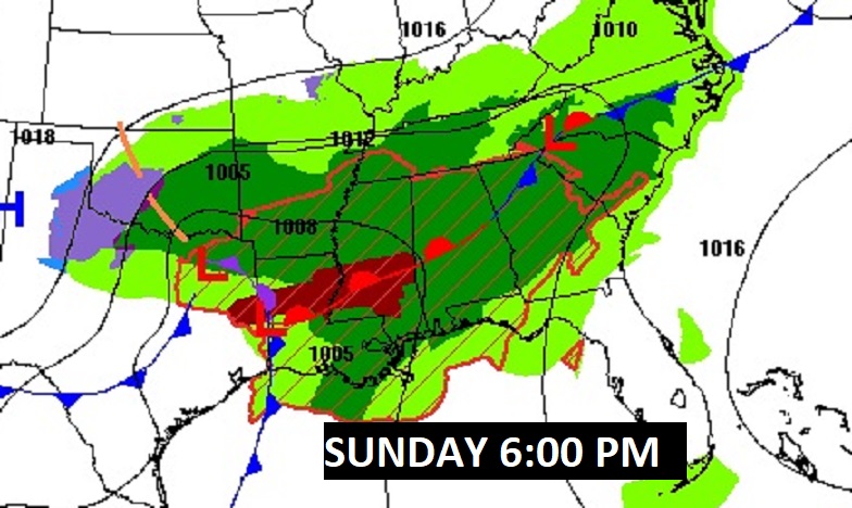
Here’s a couple of Future Radar Snapshots – one this afternoon, and one in the overnight hours tonight.
Here’s a flavor of Future radar with the potential severe Threat overnight Sunday night into Monday morning.
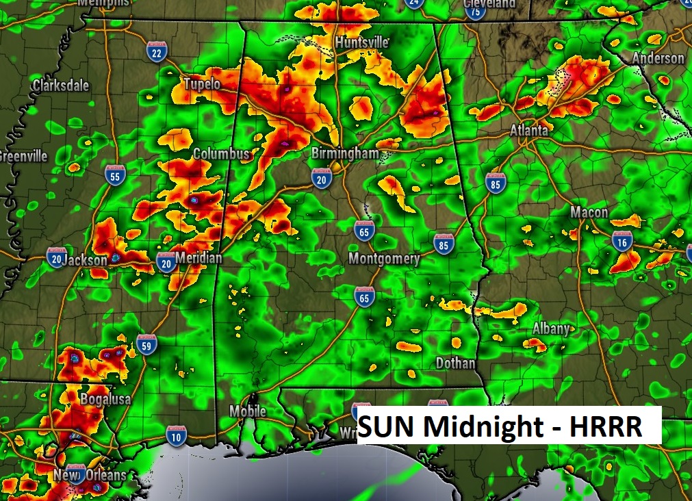
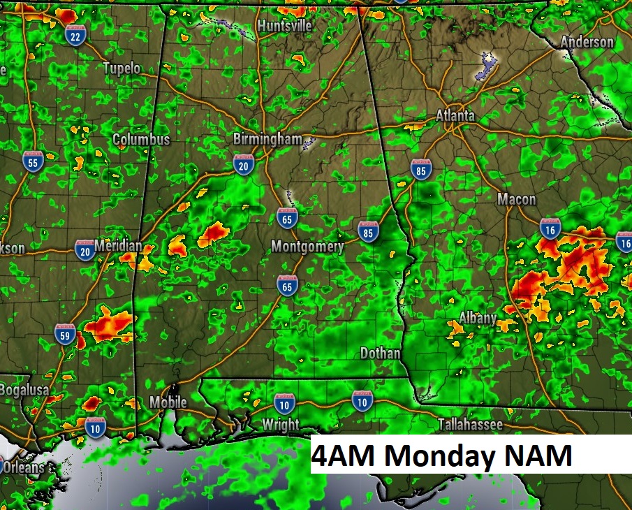
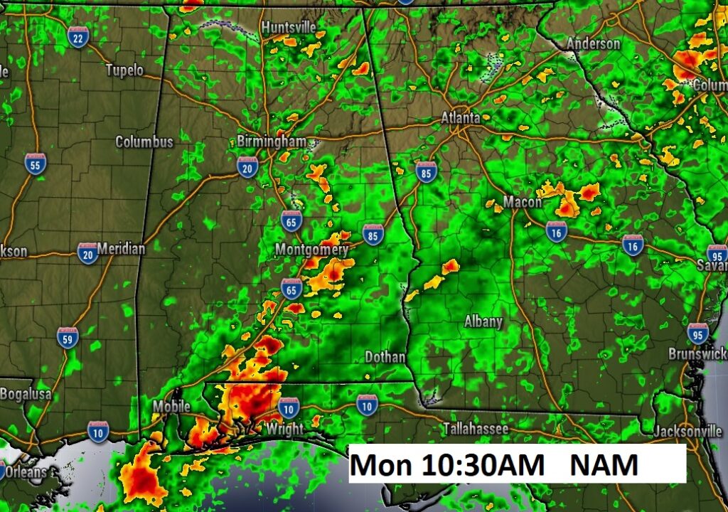
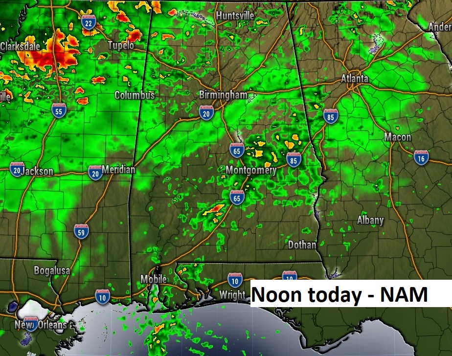
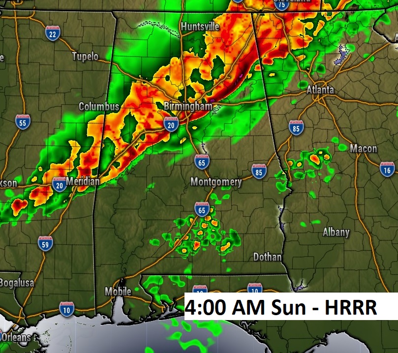
Here’s a hi-res Future Radar loop starting this afternoon through Noon MON. There will be waves of showers and storms across AL and the Gulf States. Greatest Severe Threat late SUN night through late morning MON. This includes a risk for a few tornadoes.
SEVERE WEATHER RISK: Sunday afternoon could feature a few stronger storms, some possibly reaching severe limits but for most of us, by far the main risk would be from the wee hours of late Sunday night through Monday morning. The first map shows the severe risk from SPC through 6AM Monday morning. The second (day 3) map begins at 6AM Monday morning.
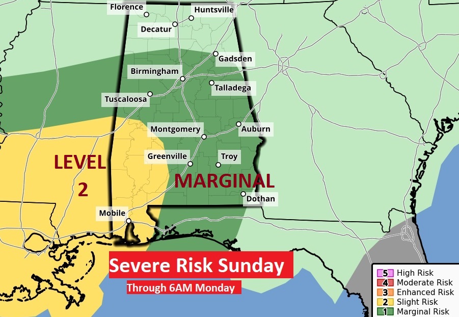
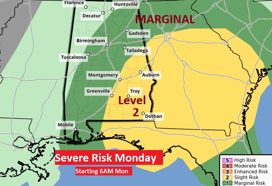
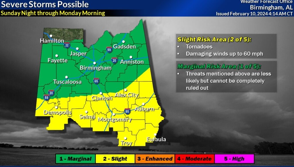
On this graphic, NWS Birmingham have melted together the threat risk into one map. Level 2 out of 5 for most of us. This includes the risk for tornadoes. A tornado watch is a good bet.
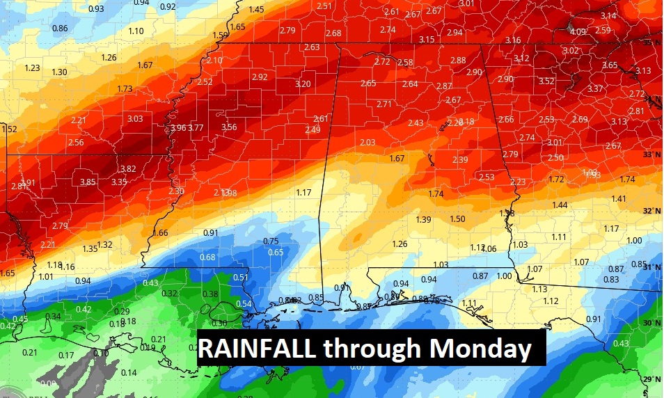
Storm total rainfall amounts could reach 1-3” along the US 80/I-85 corridor with heavier amounts in the north.
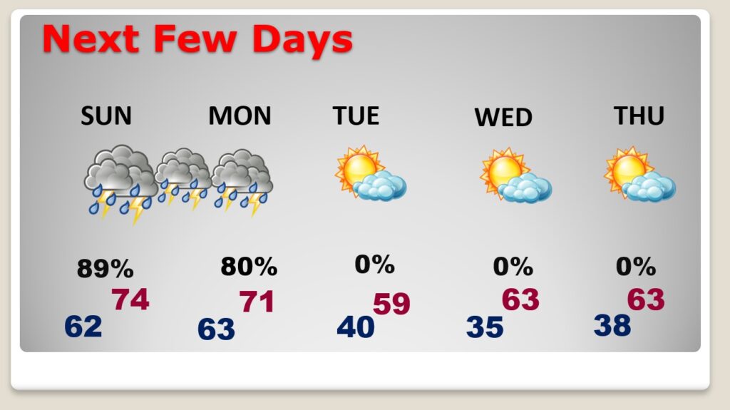
NEXT FEW DAYS: Sunday afternoon could feature a few stronger storms, some possibly reaching severe limits but for most of us, by far the main risk would be from the wee hours of late Sunday night through Monday morning. It will be sunny and cooler Tuesday. We’ll be back in the 60’s Wednesday. Most of next week will be storm-free & dry. The Next storm system will be the following weekend, February 17-18th.
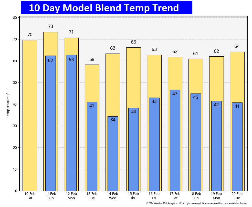
Here’s the 10 day EURO Model Temperature trend. Still, No Arctic Air in sight in the short term. Fingers crossed.
Thanks for reading the blog update. The next Complete Blog Update and Video Forecast Discussion will be Monday morning. Because of the gravity of the Sunday weather, I’m sure there will be an update on Sunday morning as well. Be flexible with your weekend plans.
–Rich