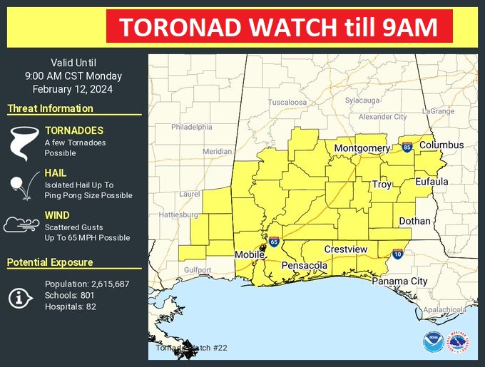
A Tornado Watch continues until 9AM for central and south Alabama. The watch extends as far east as the Georgia line. Severe Thunderstorms with scattered damaging wind gusts to 60+ mph are likely. A few tornadoes. Hail up to ping pong size.
. Our weather App will keep you on top of the action with instant push notifications. Go to the App store and search Rich Thomas Weather. Make sure your weather radios are plugged up and in the alert position. Stay weather aware. Obviously, there will be no traditional Blog update this morning as we continue to monitor this severe weather event.
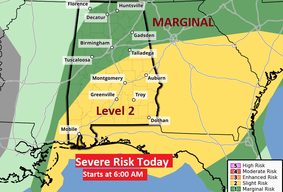
Today’s (DAY 1) Severe Risk from SPC which begins at 6:00AM. Busy day across the Southeast US. All severe weather hazards are on the table.
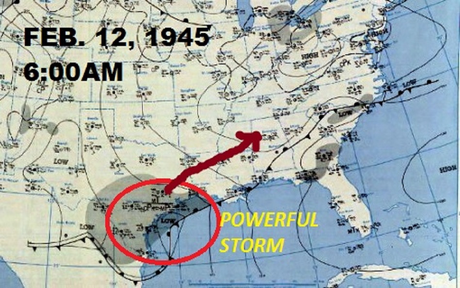
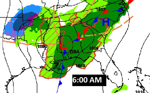
Here’s the potent Severe Weather set-up at 6:00 AM.
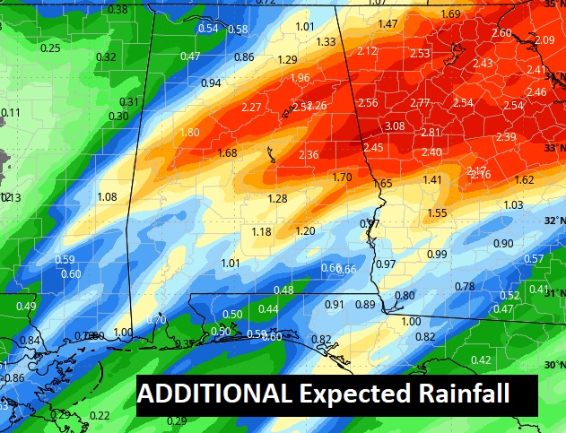
Potential additional rainfall, on top of the excessive amounts already since Sunday afternoon.. #alwx
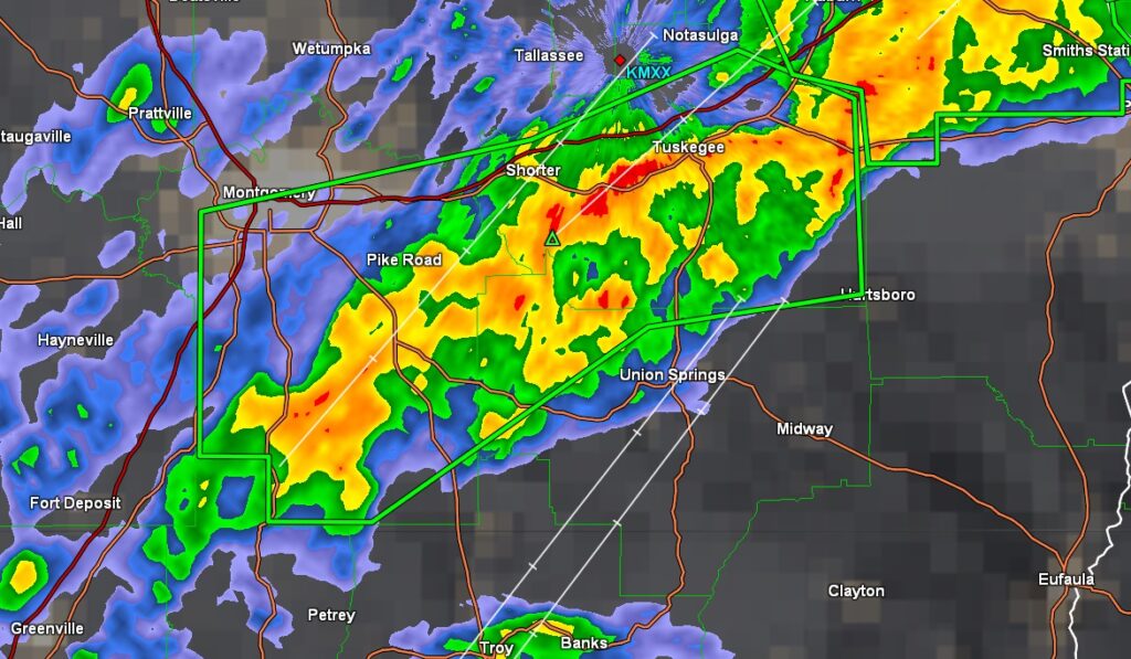
Flash flood warning has been issued until 5:45 AM for portions of Montgomery, Macon, Bullock counties. 3 to 5” of rain has occurred already. Additional rainfall total. 2-4”. Flooded roadways. LEE county is also under a Flash Flood Warning.
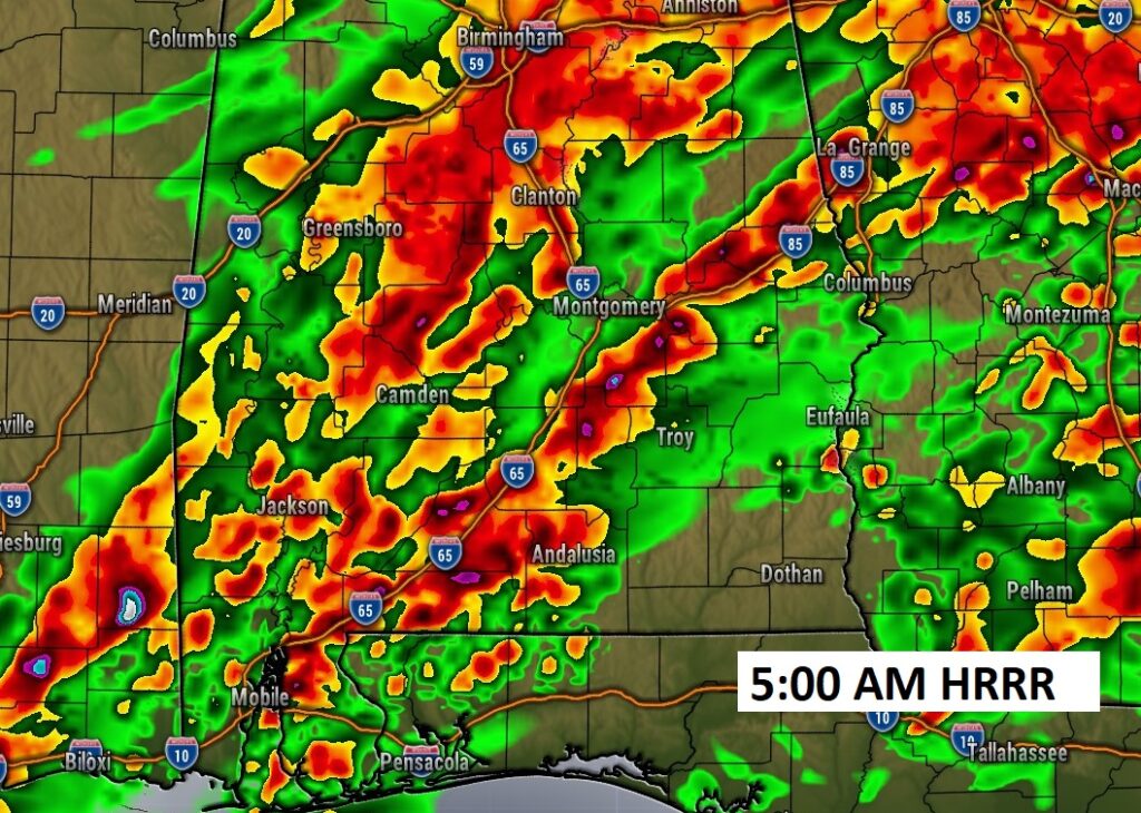
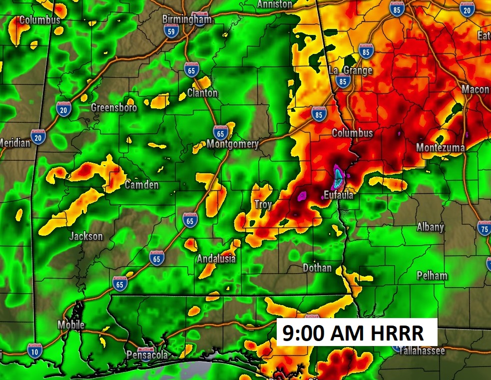
FUTURE RADAR snapshots at 5AM and 9AM. Strong to Severe storms ongoing. Tornado Watch till 9:00AM. #alwx
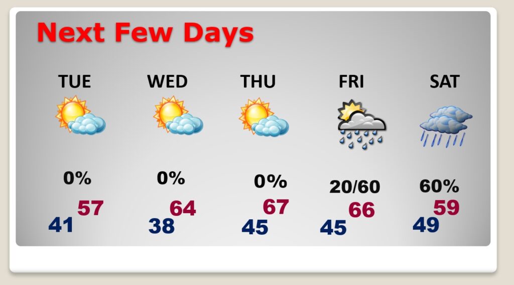
Here’s a peak at the next few days.
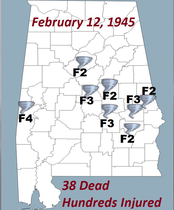
On this day in TORNADO history. Montgomery’s WORST Day ever… F3 tornado. February 12, 1945. 5:18 PM. 26 dead. Hundreds injured. Whole neighborhoods destroyed.