
Good morning! Happy Valentines Day! Most folks will love today’s forecast. We’ll be about 5 degrees warmer than yesterday with plenty of sun. Thursday and Friday will be dry and mild for February with highs in the upper 60’s. A Gulkf coast storm system will brush by the area Friday night and Saturday. Scattered showers are possible but most of the rain will stay out in the Gulf. Expect a weekend cool down. We’ll be near freezing Sunday morning and perhaps upper 20’s Monday morning. But this weekend set-back won’t be around too long and it looks like nice warming will take place next week. Here’s my brief forecast discussion.
.
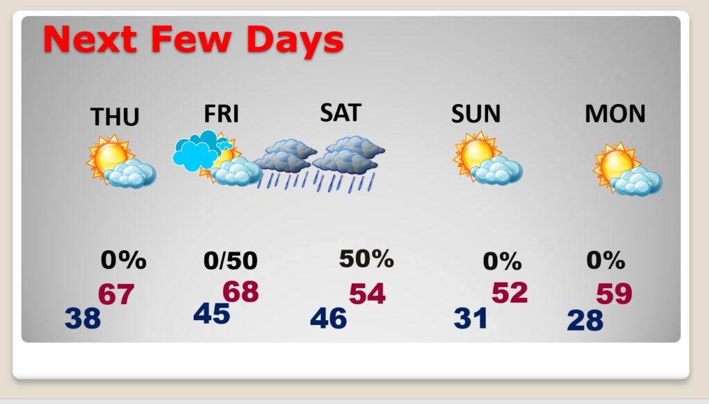
TODAY: Sunny and nice. The morning chill will fade quickly. High today 64. (Normal: 64/40) NE wind 6 to 12 mph. Clear and chilly tonight. Low 38.
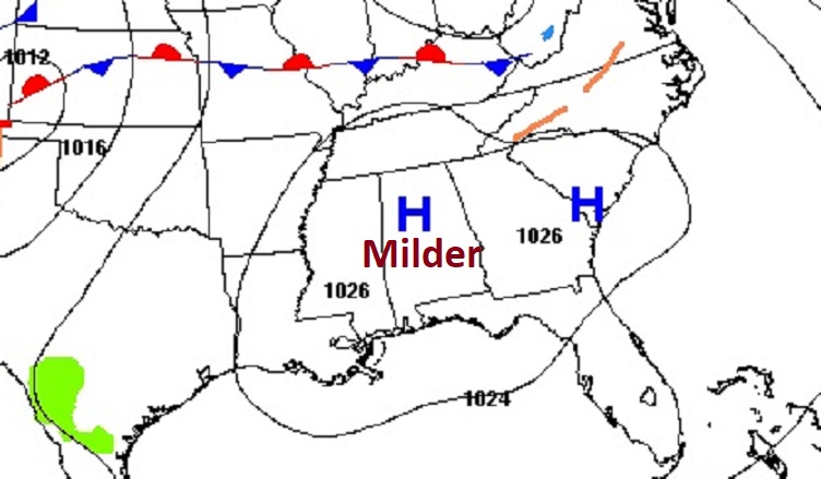
NEXT FEW DAYS: Sunshine will be in abundance on Thursday. We’re back to the 60’s on Wednesday, Thursday and Friday will be dry and mild for February with highs in the upper 60’s. The next risk of showers begins Friday night into Saturday, but most of the rain will be near the coast. Get ready for a big weekend cool-down. We’ll be near freezing Sunday morning and perhaps upper 20’s Monday morning. But this weekend set-back won’t be around too long.
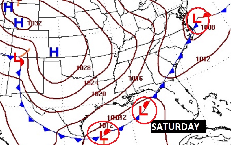
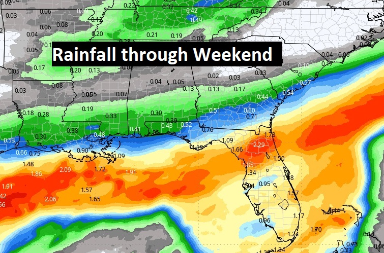
This time the main storm system will stay out in the Gulf of Mexico. That’s also where the heaviest rain will be.
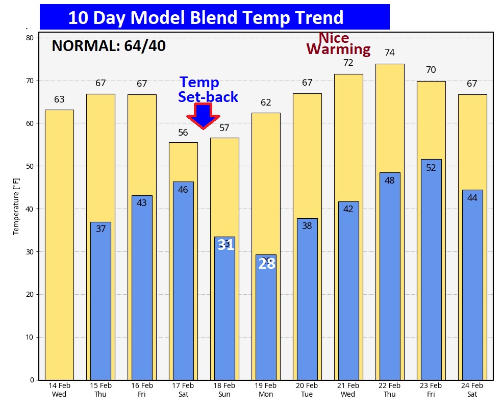
Here’s the 10 day temperature trend. The big weekend cool-down will not last too long. Looks like we could see some nice warming next week.
Thanks for reading the blog. There will be another complete Blog update and video forecast discussion tomorrow morning. This morning, everything is normal including LIVE on the Radio from 6 to 9AM on NewsTalk 93.1 – WACV. Have a great day.
–Rich