
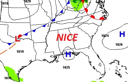
Good morning! Today, like yesterday should be another great mid-February day. We may even tease 70° today and Friday. The next Gulf storm system will just brush by the area late Friday night and Saturday. Most of the rain with this system will stay in the Gulf. Rain probabilities will be low. Colder air will funnel in over the weekend. Daytime highs will only reach the 50’s Saturday & Sunday. Expect a potential freeze Saturday and Sunday night. The Weekend chill won’t last long. A big temperature re-bound is expected next week. Here’s my brief forecast discussion.
.
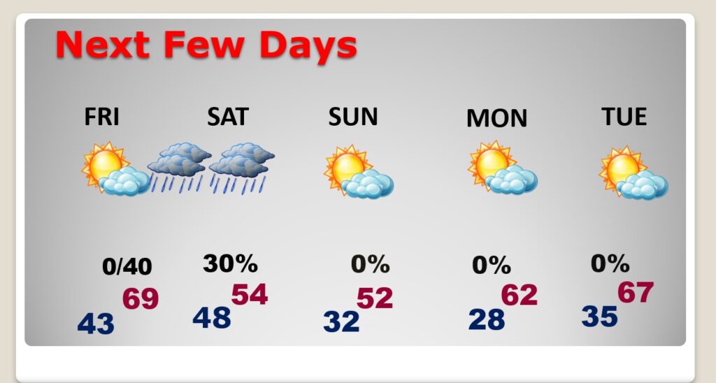
TODAY: Mostly sunny and nice. High today 69. (Normal: 65/40) NW wind 6 to 12 mph. Clear and not as chilly tonight. Low 44.
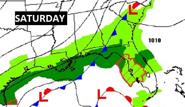
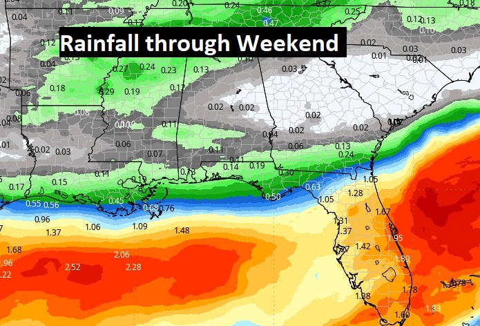
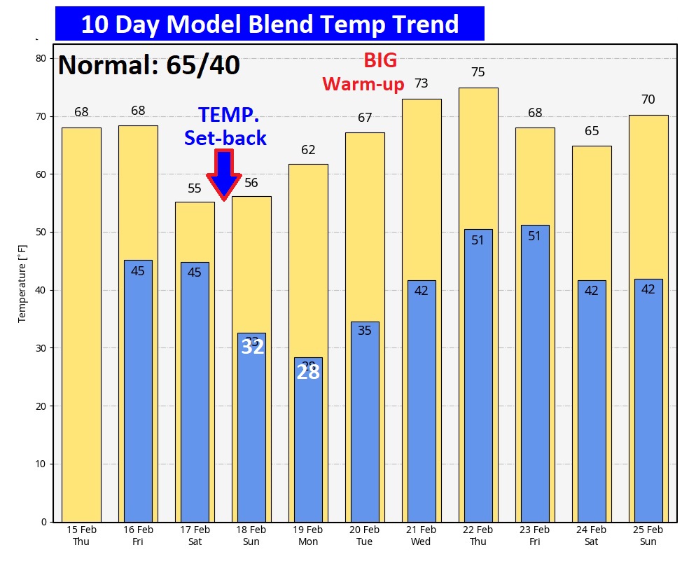
NEXT FEW DAYS: Clouds will increase tomorrow, but we’ll stay dry. We may even tease 70° again Friday. The next risk of showers begins Friday night into Saturday, but most of the rain will be near the coast. Get ready for a big weekend cool-down. We’ll be near freezing Sunday morning and perhaps upper 20’s Monday morning. But, this weekend set-back won’t be around too long
This time the main storm system will stay out in the Gulf of Mexico. That’s also where the heaviest rain will be.
Here’s the 10 day temperature trend. The big weekend cool-down will not last too long. Looks like we could see some nice warming next week.
Hang on. It won’t be long now!
Thanks for reading the blog. There will be another complete Blog update and video forecast discussion tomorrow morning. This morning, everything is normal including LIVE on the Radio from 6 to 9AM on NewsTalk 93.1 – WACV. Have a great day.
–Rich