
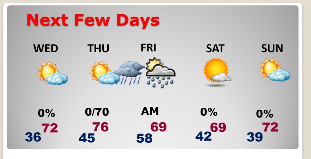
Good morning! The weather news this week is getting better. We have a modest warming trend underway. We’ll reach the 60’s today and the 70’s on Wednesday and Thursday. An An approaching frontal system will bring showers back to Alabama on Thursday night, but no severe weather is expected. The air behind the front is Pacific air, meaning we’re not expecting a big temperature plunge this time. Highs will be in the 60’s Friday and Saturday, and back in the 70’s on Sunday. There’s no “big ticket” weather in our future for the foreseeable future. That’s great news in this historically very active time of the year. Here’s my brief forecast discussion.
.
TODAY: Mostly sunny. The warming trend continues. High 67. West wind 5 to 10 mph. Clear and not as cold tonight. Low 36.
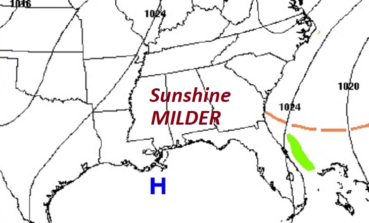
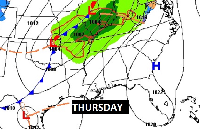
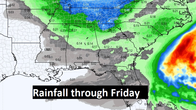
NEXT FEW DAYS: The warming trend continues . We’re headed for the mid 70’s Thursday. Showers return by late Thursday night into early Friday morning as a front approaches. Dry weather returns for the weekend. The air behind the front is Pacific air, meaning we’re not expecting a big temperature plunge this time. Highs will be in the 60’s Friday and Saturday, and back in the 70’s on Sunday.
The next weather maker for us is a Pacific Front that will bring in scattered showers Thursday night to first thing Friday morning. But not much rain.
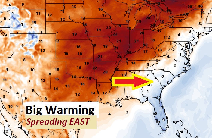
That warmer air in the middle of the country is headed our way, as the weekend chill quickly retreats.
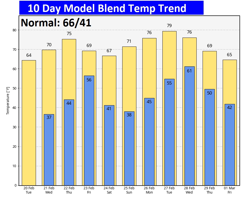
Here’s the 10 day temperature trend.
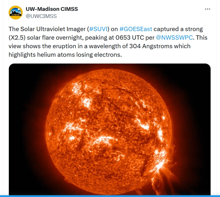
Meanwhile, a big solar flare storm continues. Could affect some radio communications.
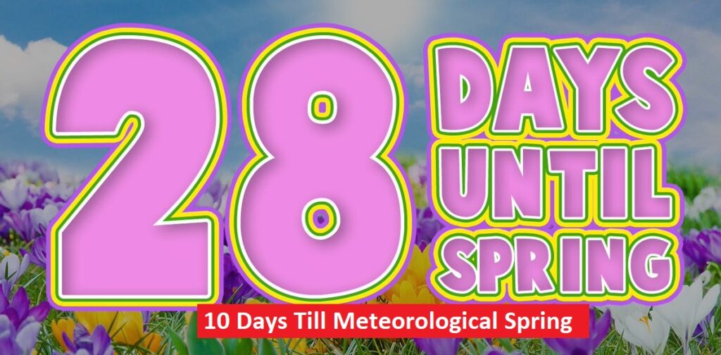
The Spring countdown continues.
Thanks for reading the blog. There will be another complete Blog update and video forecast discussion tomorrow morning. This morning, everything is normal including LIVE on the Radio from 6 to 9AM on NewsTalk 93.1 – WACV. Have a great day.
–Rich