
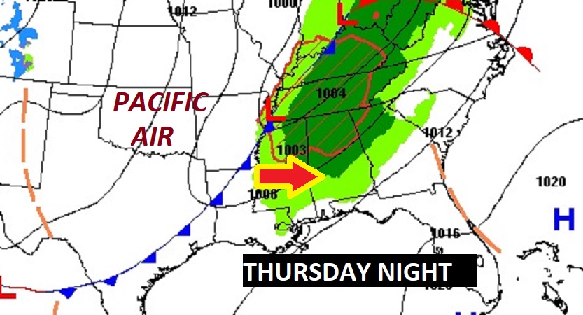
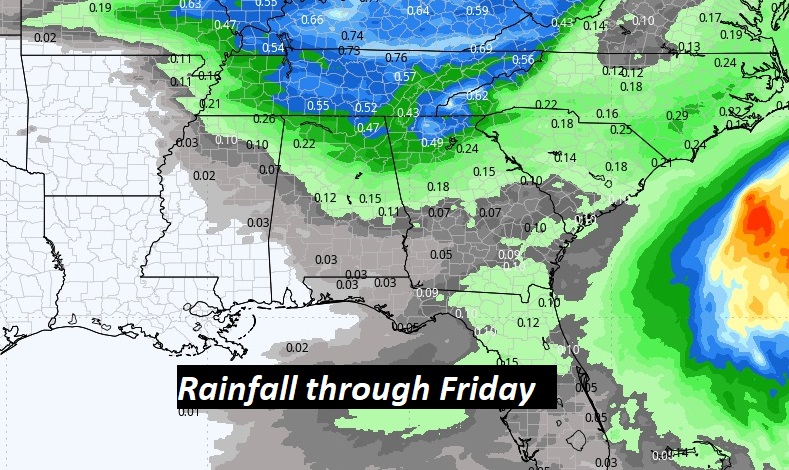
Good morning! Our nice warming trend continues. Yesterday’s high was 66. We’ll reach the lower 70’s today and the mid 70’s Thursday. An approaching frontal system will bring showers back to Alabama on Thursday night, but no severe weather is expected, and rainfall amou8nts will be small. The air behind the front is Pacific air, meaning we’re not expecting a big temperature drop this time. Highs will be in the upper 60’s Friday and Saturday, and back in the 70’s on Sunday. The next storm system next week could be a bigger deal around Wednesday night the 28th. Here’s my brief forecast discussion.
.
TODAY: Mostly sunny. The warming trend continues. High 72. East to south wind 5 to 10 mph. Clear and not as cool tonight. Low 45.
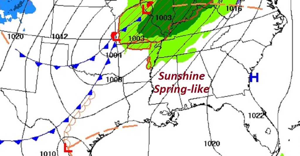
NEXT FEW DAYS: The warming trend continues . We’re headed for the mid 70’s Thursday. Showers return by late Thursday night into early Friday morning as a front approaches. Dry weather returns for the weekend. The air behind the front is Pacific air, meaning we’re not expecting a big temperature drop this time. Highs will be in the 60’s Friday and Saturday, and back in the 70’s on Sunday.
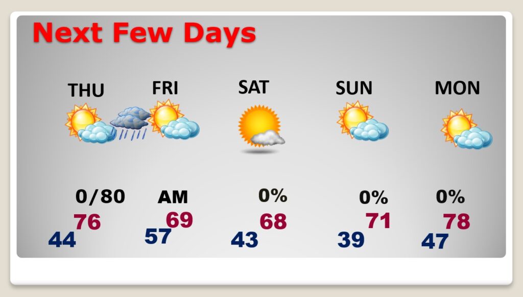
Rainfall totals are expected to be very light. The next storm system next week could be a bigger deal around Thursday the 28th.
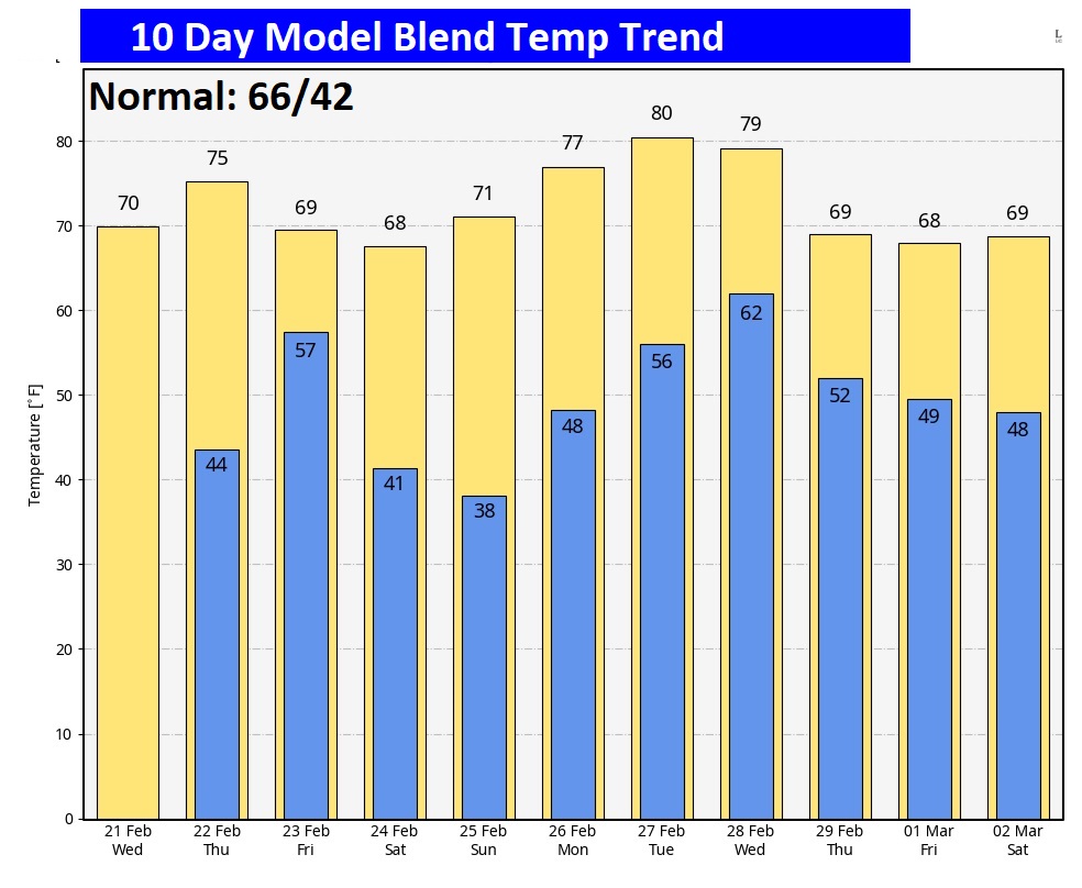
Here’s the 10 day temperature trend.
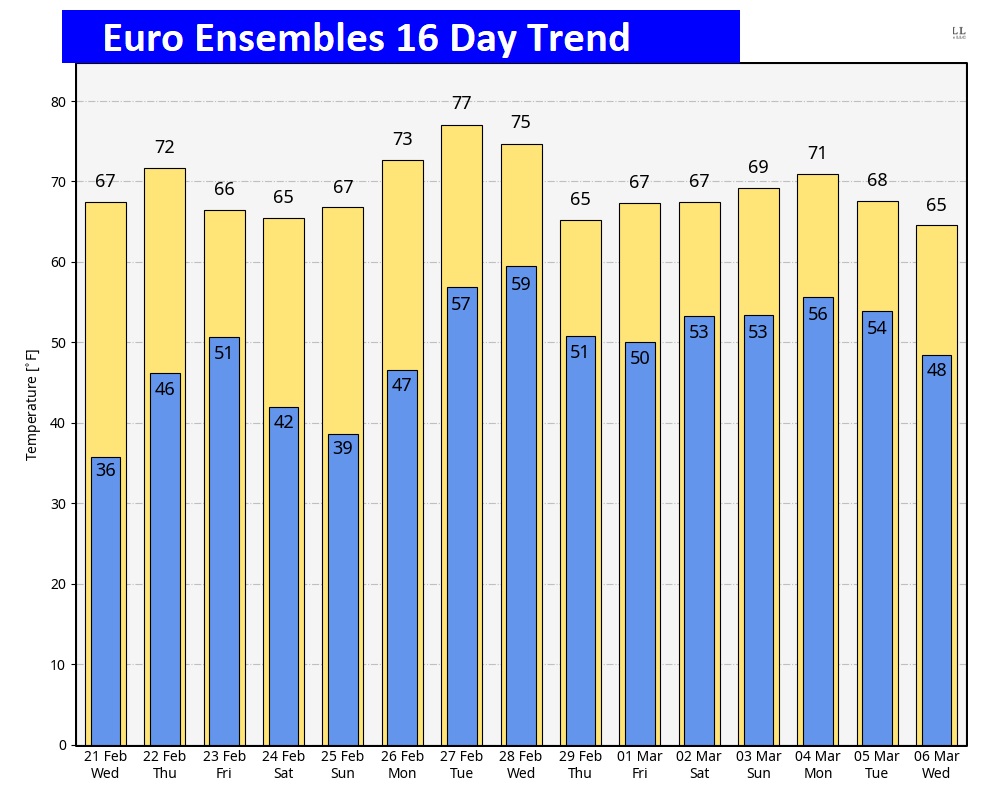
Are we done with Winter? Too early to say… But, lets look out 16 days on the EURO Model Ensembles.
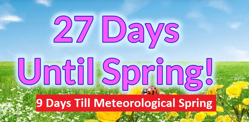
The Spring countdown continues.
Thanks for reading the blog. There will be another complete Blog update and video forecast discussion tomorrow morning. This morning, everything is normal including LIVE on the Radio from 6 to 9AM on NewsTalk 93.1 – WACV. Have a great day.
–Rich