
Good morning! Our nice warming trend continues. Yesterday’s high was 72. We’ll reach the middle 70’s today. Expect a breezy, very springlike day. An approaching frontal system will bring showers to Alabama tonight. Cloudy through the evening. Risk of showers tonight, especially late tonight. Can’t rule out a thunderstorm or two. The air behind the front is Pacific air, meaning we’re not expecting a big temperature drop this time. Highs will be in the upper 60’s Friday and Saturday, and low 70’s on Sunday. We could see our first 80+ degree day of 2024 by Tuesday. The next storm system next week could be a bigger deal around Thursday the 28th. Here’s my brief forecast discussion.
.
TODAY: Mostly sunny. High 76. Becoming breezy. South wind 7 to 15 gusting to 25 mph. Cloudy through the evening. Risk of showers tonight, especially late tonight. Can’t rule out a thunderstorm or two. Windy and mild. Low 57.
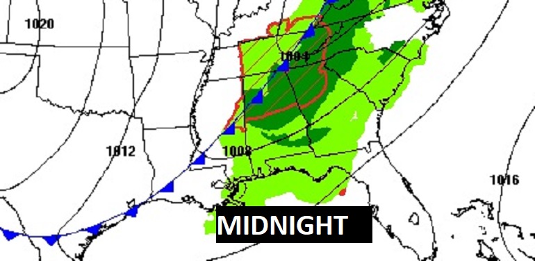
Here’s the map set-up at Midnight as the Pacific front approaches.
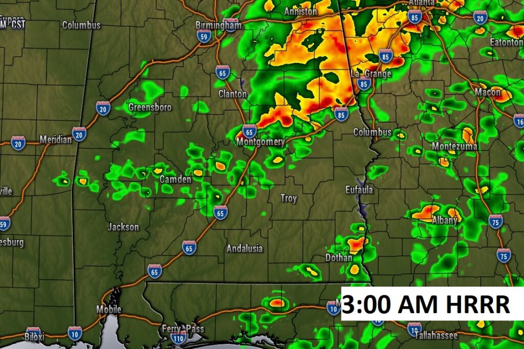
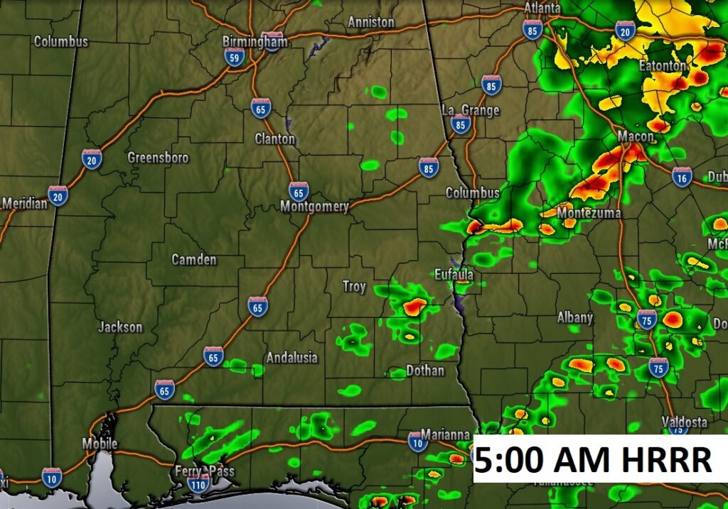
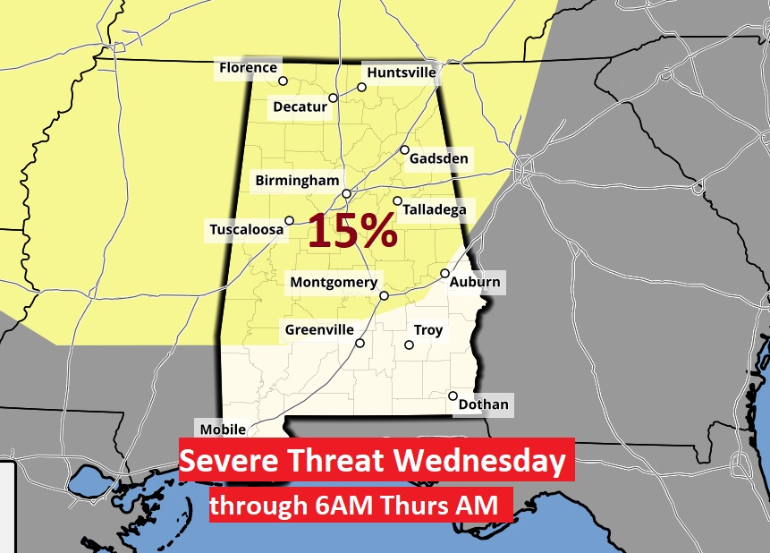
FUTURE RADAR: Best chance of rain late tonight especially in the overnight hours. Although no significant severe weather threat is expected, an isolated strong to possibly severe storm or two is certainly not completely out of the question. Now SPC has introduced a 15% Severe Threat next Wed. 2/28 through 6AM Thurs 2/29. Stay tuned.
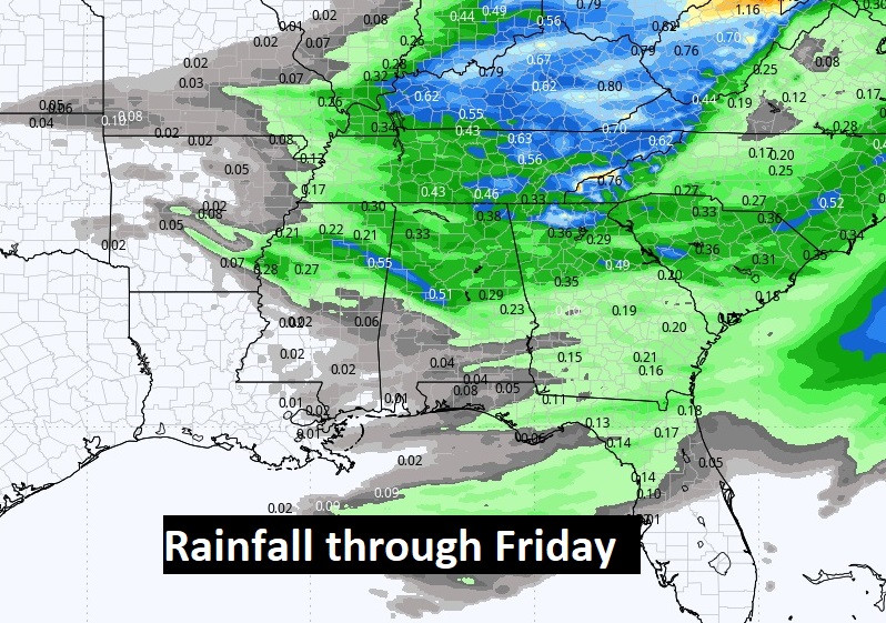
Rainfall totals are expected to be very light. Averaging .25 to .50 in north Alabama, and mostly .25 or less across south Alabama.
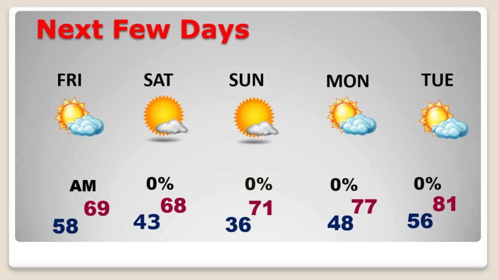
NEXT FEW DAYS: Dry weather returns for the weekend. The air behind the front is Pacific air, meaning we’re not expecting a big temperature drop this time. Highs will be in the 60’s Friday and Saturday, and back in the lower 70’s on Sunday. Expect an amazing warming trend next week, with upper 70’s by Monday. We could see our first 80+ degree day of 2024 by Tuesday. The next storm system next week could be a bigger deal around Thursday the 28th. Showers and thunderstorms.
SPC has now introduced a 15% Severe Threat next Wed. 2/28 through 6AM Thurs 2/29. Stay tuned.
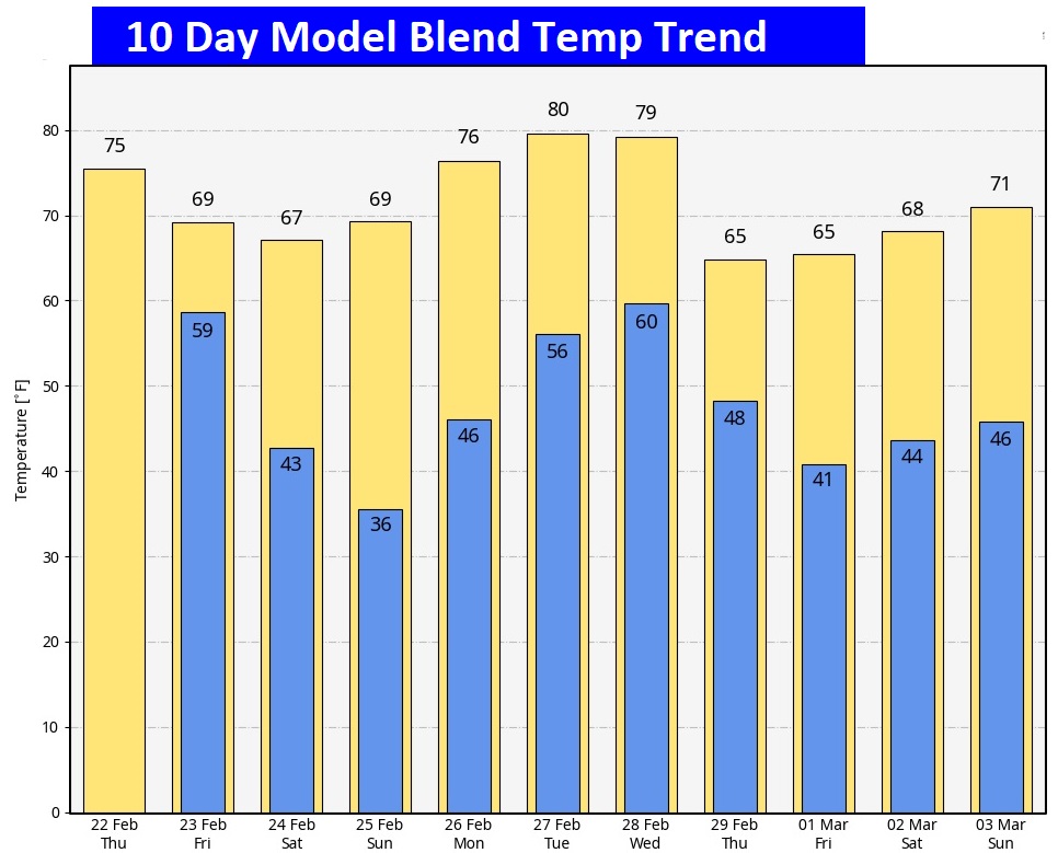
Here’s the 10 day temperature trend.
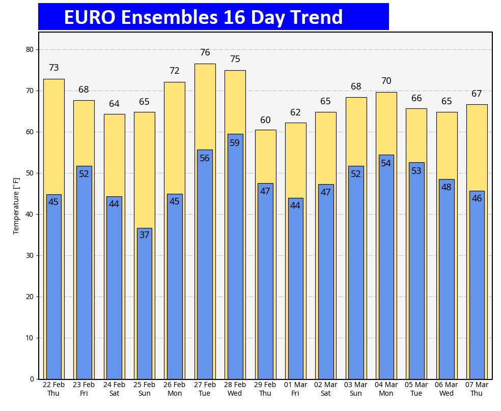
Here’s the EURO Model Ensembles. Fingers crossed that the Arctic floodgates stay closed.
The Spring countdown continues.

Yesterday was perfect. Spring Fever abounds.
Thanks for reading the blog. There will be another complete Blog update and video forecast discussion tomorrow morning. This morning, everything is normal including LIVE on the Radio from 6 to 9AM on NewsTalk 93.1 – WACV. Have a great day.
–Rich