
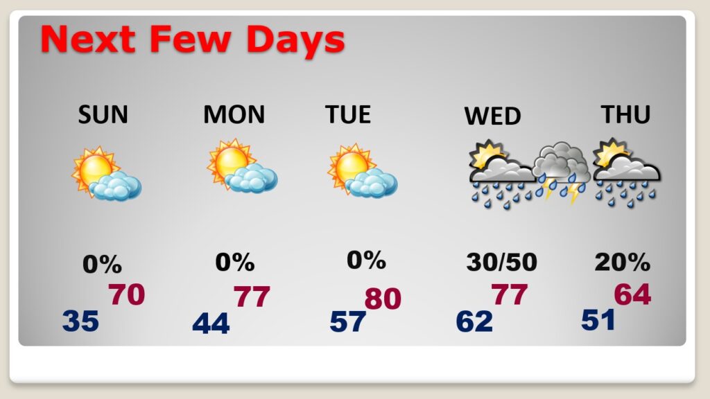
Good morning! Today will a bite brisk at times, but seasonal for the last weekend of February. Winds could gust to 30 mph. Expect a cold night tonight, but with plenty of sunshine, Sunday’s high will reach the upper 60’s to near 70. Not a bad last weekend of February. A big warm-up is in the cards next week. We could reach near 80 for the first time in 2024 by Tuesday. Showers and thunderstorms are possible by Wednesday evening, Wednesday night, but fortunately we have removed the Severe Weather Risk. That’s great news. It will turn quite a bit cooler by Thursday.
.
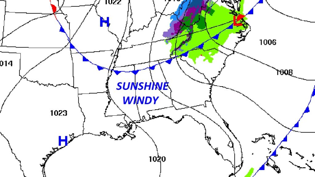
TODAY: Sunshine, windy and seasonable. High near 70. Northwest wind a5 1o 20 gusting to 30 mph. Clear cold tonight. Low 35
A Red Flag Warning simply means dry, windy conditions could promote wild fires.
NEXT FEW DAYS: Sunday will be sunny and mild. Not as windy. After a chilly morning, afternoon High near 70. Expect an amazing warming trend next week, with upper 70’s by Monday. We could see our first 80 degree day of 2024 by Tuesday. Showers and thunderstorms are possible by Wednesday evening, Wednesday night, but we have removed the Severe Risk. Good News.
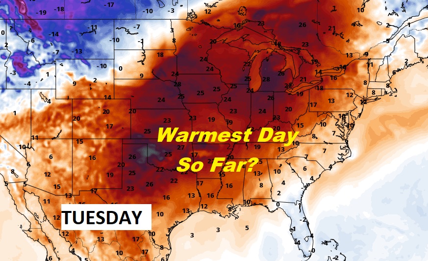
Are you ready for the big warm-up this week? Dozens of record highs will fall across the nation.
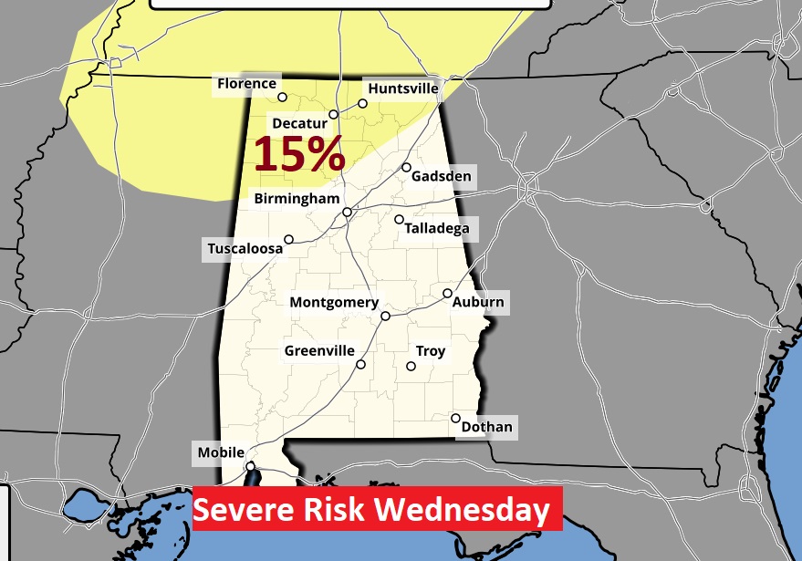
SEVERE RISK? The Storm Prediction Center has backed off quite a bit on the Wednesday severe threat, In fact, they have adjusted the risk area to just the northern counties. This is great news for most of the state. The best dynamics’ for severe weather will stay north of us.
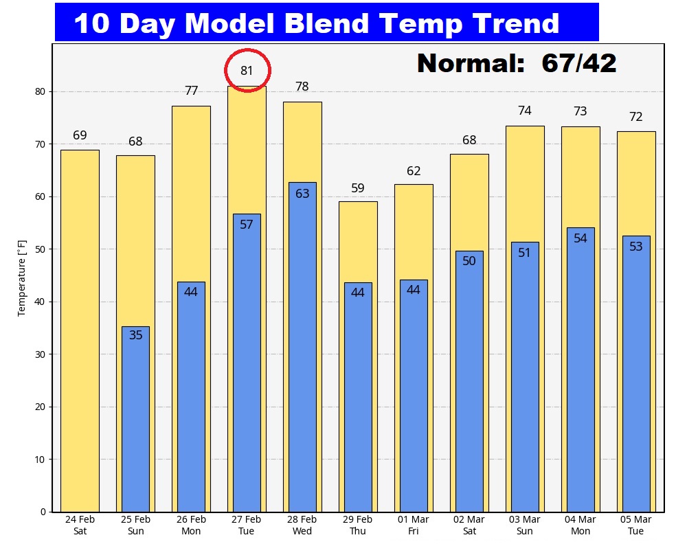
Here’s the 10 day temperature trend. Look for a big warm-up especially early next week, peaking on Tuesday. It will turn much cooler Thursday, but not arctic air.

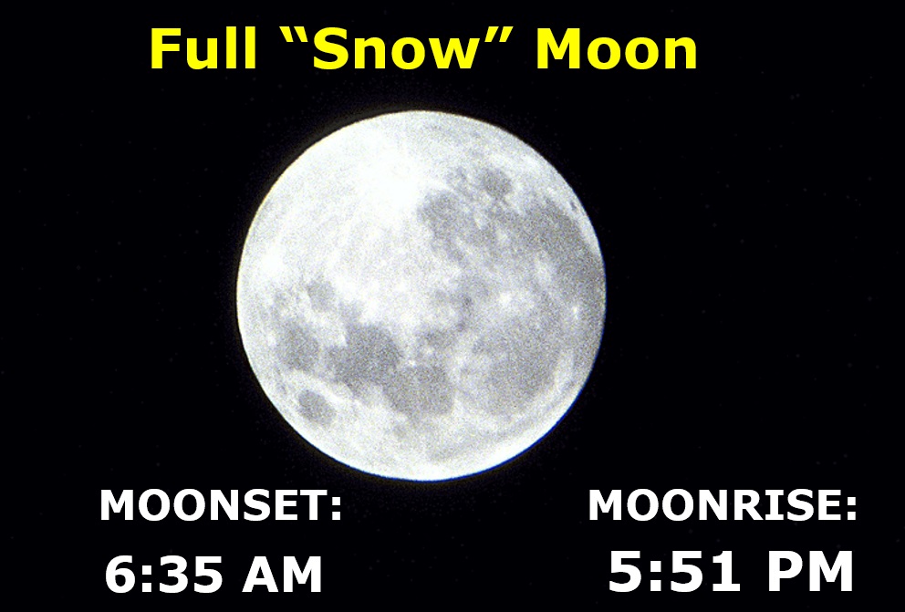
Spectacular Full “Snow” Moon this morning. Moonset 6:35 AM. Sunrise 6:18. Sunset 5:38 PM. Moonrise 5:56 PM.
Thanks for reading the Blog this morning. The next scheduled Blog update and video will be Monday morning. Have a great weekend!
–Rich