
Good morning! A cold front will bring showers back to the forecast today. Today’s high will tease 80. It will be nearly 20 degrees cooler on Thursday. Friday’s high may not make it out of the 50’s. Thursday looks dry. Another round of showers moves in Thursday night, Friday into Saturday. There could be a few showers Sunday, and a better chance Monday. We’re getting into an active pattern. Temperatures will start to recover, with mid 70’s on Sunday. Here’s my brief forecast discussion.
.
TODAY: WIND ADVISORY inn effect till 6PM. Showers likely today, especially by afternoon as a cold front moves through. Windy. South winds 15 to 20 gusting to 30. (Normal: 68/43). Showers move out by early evening. Mostly cloudy and colder. Low 40.
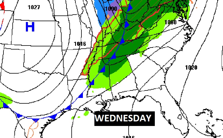
Here’s the Map set up at lunchtime today. (Noon)
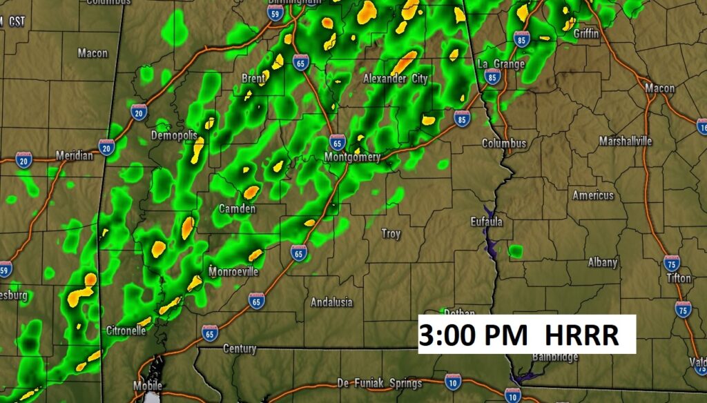
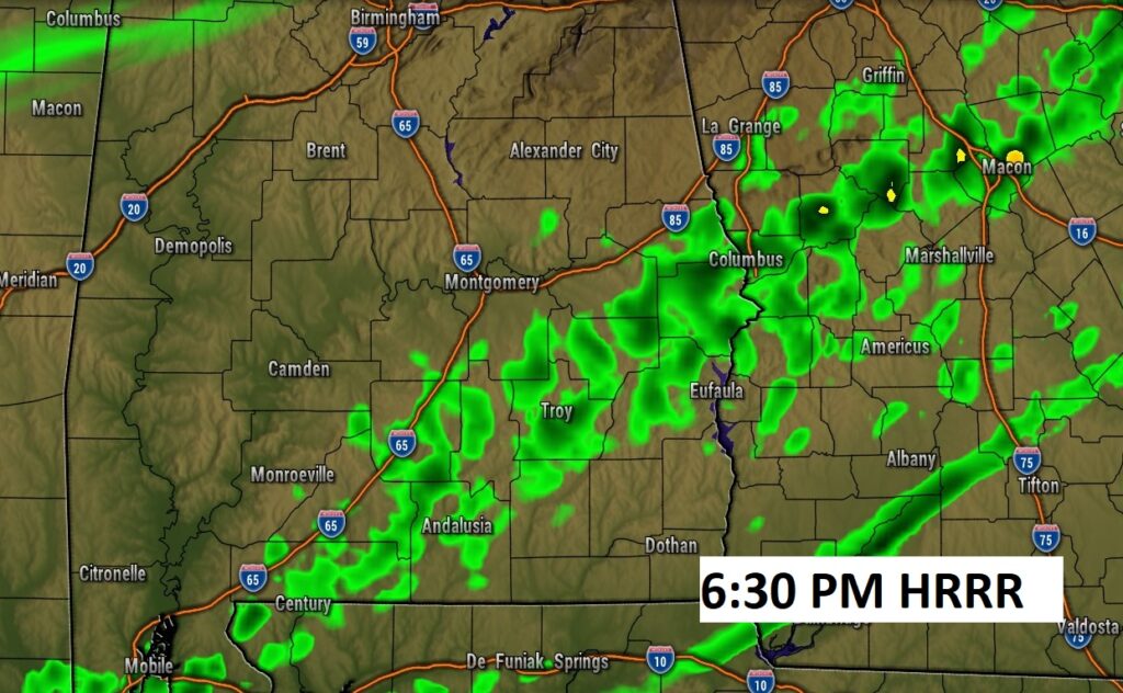
Future radar snapshots. Showers out ahead of a strong cold front.
.
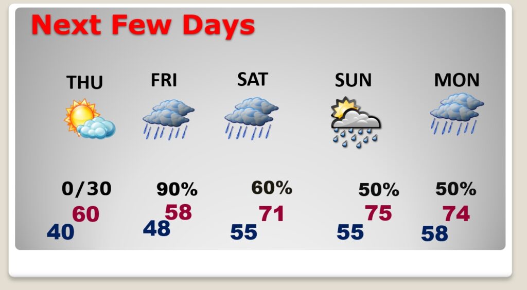
NEXT FEW DAYS: Get ready for a big change of climate. It will be nearly 20 degrees cooler on Thursday. Friday’s high may not make it out of the 50’s. Thursday looks dry. Another round of showers moves in Thursday night, Friday into Saturday. There could be a few showers Sunday, and a better chance Monday. We’re getting into an active pattern. Temperatures will start to recover, with mid 70’s on Sunday.
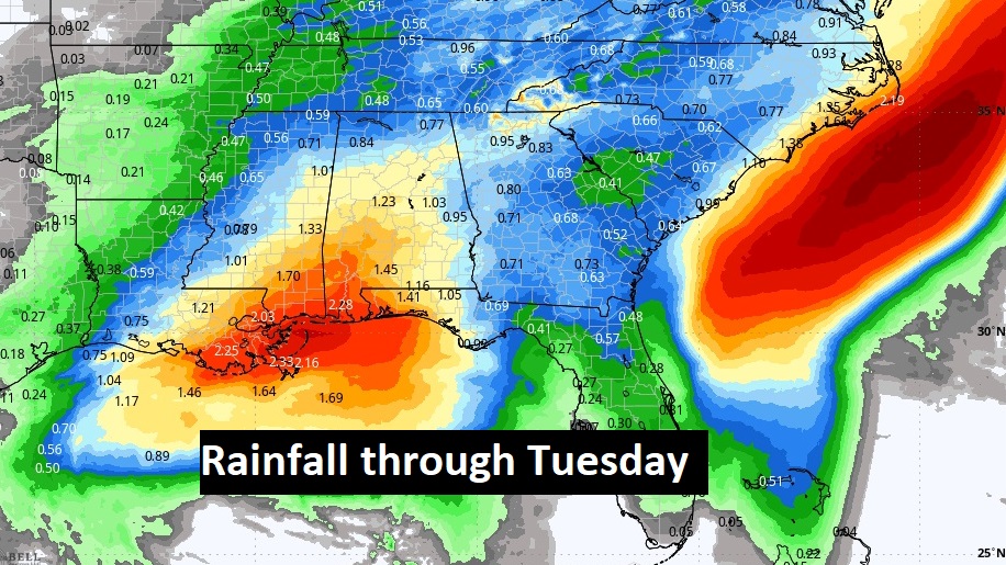
Here’s the expected rainfall through Tuesday, as a series of disturbances drift through the area. Today rainfall amounts could be impressive.
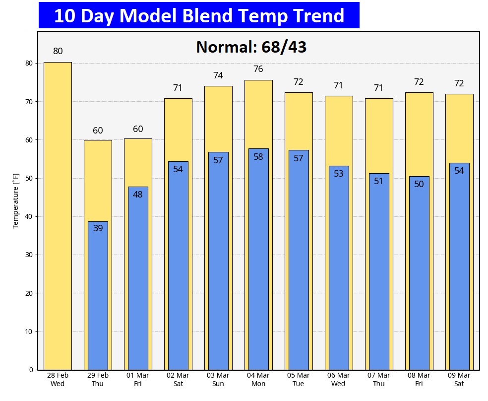
Here’s the 10 day temperature trend. Coldest days will be Thursday and Friday. Temperatures start to recover again over the weekend.
Thanks for reading the blog. There will be another complete Blog update and video forecast discussion tomorrow morning. This morning, everything is normal including LIVE on the Radio from 6 to 9AM on NewsTalk 93.1 – WACV. Have a great day.
–Rich