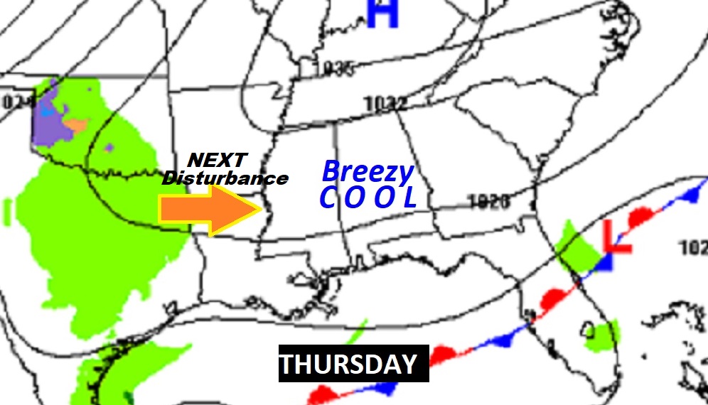
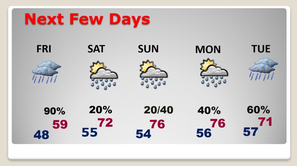
Good morning! Happy Leap Day! Today will be quite a change from yesterday. Today’s high near 60 will be nearly 20 degrees cooler than yesterday. Another round of showers moves in late tonight and through Friday. There could be more showers on Saturday and Sunday, and Monday, but the shower risk each day will be small. Tuesday looks like a very wet and stormy day. We’re getting into an active pattern. Temperatures will start to recover, with mid 70’s on Sunday and Monday. Here’s my brief forecast discussion.
.
TODAY: Today will be quite a change from yesterday. Much cooler. Quite a change of climate. Mostly cloudy. Breezy. High near 60. North wind 6 to 15 gusting to 20 mph. Dry this evening. But, the risk of more showers returns late tonight, after Midnight. Low 48.
.
NEXT FEW DAYS: Another round of showers moves in late tonight and through Friday. There could be more showers on Saturday and Sunday, and Monday, but the shower risk each day will be small. Tuesday looks like a very wet and stormy day. We’re getting into an active pattern. Temperatures will start to recover, with mid 70’s on Sunday and Monday.
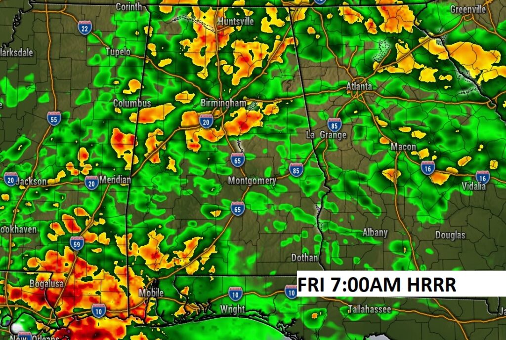
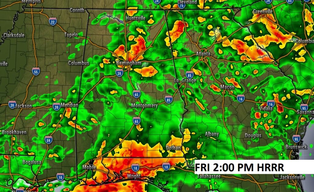
Future Radar snapshots on Friday. Looks like a very wet March 1st. First Day of Meteorological Spring.
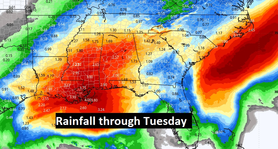
Here’s the expected rainfall through Tuesday, as a series of disturbances drift through the area. The two wettest days will be Friday and especially Tuesday.
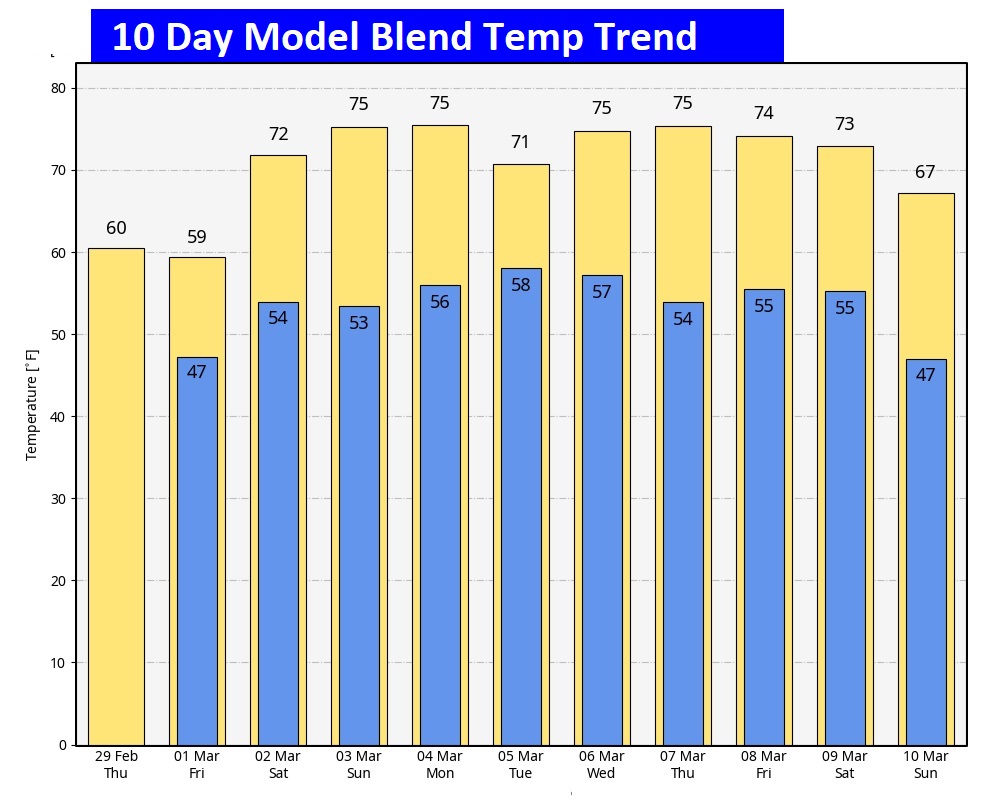
Here’s the 10 day temperature trend. Coolest days will be today and Friday. Temperatures start to recover again over the weekend. Next week looks very spring-like,
Thanks for reading the blog. There will be another complete Blog update and video forecast discussion tomorrow morning. This morning, everything is normal including LIVE on the Radio from 6 to 9AM on NewsTalk 93.1 – WACV. Have a great day.
–Rich
