
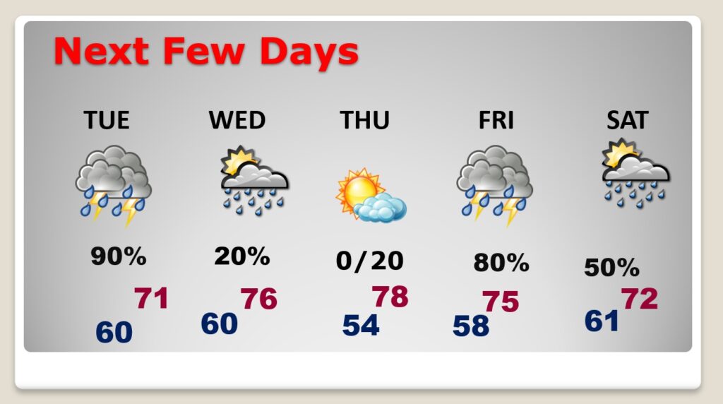
Good morning! Our temperatures are warming up. Today we’re headed for the upper 70’s. Although today’s rain chance is small, get ready for a Super Tuesday soaker tomorrow, as a disturbance tracks through the Gulf states. Rainfall amounts could be heavy. Thunderstorms are possible, but no severe weather is expected. The next significant storm system will arrive Friday, with another round of rain and thunderstorms. In fact, the Friday storm system could bring a severe weather threat and some very heavy rainfall amounts. The risk of showers continues Saturday. Here’s my brief forecast discussion.
.
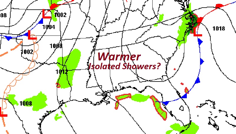
TODAY: Cloudy skies will give way to sunshine later. Isolated showers can’t be ruled out. Warmer today. High 78. Southwest wind 6 to 12 mph. Very mild tonight. Low near 60.
.
NEXT FEW DAYS: Election Day will be wet and stormy. There could be sole isolated showers Wednesday. Highs will be in the 70’s each day. The next significant storm system will arrive Friday, with another round of rain and thunderstorms. Locally heavy rainfall is a good bet, as well as a potential Severe Weather threat.
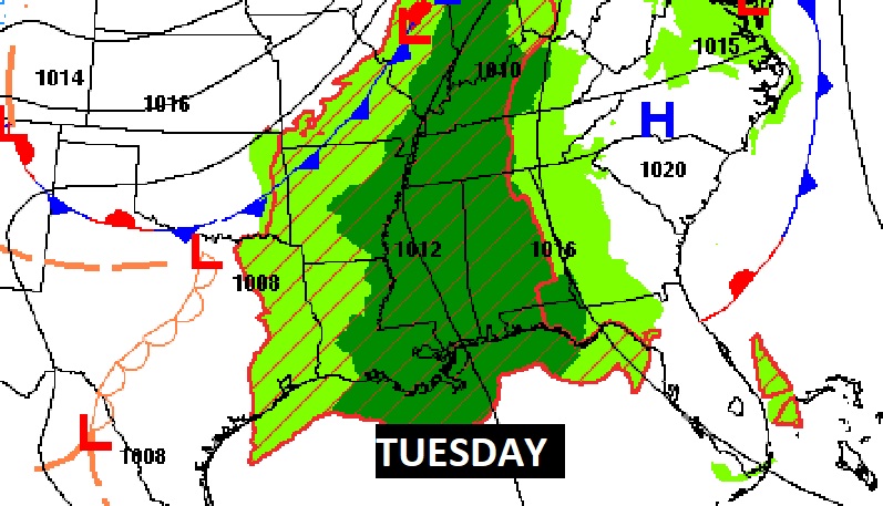
Super Tuesday rainfall will be widespread across multiple states.
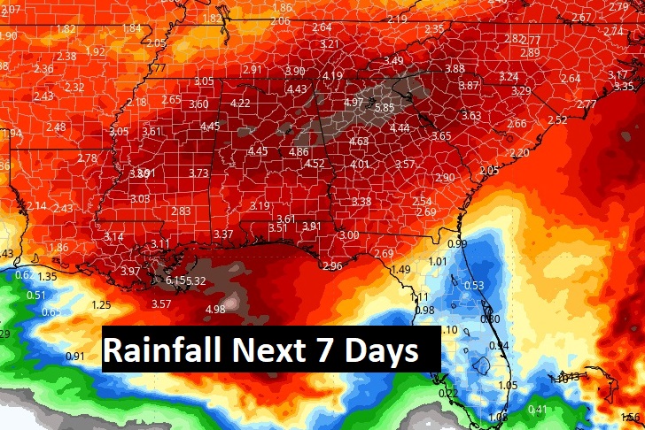
Total rainfall through the next seven days could be excessive. Here’s the expectedfor the next 7 days.
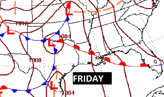
All eyes on the Friday storm system. Looks like the storm of the week. Late breaking SPC has introduced a 15% Severe Risk. Rainfall amounts of 2 to 4 inches, locally 5″. #alwx
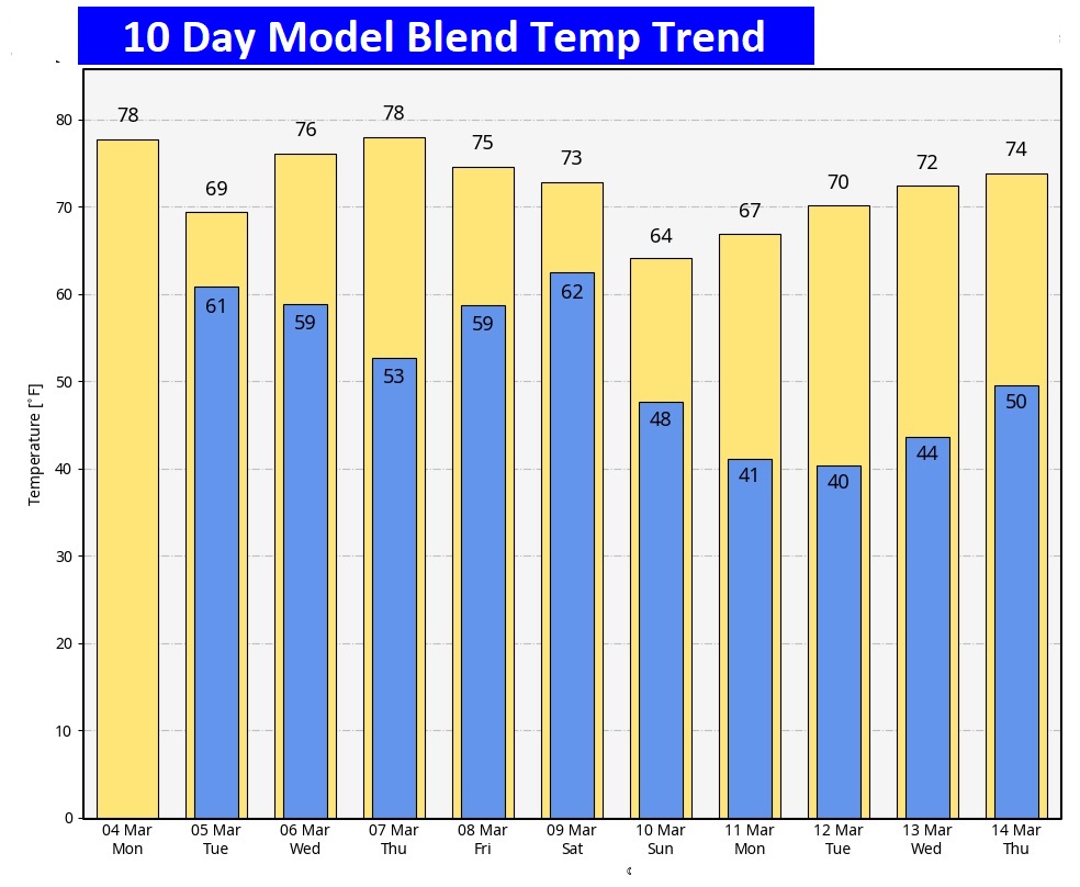
Here’s the 10 day temperature trend. Looks very spring-like.
Thanks for reading the blog. There will be another complete Blog update and video forecast discussion tomorrow morning. This morning, everything is normal including LIVE on the Radio from 6 to 9AM on NewsTalk 93.1 – WACV. Have a great day.
–Rich