
Good morning! Carry an umbrella to the Polls on this Election Day. Looks like a very wet day ahead. There could even be some thunderstorms, but no severe weather is expected. We’ll get a little break in the action Wednesday and Thursday. The next significant storm system will arrive Friday, with another round of rain and thunderstorms. The Friday storm system could bring some very heavy rainfall amounts. The risk of showers continues Saturday. Here’s my brief forecast discussion.
.
TODAY: Periods of showers and possibly some thunderstorms. High 71. East wind 6 to 12. Risk of more rain continues till about Midnight tonight. Low 60.
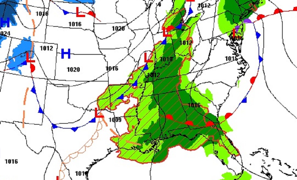
Super Tuesday rainfall will be widespread across multiple states.
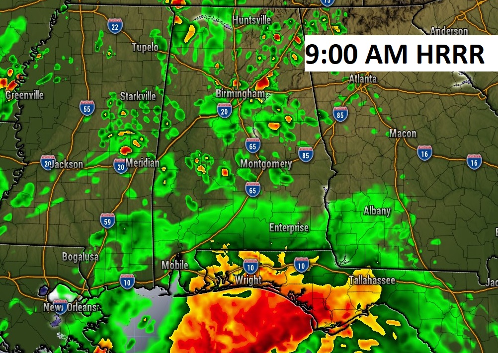
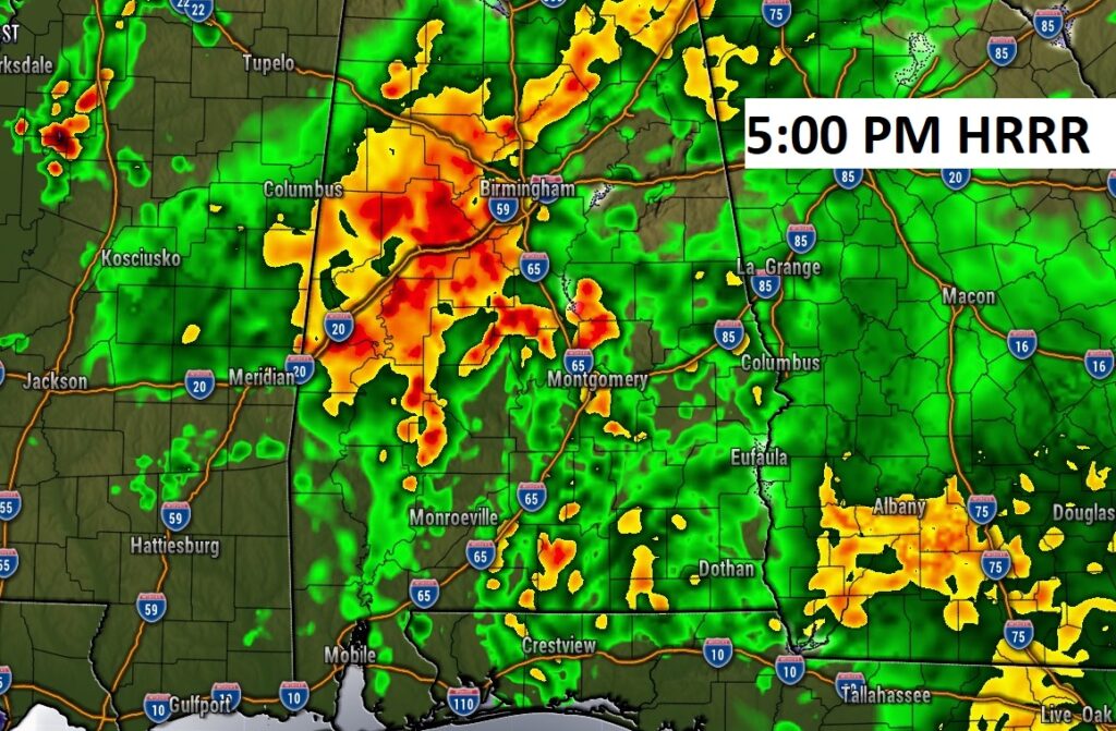
Here’s a couple of Future Radar snapshots. Widespread rain today and maybe a few thunderstorms.
.
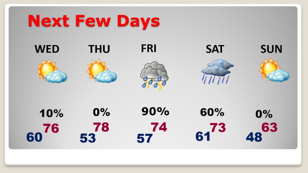
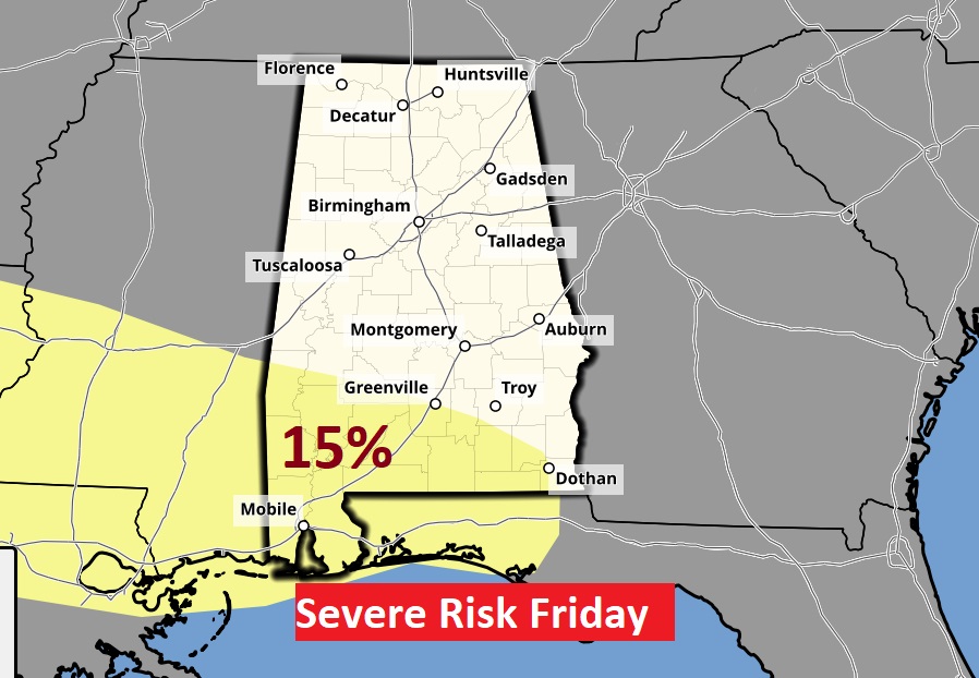
NEXT FEW DAYS: We’ll get a little break in the action Wednesday and Thursday. Highs in the 70’s. The next significant storm system will arrive Friday, with another round of rain and thunderstorms. The Friday storm system could bring a severe weather threat and some very heavy rainfall amounts. The risk of showers continues Saturday. It will turn cooler Sunday, but the sun will return. Highs will fall back to the 60’s.
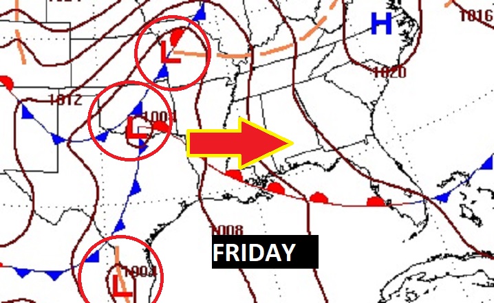
All eyes on that Friday storm system. Looks like the storm of the week. Rain and thunderstorms. Potentially heavy rainfall.
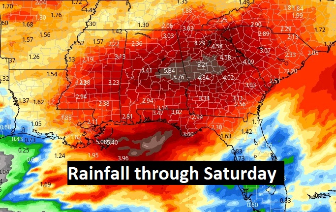
Total rainfall through the next seven days could be excessive. Here’s the expectedthrough Saturday.
The greatest severe weather risk has shifted to mostly south Alabama on the current SPC outlook.
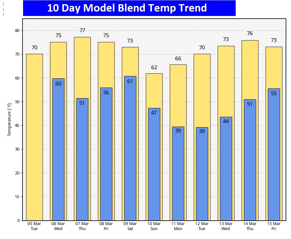
Here’s the 10 day temperature trend. Looks very spring-like.
Thanks for reading the blog. There will be another complete Blog update and video forecast discussion tomorrow morning. This morning, everything is normal including LIVE on the Radio from 6 to 9AM on NewsTalk 93.1 – WACV. Have a great day.
–Rich