
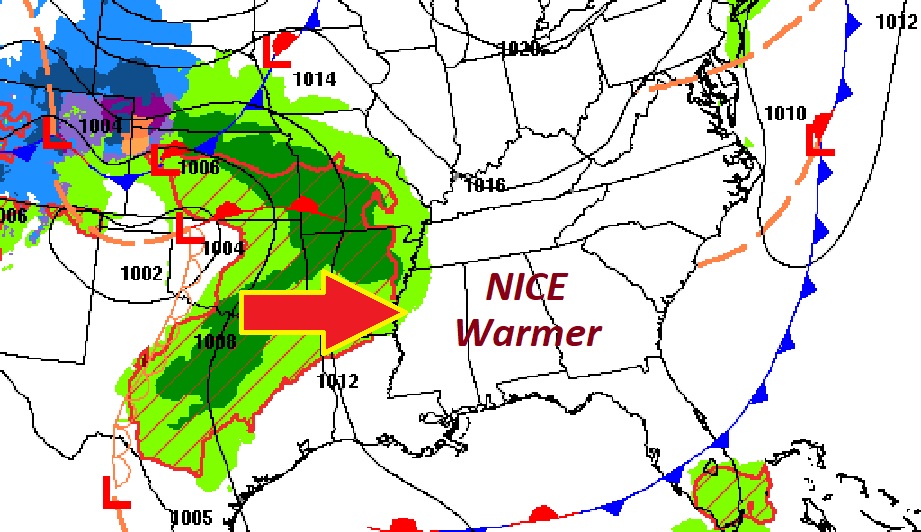
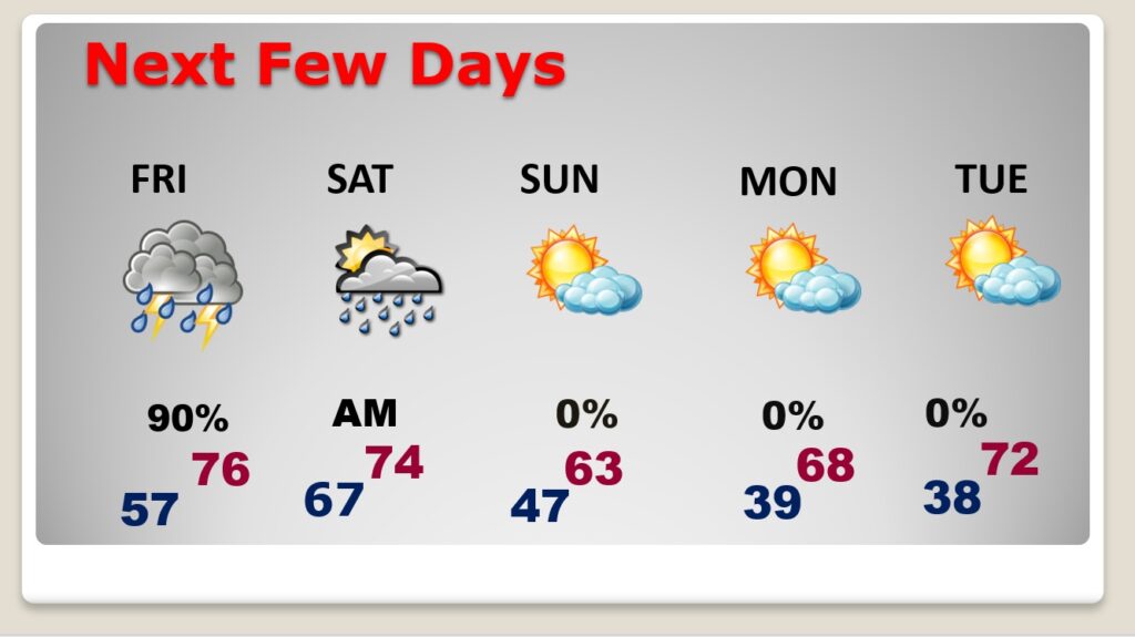
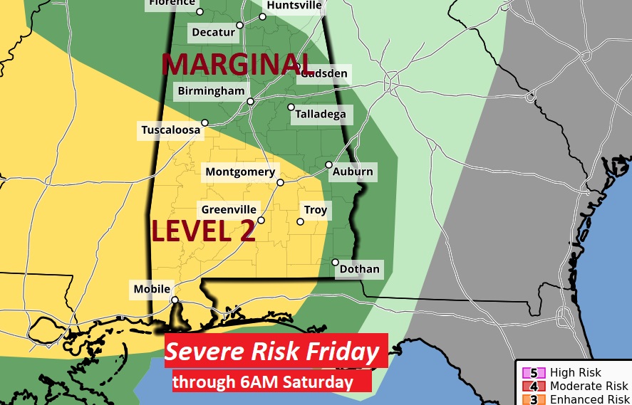
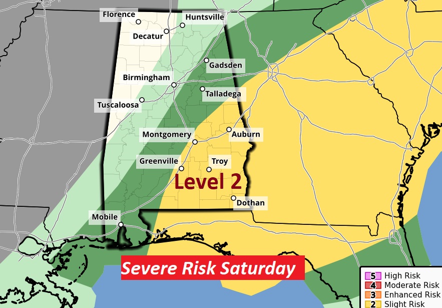
Good morning! We’re continuing to enjoy a nice break in-between storm systems today, before that next big storm system Friday Night/Saturday morning. Today will be mild with a good bit of sun. Clouds increase tonight. On Friday the risk of showers for most of us tarts in the late afternoon. Expect widespread rain and thunderstorms Friday night, through the overnight hours, in through Saturday morning. Most of us are in a Level 2 Severe Risk, including a damaging wind gusts and possible tornadoes. Hail is also possible. It will turn quite a bit cooler Sunday as sunshine returns. Attention growers, some towns could see a little frost by Sunday and Monday nights. Here’s my brief forecast discussion.
.
TODAY: Patchy AM fog. Otherwise Mostly sunny. A little warmer. High 78. Northeast wind at 6 to 12, becoming SE in the afternoon. Increasing clouds tonight. Low 57.
.
NEXT FEW DAYS: On Friday the risk of showers for most of us tarts in the late afternoon. Expect widespread rain and thunderstorms Friday night, through the overnight hours, in through Saturday morning. Most of us are in a Level 2 Severe Risk, including a damaging wind gusts and possible tornadoes. Hail is also possible. It will turn quite a bit cooler Sunday as sunshine returns. Coldest nights will be Sunday and Monday. Patchy frost can’t be ruled out.
All eyes on that Friday Night storm system. Rain and thunderstorms. Potentially heavy rainfall.

Most of us are in a Level 2 Severe Risk, including a damaging wind gusts and possible tornadoes. Hail is also possible.
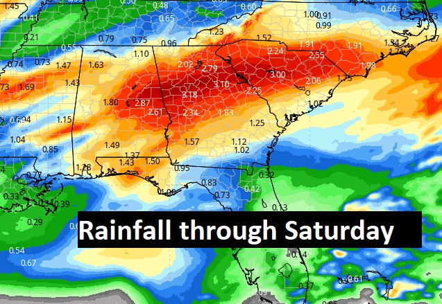
Total rainfall through the next seven days could be quite heavy. Here’s the expectedthrough Saturday.
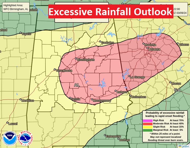
Here’s the WPC Excessive Rainfall Outlook for Friday morning through Saturday morning.
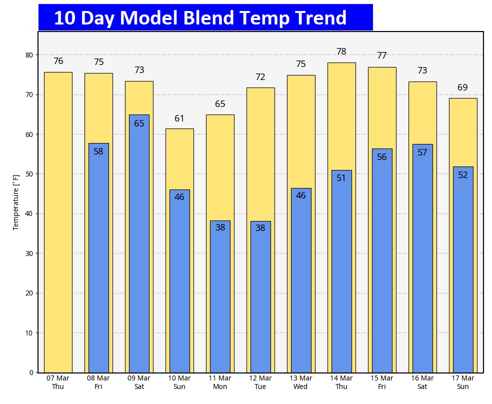
Here’s the 10 day temperature trend. Coldest mornings will be Monday and Tuesday. Attention growers, some towns could see a little frost by Sunday and Monday nights.
SPRING FORWARD THIS WEEKEND: One less hour of sleep this weekend as we set the clocks forward Saturday night.

Thanks for reading the blog. There will be another complete Blog update and video forecast discussion tomorrow morning. This morning, everything is normal including LIVE on the Radio from 6 to 9AM on NewsTalk 93.1 – WACV. Have a great day.
–Rich