
Good morning! A potent storm system will bring multiple risks – including a Severe Risk and the potential for flooding rainfall. The risk of showers for most of us starts by late afternoon. Expect widespread rain and thunderstorms through the overnight hours tonight, in through Saturday morning. We are in a Level 2 Severe Risk, including a damaging wind gusts and possible tornadoes. Flood watch in effect. Some towns in central Alabama could see 3-5”+. It will turn quite a bit cooler Sunday as sunshine returns. Attention growers, some towns could see a little frost by Sunday and Monday nights. Here’s my brief forecast discussion.
.
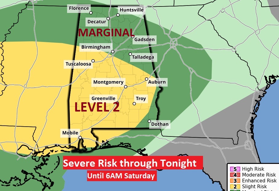
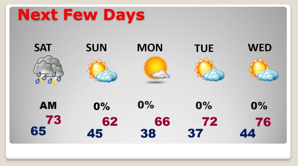
TODAY: The risk of showers for most of us starts by late afternoon. High today 73. SE wind 5 to 15 gusting to 25 mph. Expect widespread rain and thunderstorms through the overnight hours tonight, in through Saturday morning. We are in a Level 2 Severe Risk, including a damaging wind gusts and possible tornadoes. Flood watch in effect. Low tonight 65.
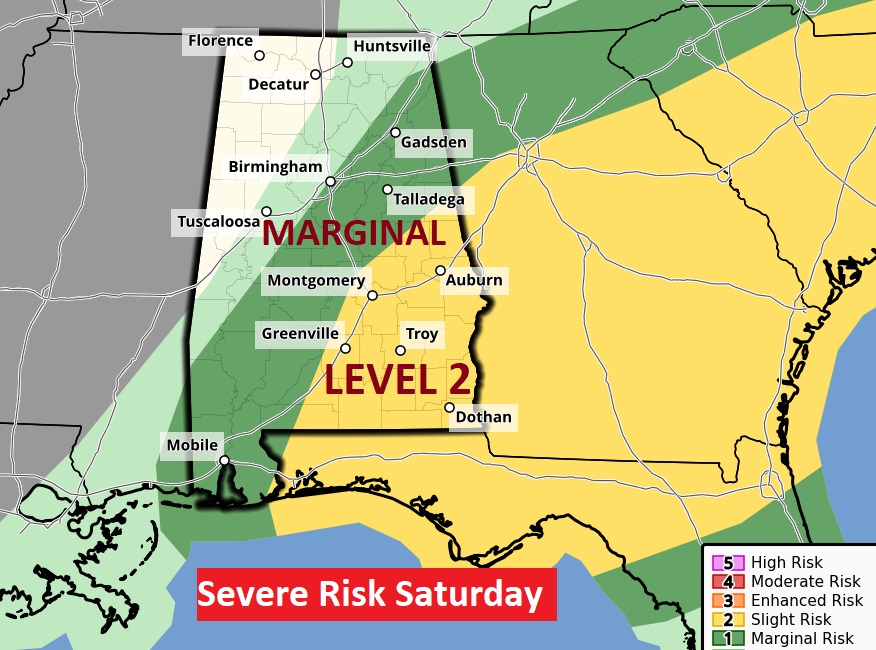
We are in a Level 2 Severe Risk. Damaging wind gusts to 60+, and a few tornadoes are possible. Aftter 6AM Saturday AM, the Day 2 Risk shifts to SE Alabama.
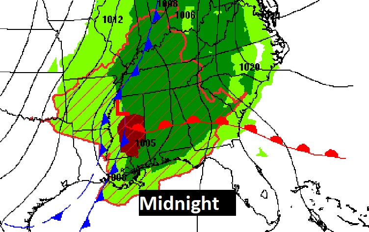
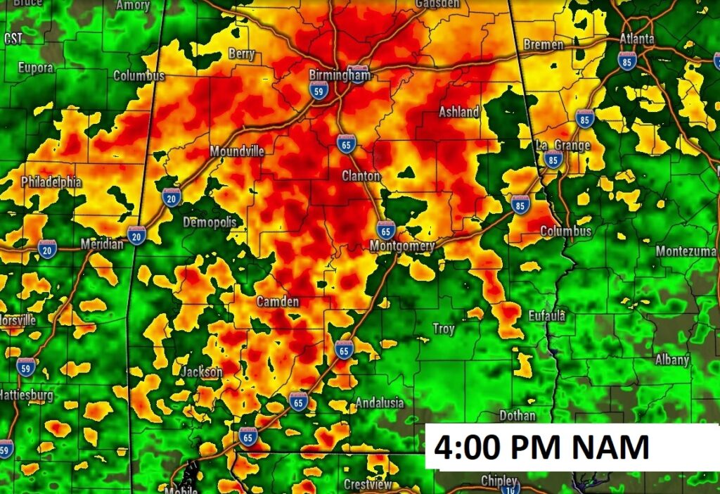
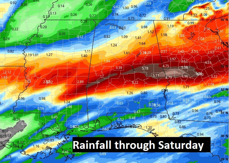
Future Radar: Two phases of the storm system. Look at this heavy rain shield late this afternoon at 4. Then, the severe Threat including tornado risk in the wee hours of the morning. Don’t tale the times literally

POTENTIAL TIMING: NWS says: Through the overnight hours and after midnight, we could see enough unstable air push north of the U.S 80/I-85 corridor between 3am and 7am. The severe threat will spread as far north as Shelby eastward to Randolph. Farther north, the severe threat will be greatly diminished.
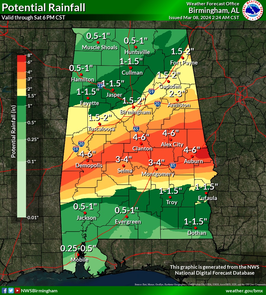
A flood watch is in effect. WPC has much of central Alabama in a Moderate Excessive Rainfall threat.
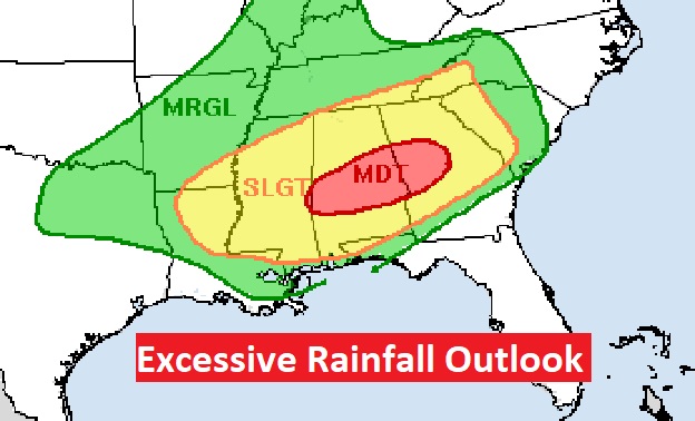
This map will get your attention. Rainfall could total 3-5” if not more in some towns. NWS:
WPC this morning mentioned a potential of up to 8 inches of storm total rainfall somewhere within this heavier axis, which is certainly not out of the question.
.
NEXT FEW DAYS: The rain should exit by about Noon Saturday if not before. Then, dry for the rest of the weekend. It will turn quite a bit cooler Sunday as sunshine returns. Coldest nights will be Sunday and Monday, as we fall into the 30’s . Attention Alabama growers: Patchy frost can’t be ruled out.
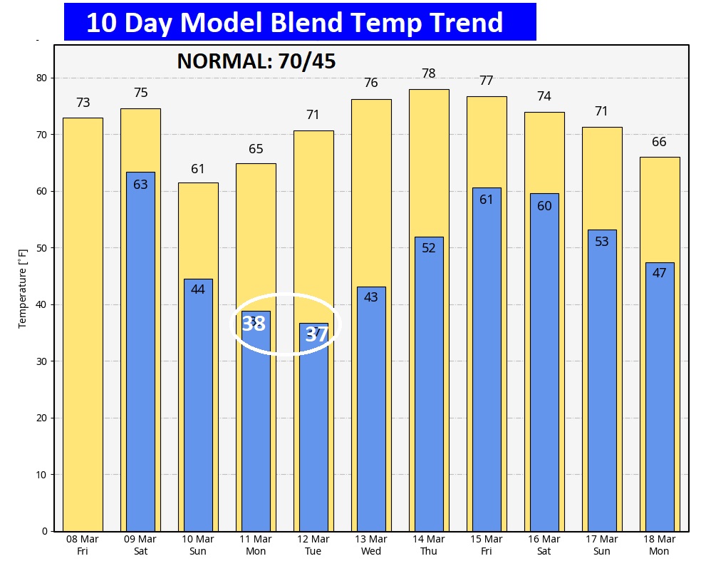
Here’s the 10 day temperature trend. Coldest mornings will be Monday and Tuesday. Attention growers, some towns could see a little frost by Sunday and Monday nights.
SPRING FORWARD THIS WEEKEND: One less hour of sleep this weekend as we set the clocks forward.

Thanks for reading the blog. There will be another complete Blog update and video forecast discussion tomorrow morning. This morning, everything is normal including LIVE on the Radio from 6 to 9AM on NewsTalk 93.1 – WACV. Have a great day.
–Rich