
(11:45 PM CDT 3/8/24)
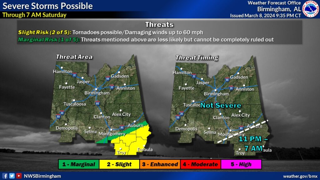
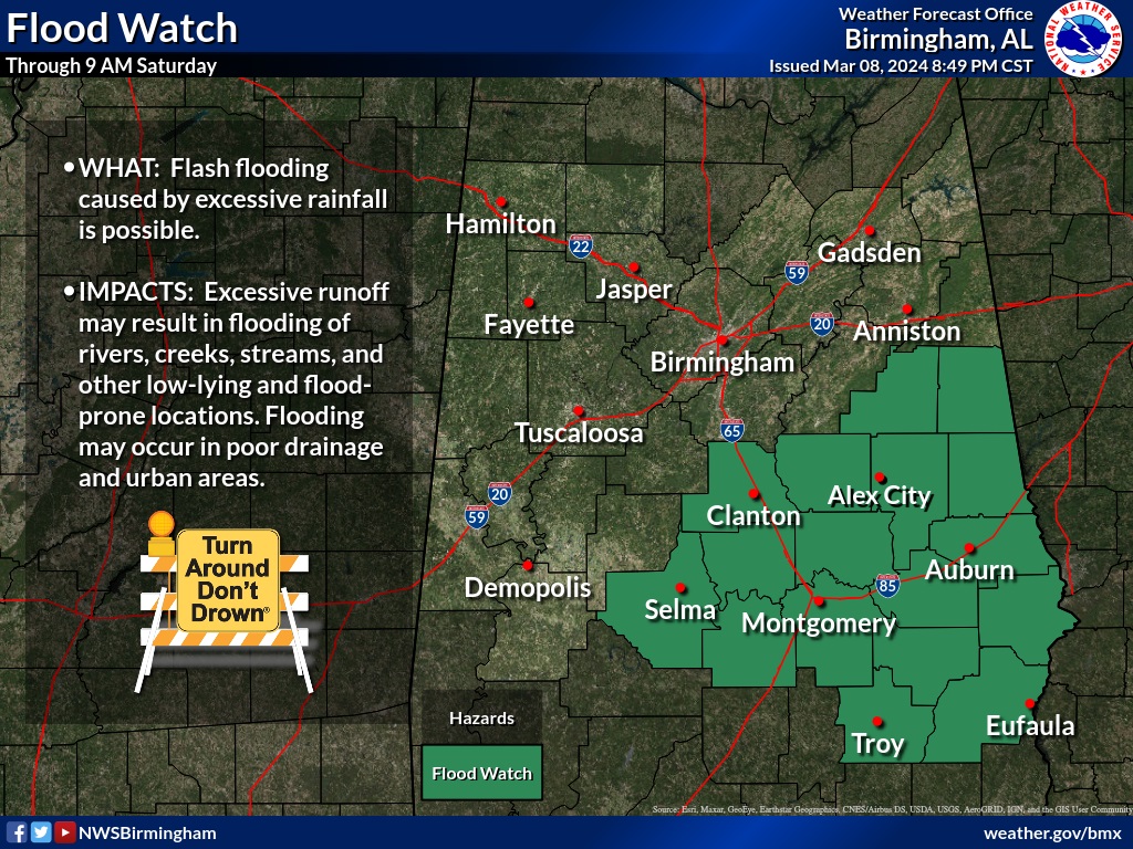
Updating our situation for the rest of the night: A warm front is located near a Greenville/Auburn line. So, the severe weather threat for the rest of the night has shifted mainly to Southeast Alabama generally south of a Greenville/Pike Road Auburn line. From I-85 northwest the severe threat has ended. Meanwhile the Flash Flood Watch continues. Many areas have already had 2-4” already and the potential exists for up to 2-4 additional inches overnight, especially along and south of I-85. Some areas have already experienced flooding. But, again the best news for many in central Alabama is a reduced severe weather threat. The threat of damaging wind gusts and isolated tornadoes will continue for southeast Alabama through 7AM.
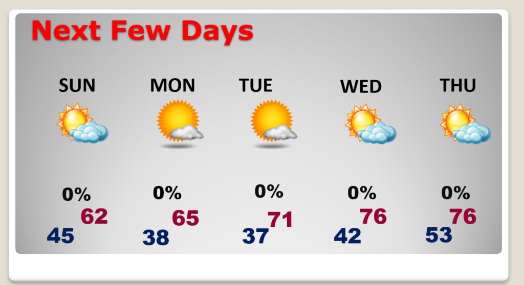
TODAY: After 7AM, Most of the rain will have shifted to Southeast Alabama. For much of the area: Cloudy today. Northwest wind 5 to 15 mph. High 73. Mostly cloudy, colder tonight. Low 45.
NEXT FEW DAYS: It will turn quite a bit cooler Sunday as sunshine returns. Coldest nights will be Sunday and Monday, as we fall into the 30’s . Attention Alabama growers: Patchy frost can’t be ruled out. Sunny, mid 60’s Monday. We’ll be back to the 70’s on Tuesday and Wednesday.
Sorry for the brief Blog—but its been about a 20 hour day. Have a good weekend.
–Rich