
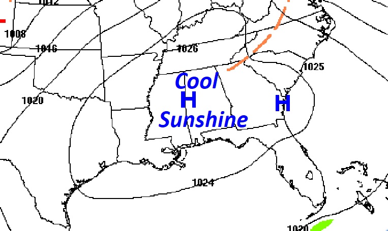
Good morning! We’re starting off this new week with below normal temperatures, but otherwise, it’s a pretty nice forecast. It’s a COLD start this morning. Frost Advisory. Today’s high will be about 6 degrees below normal. We’re headed for the 30’s again tonight. But, a major warming trend begins tomorrow. By Thursday, our high will be near 80. Periods of rain and thunderstorms return Friday, Saturday and Sunday. Another round of locally heavy rainfall totals. Here’s my brief forecast discussion.
.
TODAY: Frost Advisory early this morning. Mostly sunny. Cool but nice. High 64. (Normal 71/46) Northwest wind 5 to 10 mph. Clear and cold tonight. Low 37.
.
NEXT FEW DAYS: Temperature recovery starts Tuesday. High in the lower 70’s. Mid 70’s Wednesday. Near 80 Thursday. Mostly sunny Tuesday through Thursday. Risk of showers returns late Thursday night. Periods of rain and thunderstorms return Friday, Saturday and Sunday.
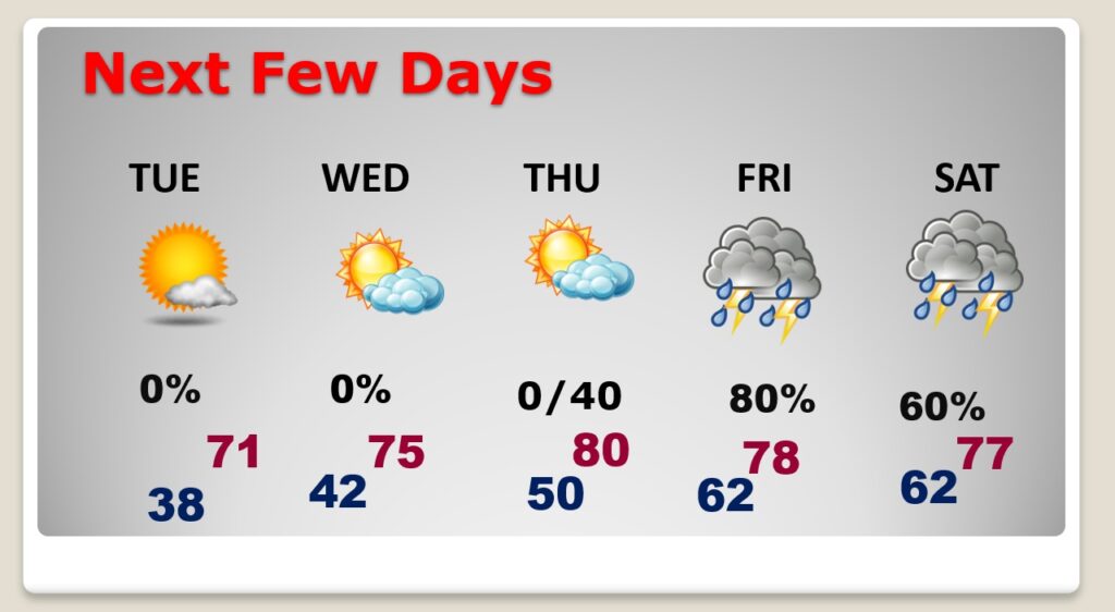
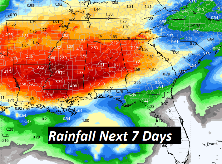
More excessive rainfall totals are possible Friday through Sunday.
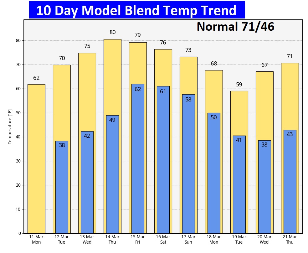
Here’s the 10 day temperature trend.
Thanks for reading the blog. There will be another complete Blog update and video forecast discussion tomorrow morning. This morning, everything is normal including LIVE on the Radio from 6 to 9AM on NewsTalk 93.1 – WACV. Have a great day.
–Rich