
Good morning! The weather news in the short term continues very good. Today will be another great day, as the warming trend continues. Nights are not as chilly. By Thursday, our high will be near 80. It will be mostly sunny through Thursday. Periods of rain and thunderstorms return Friday, Saturday and Sunday. Highest probabilities Friday and Sunday. Locally heavy rainfall totals. Here’s my brief forecast discussion.
.
TODAY: Partly sunny. Warmer. High 76. (Normal 71/46) South wind 5 to 10 mph. Clear and not quite as chilly tonight. Low 50.
.
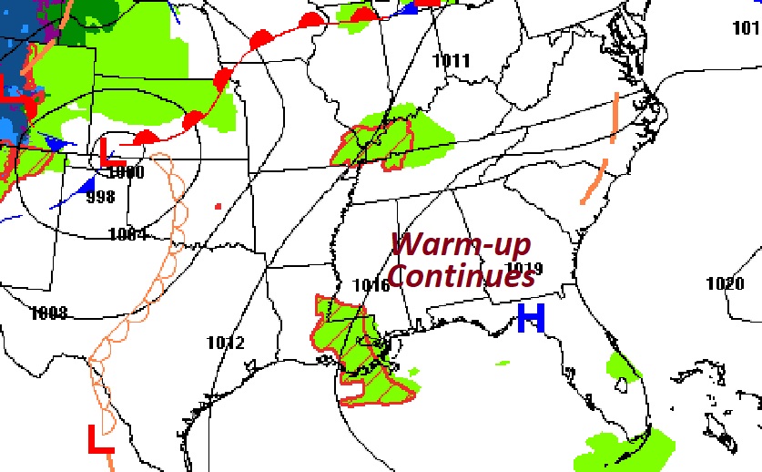
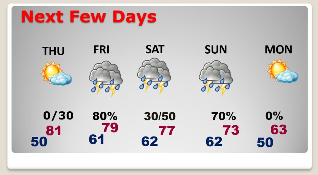
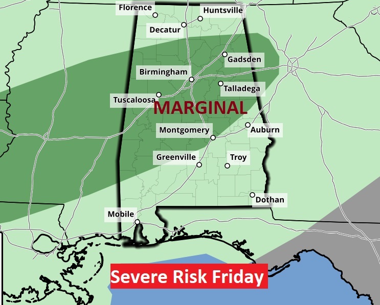
NEXT FEW DAYS: The warming trend continues. It ill be near 80 Thursday. Mostly sunny. Risk of showers returns late Thursday night. Periods of rain and thunderstorms return Friday, Saturday and Sunday. Highest probabilities Friday and Sunday Locally heavy rainfall totals. Low end severe threat Friday. Marginal Risk.
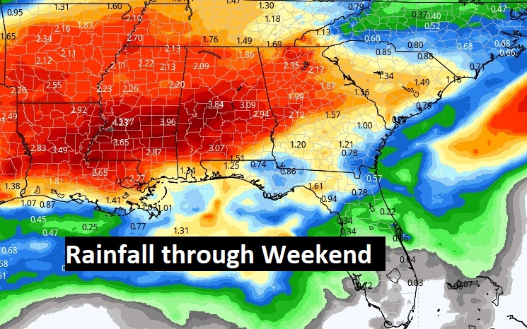
More potentially heavy rain. Front approaches Friday. Low end Marginal Severe Risk Friday.
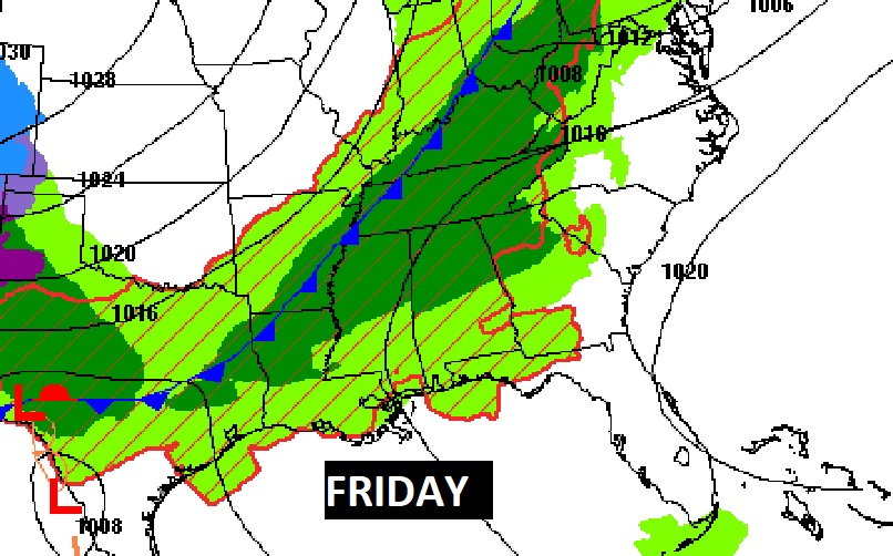
More locally heavy rainfall totals are possible Friday through Sunday.
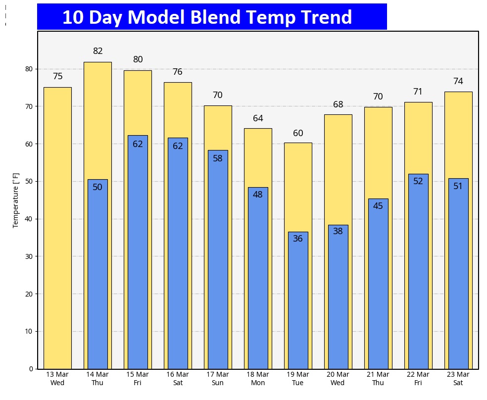
Here’s the 10 day temperature trend.
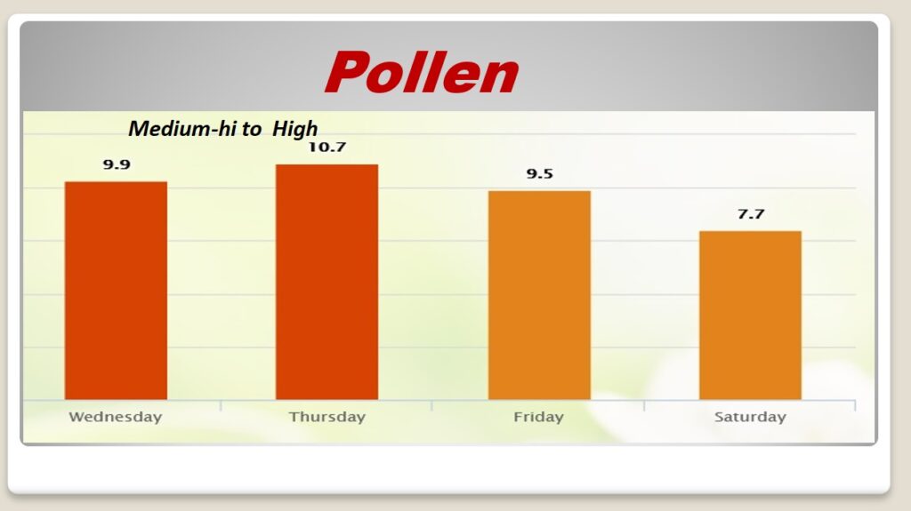
POLLEN: Pollen is coating everything. ‘Tis the season. Here’s a look at the next 4 days.
Thanks for reading the blog. There will be another complete Blog update and video forecast discussion tomorrow morning. This morning, everything is normal including LIVE on the Radio from 6 to 9AM on NewsTalk 93.1 – WACV. Have a great day.
–Rich