
12 NOON
New Severe Thunderstorm Watch covers all of south Alabama until 7PM. Damaging wind gusts are the main threat. #alwx

9:30 am
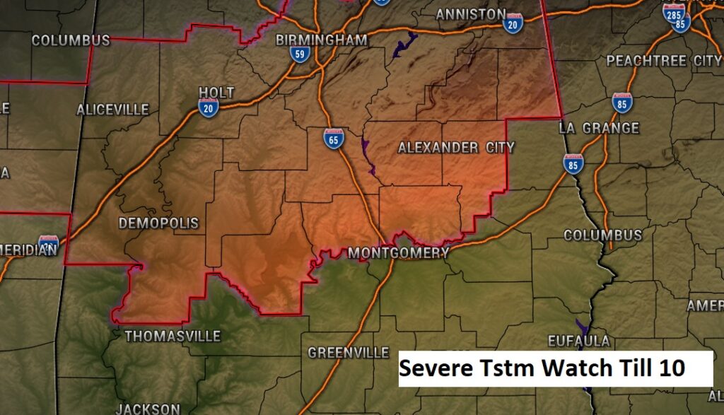
NWS Birmingham AL Extends in time and area the Severe Thunderstorm Watch for Chambers, Lee, Lowndes, Macon, Montgomery until 12 Noon.
8:15 AM:
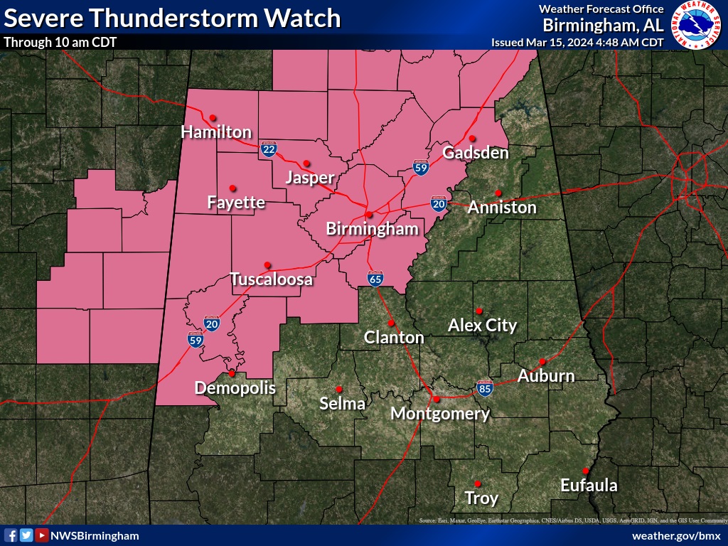
The severe thunderstorm watch has just been extended southward to Elmore, Autauga, Macon, Tallapoosa and Dallas counties until 10 AM.
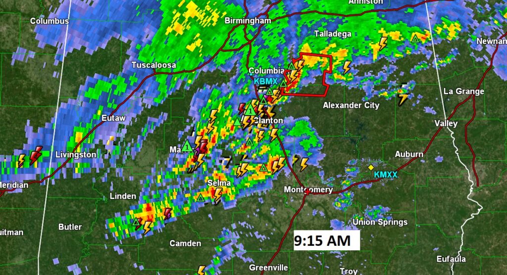
9:15 AM:
Looks like we’re going to have stay very watchful for the next few hours, as these storm clusters slide SE. Some are producing 40-50+ mph wind gusts. Some storms are showing modest rotation. A downstream weather watch is possible if not likely.
EARLY MORNING UPDATE:
Good morning! Looks like yet another active weather Friday. Expect rain and thunderstorms. The most concentrated rain and storm threat will be this afternoon and this evening. Severe weather threat. A Level 2 risk for some of us. The main threat will be damaging wind gusts. The tornado threat is low, but not zero. On Saturday, the rain chance will be very tiny. Not a bad day. Highest rain probabilities Friday and Sunday. Scattered showers become likely again Sunday. It will turn quite a but colder again by the start of next week. We could fall into the low 30’s by Tuesday AM. Frost will be likely. We may tease the freeze mark. It’s not out of the question. It’s late in the ball game for that kind of nonsense. Here’s my brief forecast discussion.
.
TODAY: Showers and storms becoming likely today and into tonight, especially this afternoon and this evening. Some storms could be strong to severe with damaging wind gusts the main threat. Today’s high 79. Low tonight 61. Southwest winds 6 to 12 mph. Yesterday we tied the record high of 85.
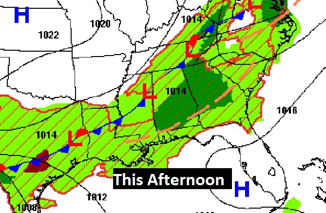
Severe weather threat today. Level 2 risk for some of us. The main threat will be damaging wind gusts. The tornado threat is low, but not zero.

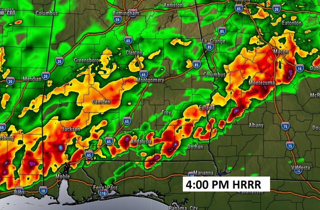
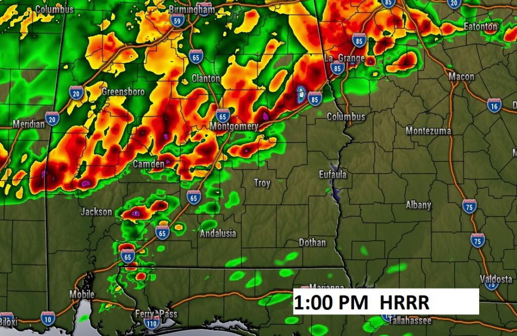
FUTURE RADAR: Shows a southward moving line of strong storms. Some storms along the line could be strong/severe. Damaging wind gusts possible. Tornado threat is relatively low, but not zero.
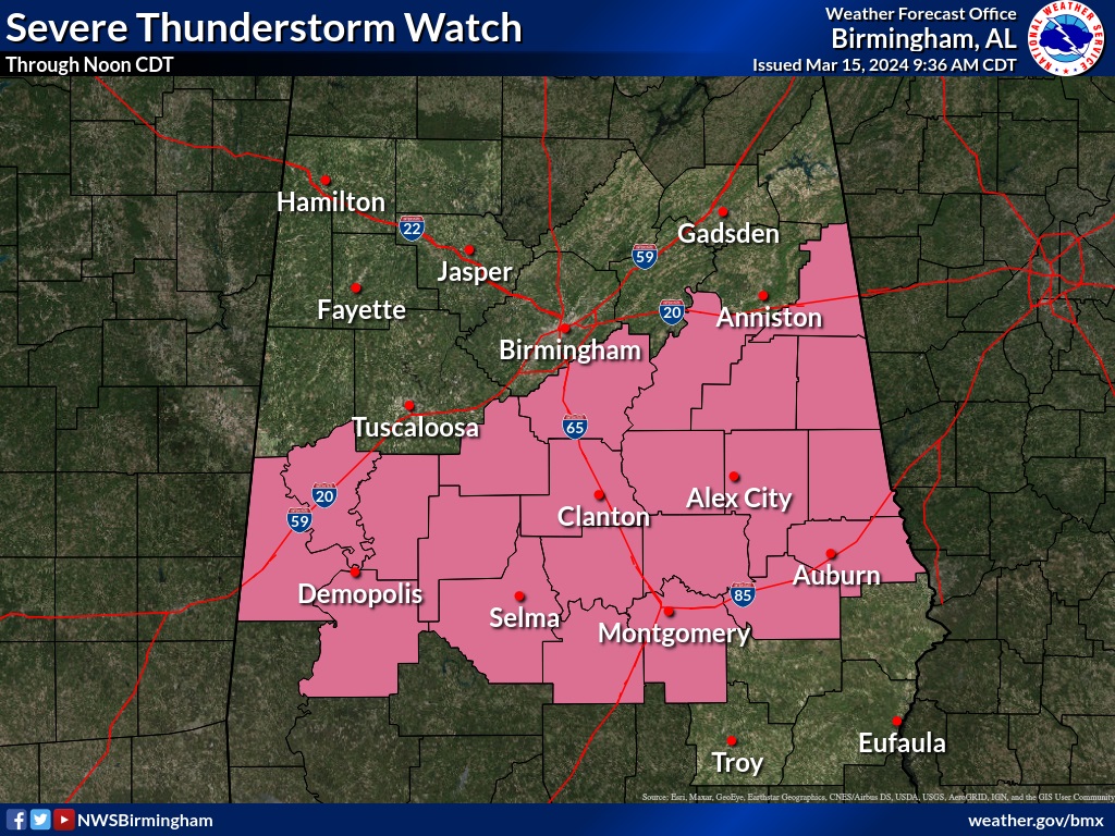
Late breaking. A Severe thunderstorm Watch covers NW Alabama until 10:00AM.
.
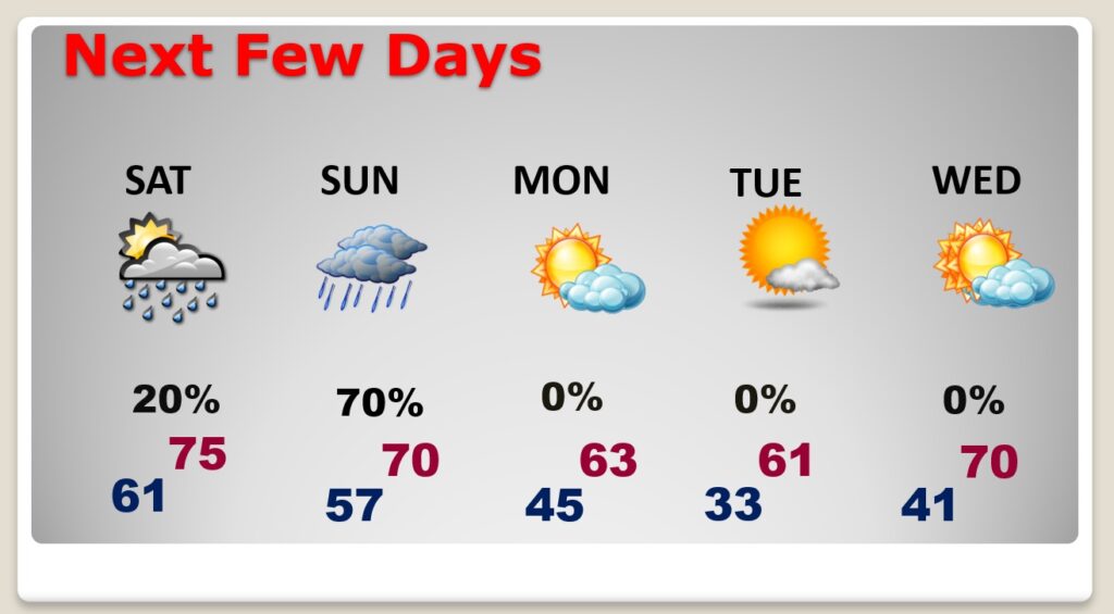
NEXT FEW DAYS: Small rain chance Saturday. Limited sun. High 76. Another round of scattered showers Sunday. It will turn quite a but colder again by Monday. We could fall into the mid 30’s by Tuesday AM. Yet another frost threat, on the first day of Spring. .
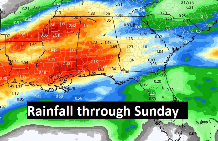
Here’s the expected rainfall through Sunday. The most concentrated rainfall will be today and Sunday.
Here’s the 10 day temperature trend. We’ll be close to freezing Tuesday morning. (First day of Spring) It’s late in the ballgame for that. Average date of the last freeze has already past (MGM): March 8. Last freeze last year was March 20. The last time we’ve been to the freeze mark this year was February 20th.

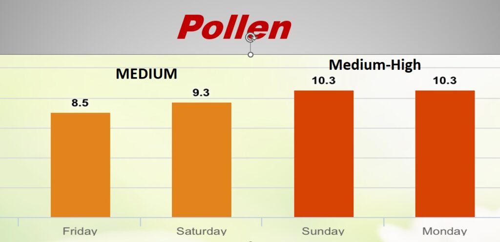
POLLEN: Here’s a look at the next 4 days. The rain may help a bit today and over the weekend. Not enough.
Thanks for reading the blog. There will be another complete Blog update and video forecast discussion tomorrow morning. This morning, everything is normal including LIVE on the Radio from 6 to 9AM on NewsTalk 93.1 – WACV. Have a great day.
–Rich