
Good morning! After another rather frosty start this morning, temperatures should finally start to recover today. We’ll be in the low 70’s today and mid 70’s Thursday. Even the nights are starting to moderate. Look for 40’s tonight. Scattered showers return to the forecast late Thursday night and through Friday. Nothing severe and nothing heavy. Fortunately, most of the weekend looks dry and nice. There could be a leftover shower early Saturday AM. Looks like the next big deal storm system could arrive by next Tuesday. Here’s my brief forecast discussion.
.
TODAY: FROST Advisory this morning. Lots of sunshine today. Little warmer. High 71. West wind 6 to 12 mph. Partly cloudy, not as cold tonight. Low 43.
.
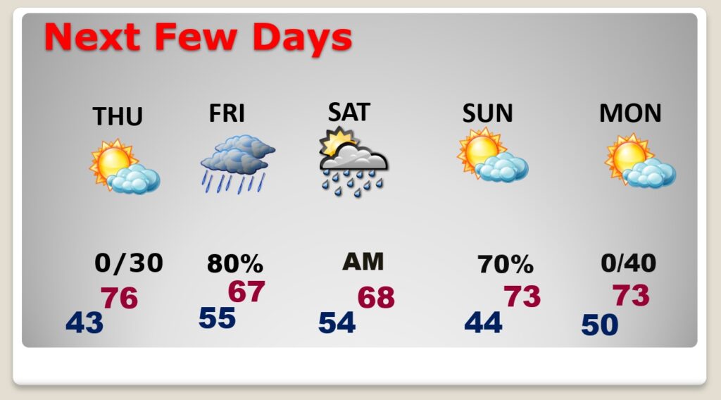
NEXT FEW DAYS: Wednesday will start out frosty again. This late season cool snap won’t last too long. Temperatures will moderate to near 70 Wednesday and the low 70’s Thursday. Scattered showers return to the forecast Thursday night and Friday. Fortunately, the weekend looks dry and nice. (Normal hi/lo 72/47)
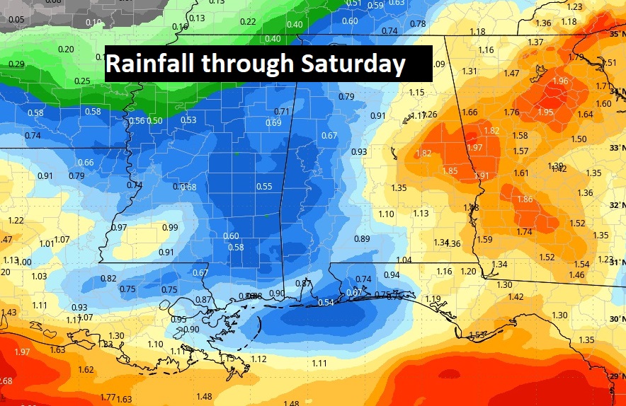
Here’s the expected rainfall through Saturday. Nothing heavy here. Notice the heaviest rain stays off the Gulf Coast.
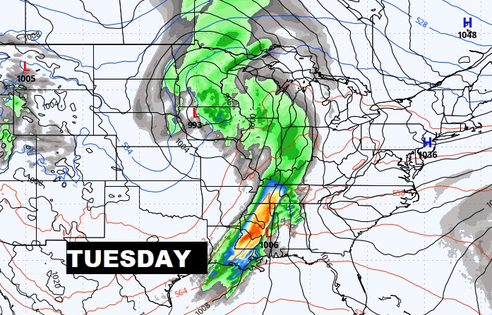
A storm system & front next Tuesday is worth watching for the potential of strong storms. It appears the best dynamics for severe weather will be father to the northwest. We’re watching.
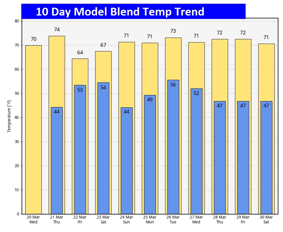
Here’s the 10 day temperature trend. Looks like the cold will retreat and temperatures should moderate in e nice way.
POLLEN: Here’s a look at the next 4 days. Today will be the highest. We get a little break Thursday through Saturday.

Thanks for reading the blog. There will be another complete Blog update and video forecast discussion tomorrow morning. This morning, everything is normal including LIVE on the Radio from 6 to 9AM on NewsTalk 93.1 – WACV. Have a great day.
–Rich