
Good morning! Our nice warm-up continues. Today will be another comfortable, dry March day with highs in the middle 70’s. But changes are on the way. Scattered showers, and maybe a couple of thunderstorms return to the forecast late tonight and through Friday. Rainfall amounts will not be excessive. Fortunately, most of the weekend looks dry and nice. There could be a leftover shower early Saturday AM. Looks like the next “bigger deal” storm system could arrive by next Tuesday. Here’s my brief forecast discussion.
.
TODAY: Limited sunshine today. A sun/cloud mix. Warmer. High 76. Southeast wind 6 to 12 mph. Risk of s few showers by Late tonight.
.
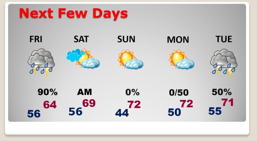
NEXT FEW DAYS: Scattered showers, and maybe a couple of thunderstorms will dominate Friday through Friday night. Rainfall amounts will not be excessive. Most of the weekend looks dry and nice. There could be a leftover shower early Saturday AM. Sunday looks nice, Sunshine and highs in the lower 70’s. Looks like the next “bigger deal” storm system could arrive by Tuesday.
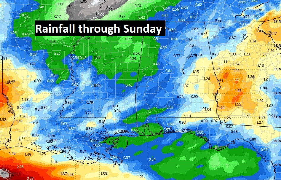
Here’s the expected rainfall through Sunday. The eastern counties could see an inch or more. Most of us will see less than that. Notice the heaviest rain stays off the Gulf Coast.
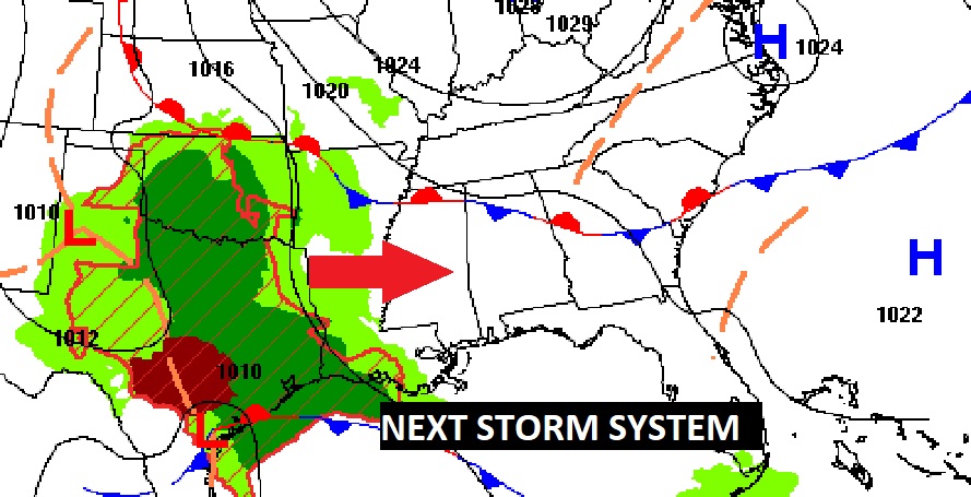
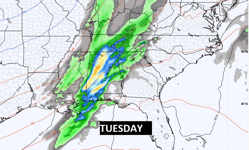
A storm system & front next Tuesday is worth watching for the potential of strong storms. It appears the best dynamics for severe weather will be father to the northwest. We’ll be watching this closely.
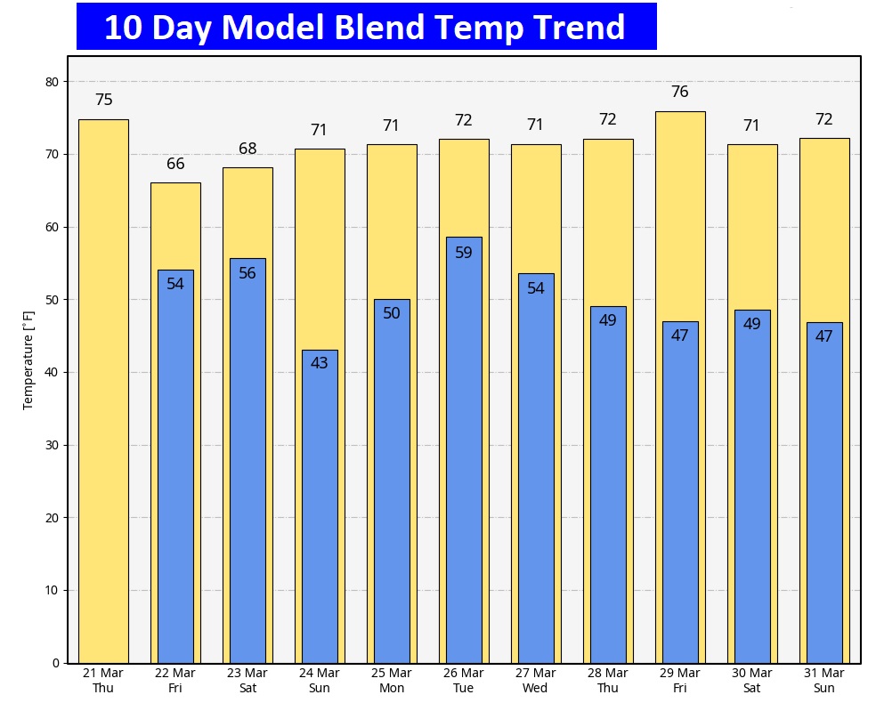
Here’s the 10 day temperature trend. The cold snap has retreated. Temperatures will be a lot more reasonable over the next several days.
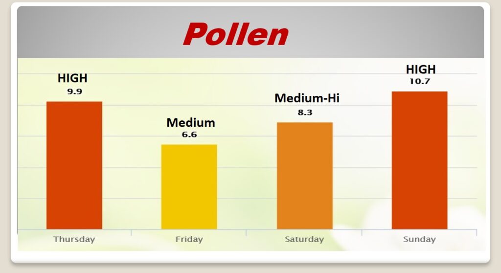
POLLEN: Here’s a look at the next 4 days. We get a tiny break, perhaps, Friday and Saturday.
Thanks for reading the blog. There will be another complete Blog update and video forecast discussion tomorrow morning. This morning, everything is normal including LIVE on the Radio from 6 to 9AM on NewsTalk 93.1 – WACV. Have a great day.
–Rich