
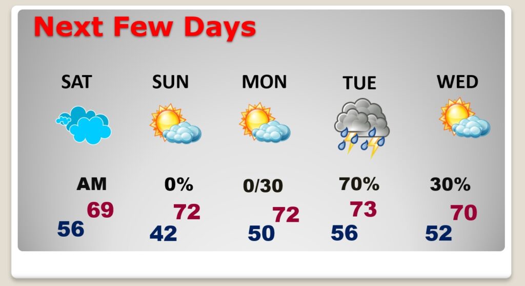
Good morning! Another Friday…another storm system. Rain and a few thunderstorms are a good bet today and tonight. Rainfall amounts will not be excessive. Fortunately, most of the weekend looks dry and nice. There could be a leftover shower early Saturday AM. Sunday looks nice. Lots of sunshine. Highs in the lower 70’s. Monday looks dry. Looks like the next “bigger deal” will bring another round of showers & storms returning Monday night into Tuesday. Here’s my brief forecast discussion.
.
TODAY: Showers and thunderstorms likely, especially in the afternoon and evening. Locally heavy downpours. High 65. East wind 5 to 15. Low tonight 56.
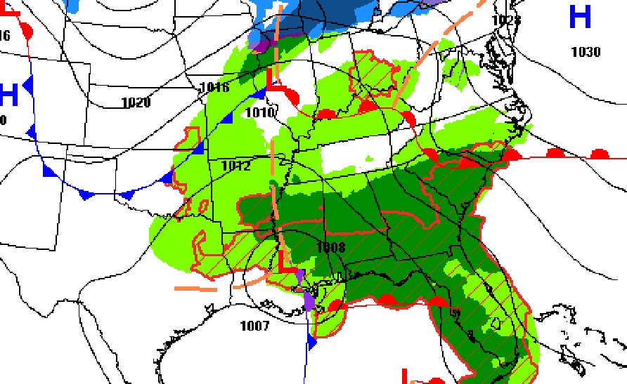
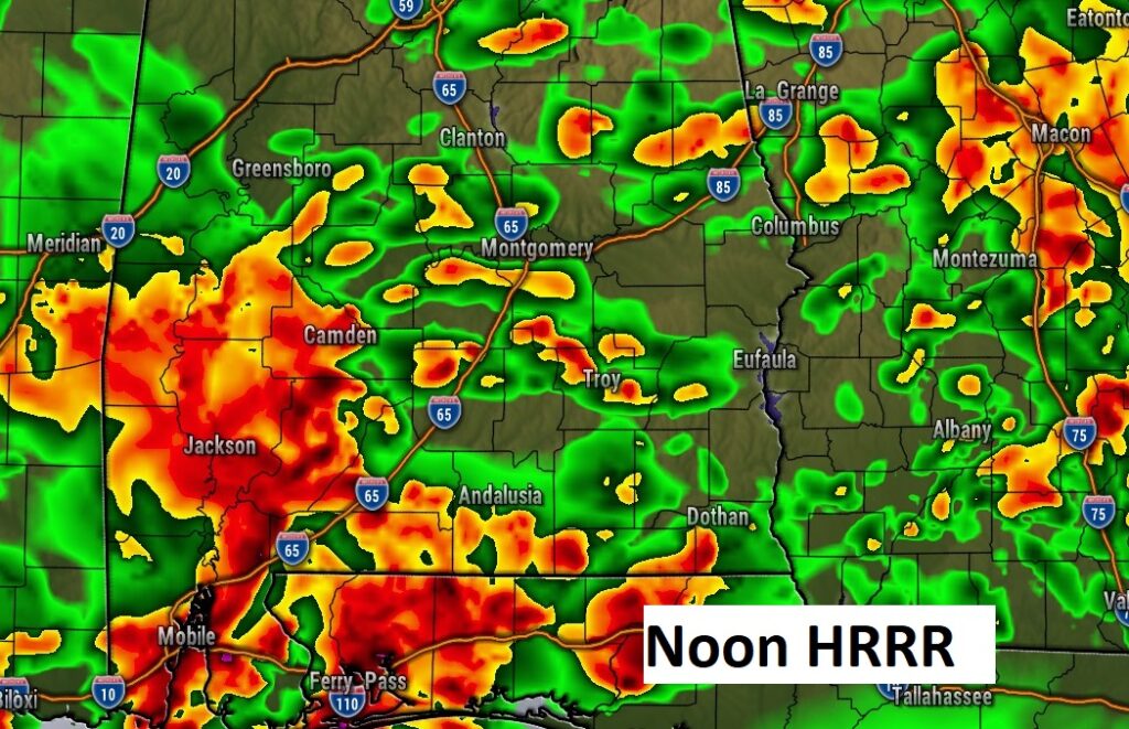
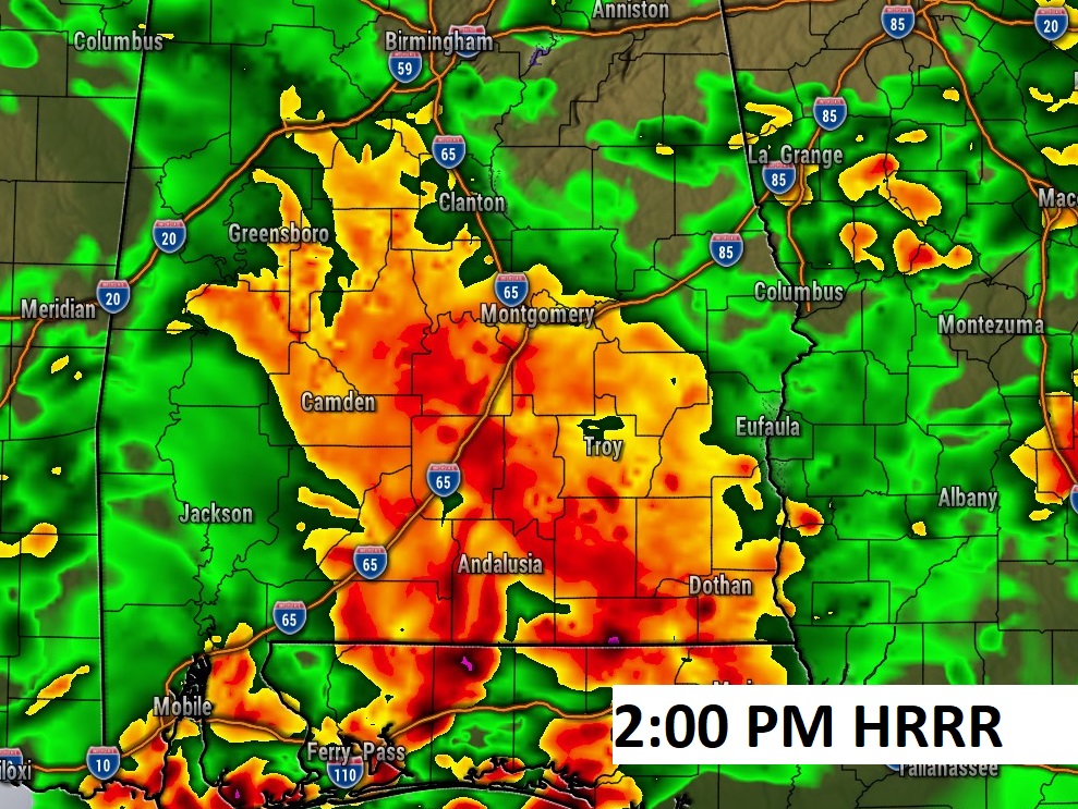
FUTURE RADAR: Wet and stormy day ahead, especially in the afternoon. Check out a few model snapshots.

.
NEXT FEW DAYS: Most of the weekend looks dry and nice. There could be a leftover shower early Saturday AM. Sunday looks nice, Sunshine and highs in the lower 70’s. Looks like the next “bigger deal” will bring another round of showers & storms returning Monday night into Tuesday. A severe threat is not out of the question.
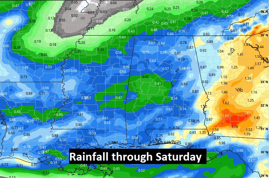
Here’s the expected rainfall through Saturday.
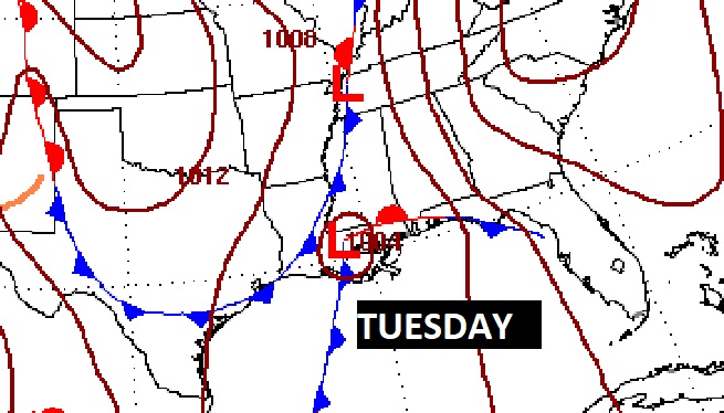
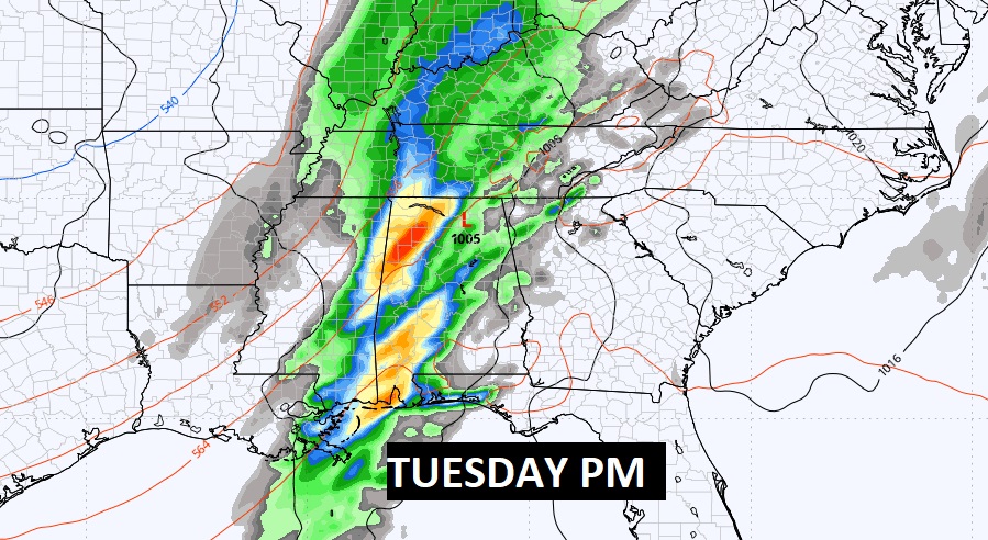
A storm system & front next Tuesday is worth watching for the potential of strong storms.
Here’s the 10 day temperature trend. Temperatures will be a lot more reasonable over the next several days.

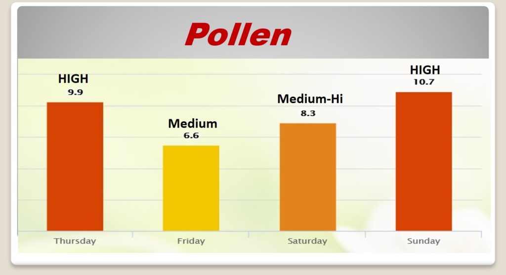
POLLEN: Here’s a look at the next 4 days.
Thanks for reading the blog. There will be another complete Blog update and video forecast discussion tomorrow morning. This morning, everything is normal including LIVE on the Radio from 6 to 9AM on NewsTalk 93.1 – WACV. Have a great day.
–Rich