
Good morning! We’re starting this final week of March on a dry note, but weather changes are on the way. Today will be quite breezy. There’s a wind advisory tonight for gusty winds to 30 mph. Showers/storms move in during the overnight hours. Tuesday will be quite wet, especially in the morning. Showers and thunderstorms. Locally heavy downpours. Overnight the severe weather threat extends as far east as I-65 through 6AM. Tuesday the severe weather threat covers south Alabama. Back to dry weather Wednesday through Easter Weekend. Thursday’s high only in the 60’s, but warmer by the weekend. Here’s my brief forecast discussion.
.
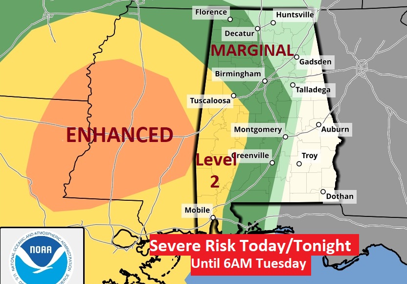
TODAY: Mostly cloudy, quite breezy today. High 72. Dry through the evening hours tonight. Wind Advisory for winds gusting to 30 mph. Showers/storms move in during the overnight hours. Low 62. Overnight the severe weather threat extends as far east as I-65 through 6AM. Tuesday the severe weather threat covers south Alabama.
Here’s the Day 1 and Day 2 severe threat. Overnight the severe weather threat extends as far east as I-65 through 6AM. Tuesday the severe weather threat covers south Alabama. The main risk is damaging wind gusts. But, brief tornadoes can’t be ruled out.

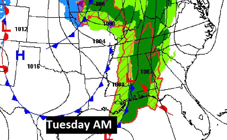
FUTURE RADAR: Let me show you a couple of different models. The HRRR is a little faster bringing in the “squall line” (QLCS) in west Alabama at 5AM, spreading east to I-65 at 8AM.


Here’s the NAM model. A somewhat slower time line through Noon.


This storm system will effect a multi-state area.
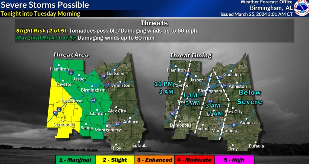
The graphic below includes an expected timeline from NWS on the severe weather threat.
.
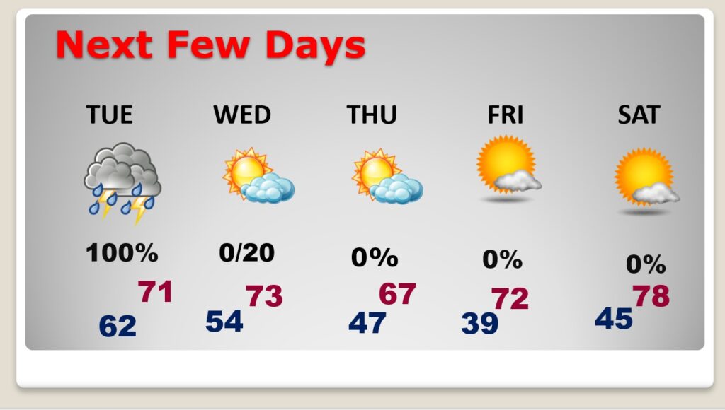
NEXT FEW DAYS: Tuesday will be quite wet. Showers and thunderstorms. Locally heavy downpours, especially in the morning hours. Back to dry weather Wednesday through Easter Weekend. Thursday’s high only in the 60’s, but warmer by the weekend. Highs back in the 70’s as we end the month of March.
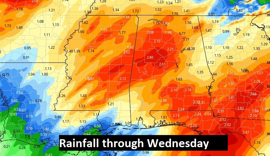
Here’s the expected rainfall through Wednesday.
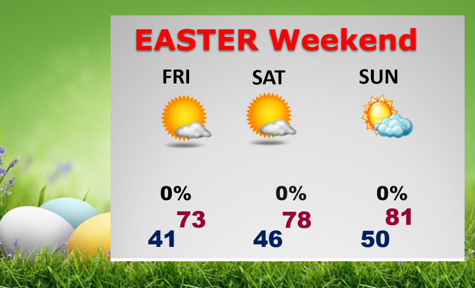
. So far…the Easter weekend forecast looks spectacular.
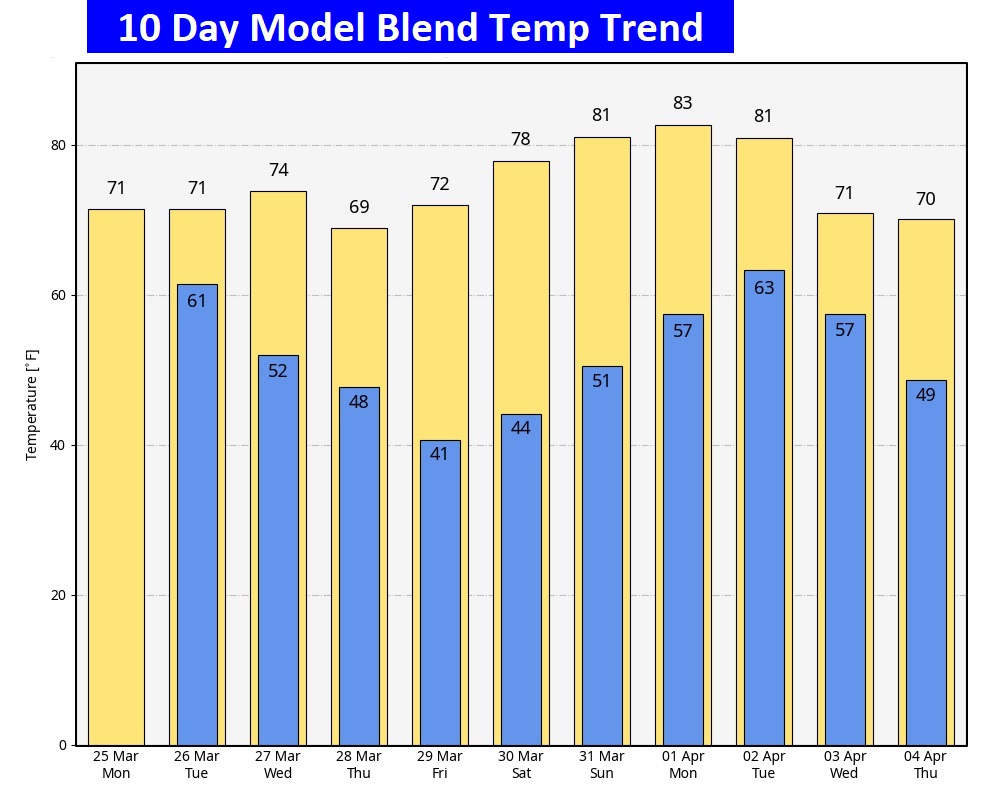
Here’s the 10 day temperature trend. The coolest day will be Thursday. We could be near or above 80 by Easter Sunday.
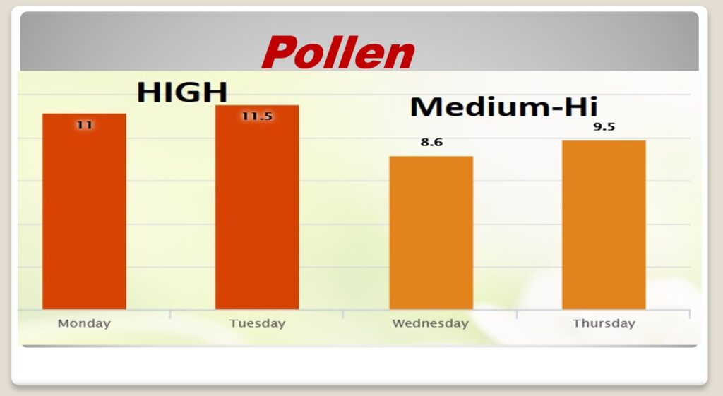
POLLEN: Here’s a look at the next 4 days.
Thanks for reading the blog. There will be another complete Blog update and video forecast discussion tomorrow morning. This morning, everything is normal including LIVE on the Radio from 6 to 9AM on NewsTalk 93.1 – WACV. Have a great day.
–Rich