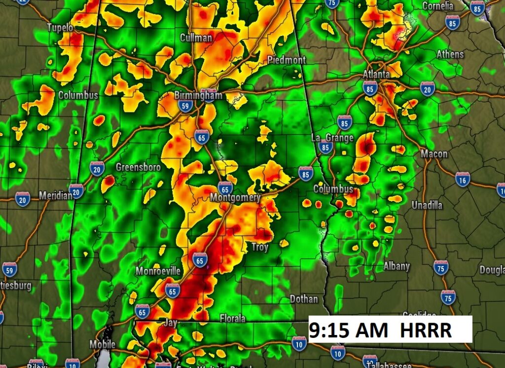
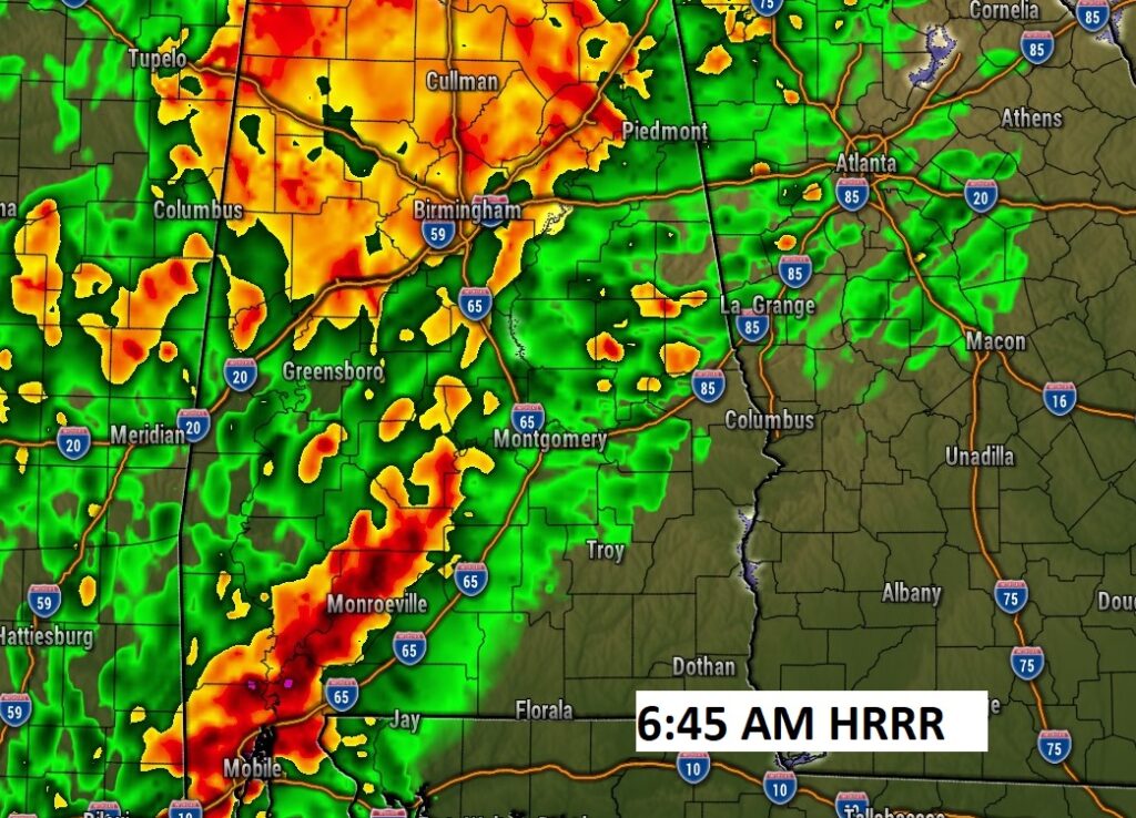
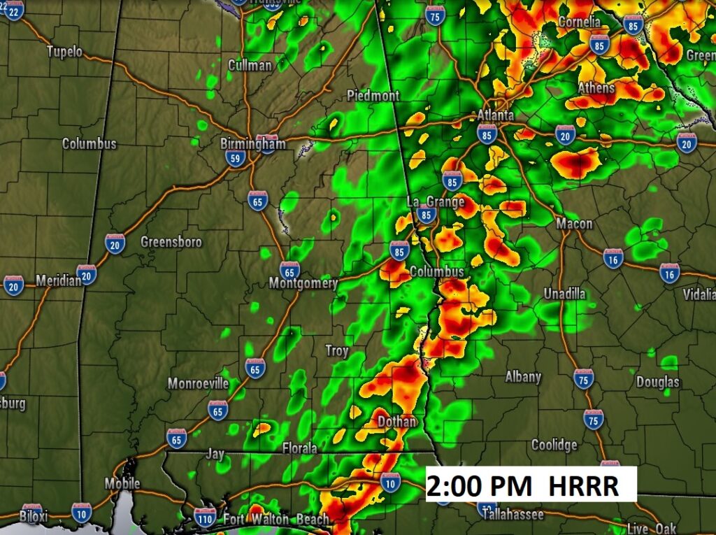
Good morning! Early this morning, as expected, we are tracking a line of strong storms tracking from west Alabama toward the central counties. Some of the storms are putting on quite a show with gusty winds to 40 mph and lots of lightning. This line of storms will reach the I-65 corridor between 6 and 8AM. The storms will exit the state by mid afternoon. A severe Risk covers a good chunk of south Alabama especially this morning. Back to dry weather Wednesday through Easter Weekend. Thursday’s high only in the 60’s, but warmer by the weekend. Easter weekend looks great. By Easter Sunday, highs will be near or above 80. Here’s my brief forecast discussion.
.
TODAY: Showers and locally strong storms this morning. Storms exit the area by lunchtime. Mostly cloudy this afternoon. Breezy. SE wind 10-20 this morning, then NE wind at 6 to 12 mph. Partly cloudy tonight. Low 52.
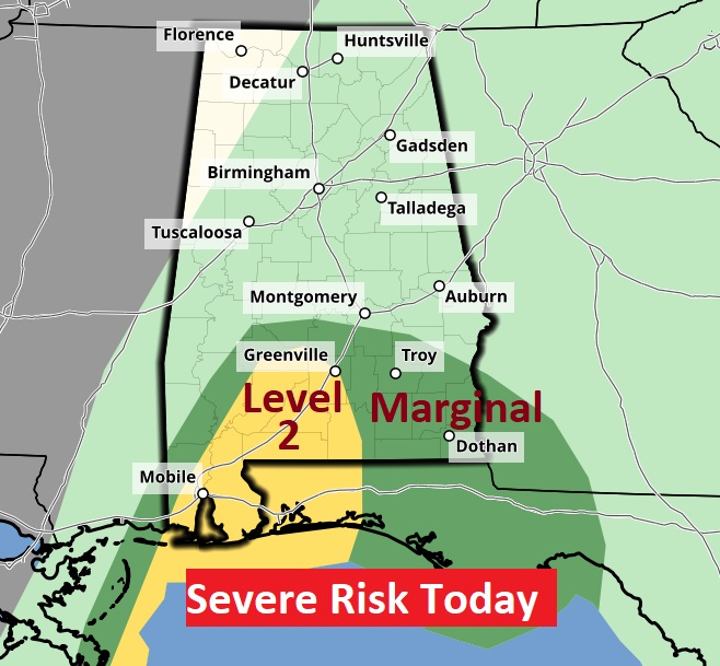
Here’s the Day 1 severe threat covering much of south Alabama, particularly this morning. The main risk is damaging wind gusts. But, brief tornadoes can’t be ruled out.
FUTURE RADAR: Here’s the hi-res HRRR model, showing the line of strong storms tracking eastward through the state this morning and exiting the state during the early to mid afternoon.
.
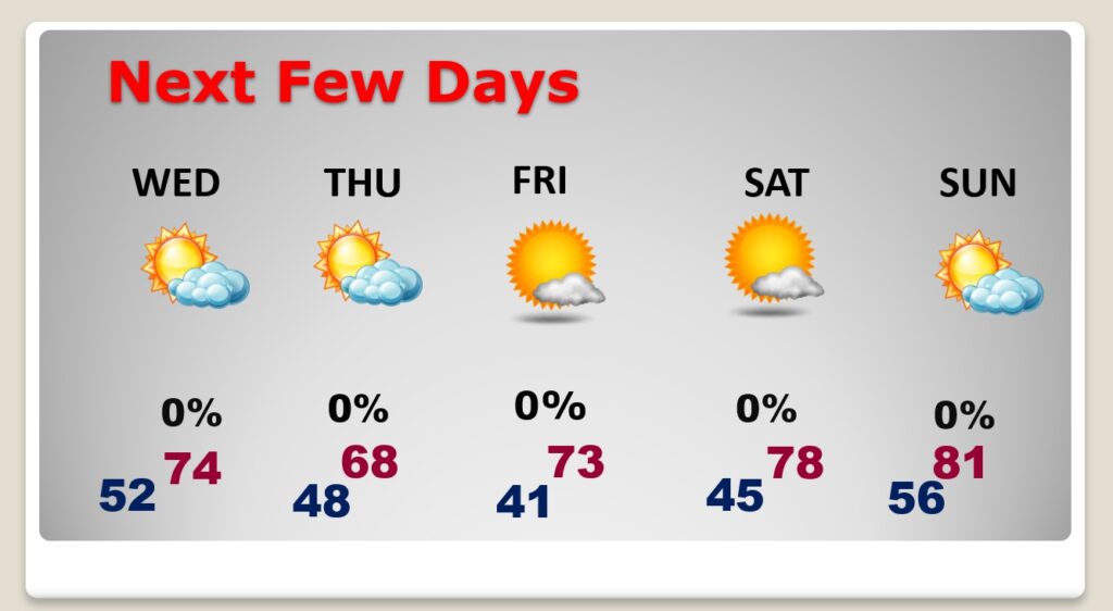
NEXT FEW DAYS: Sunshine returns Wednesday. A weak cool front moves in Wednesday night. Thursday will be a little cooler with highs in the upper 60’s. The Easter Weekend forecast looks spectacular. We’ll be in the lower 70’s on Good Friday. Upper 70’s Saturday, and near or above 80 on Easter Sunday. Mostly sunny Wednesday through Sunday.
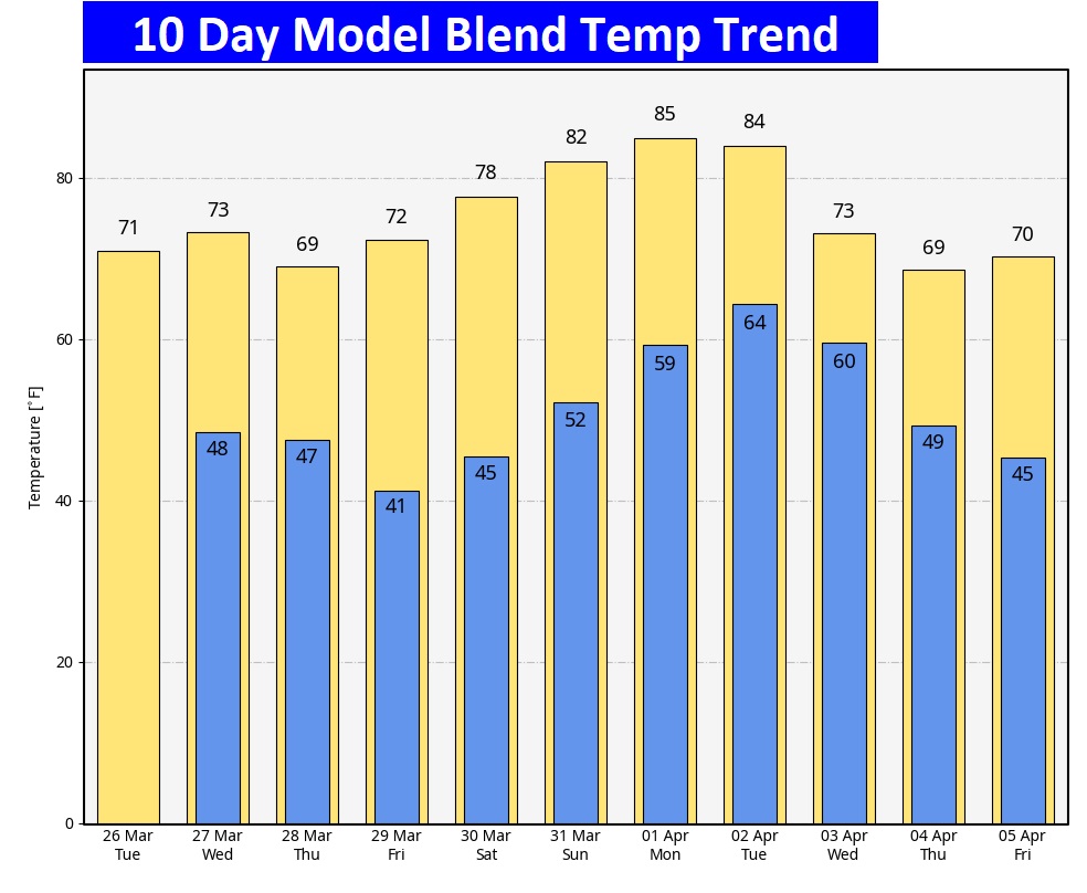
Here’s the 10 day temperature trend. The coolest day will be Thursday. We could be near or above 80 by Easter Sunday. We have a really nice pattern ahead of us.
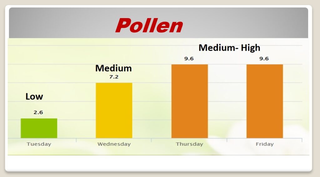
POLLEN: Here’s a look at the next 4 days.
Thanks for reading the blog. There will be another complete Blog update and video forecast discussion tomorrow morning. This morning, everything is normal including LIVE on the Radio from 6 to 9AM on NewsTalk 93.1 – WACV. Have a great day.
–Rich
