
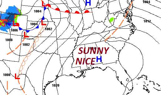
Good morning! I don’t think you could possibly write a better script for the Easter Weekend forecast. There will be high clouds at times, but overall sunshine will be in abundance. On this Good Friday, our warm-up begins as we head for the middle 70’s. By Easter Sunday highs will reach the low to mid 80’s with lots of sun. Middle 80’s are a good bet Monday. Showers and storms return Tuesday. Parts of the state could see strong to severe storms. Here’s my brief forecast discussion.
.
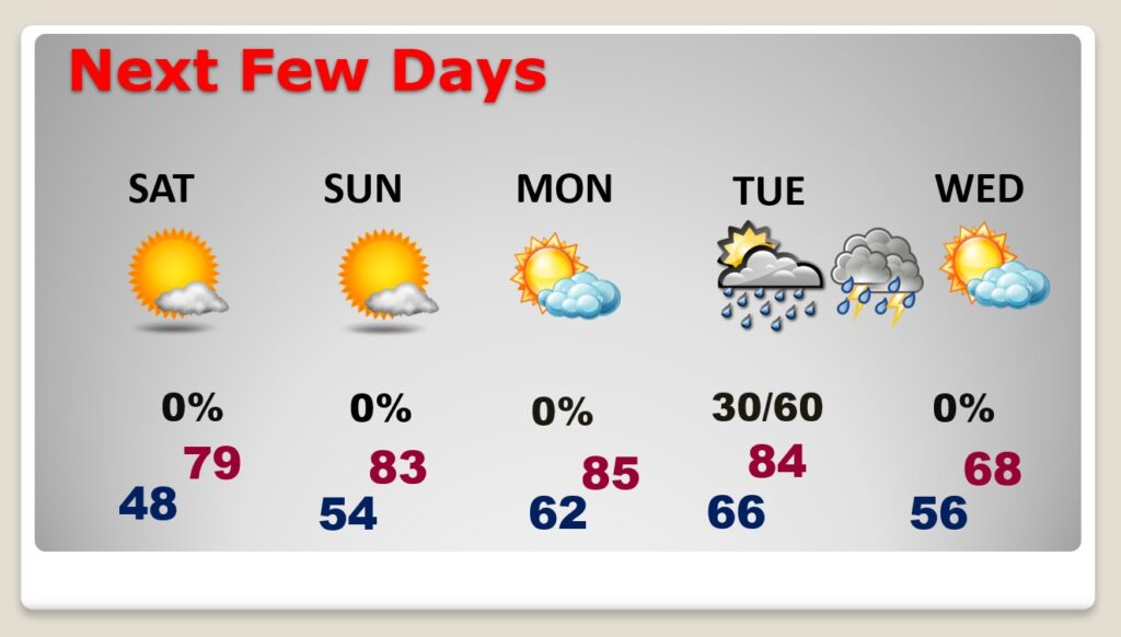
TODAY: Mostly sunny. Little warmer. High near 74. Wind: East wind at 6 to 12 mph. Partly cloudy, cool tonight. Low 48.
.
NEXT FEW DAYS: It’s a beautiful forecast for several days. It will be storm-free/Dry for several days through at least through Monday. The Easter weekend looks perfect. By Easter Sunday, highs will be in the lower 80’s, and mid 80’s Monday. Showers and storms return Tuesday. Parts of the state could see strong to severe storms.
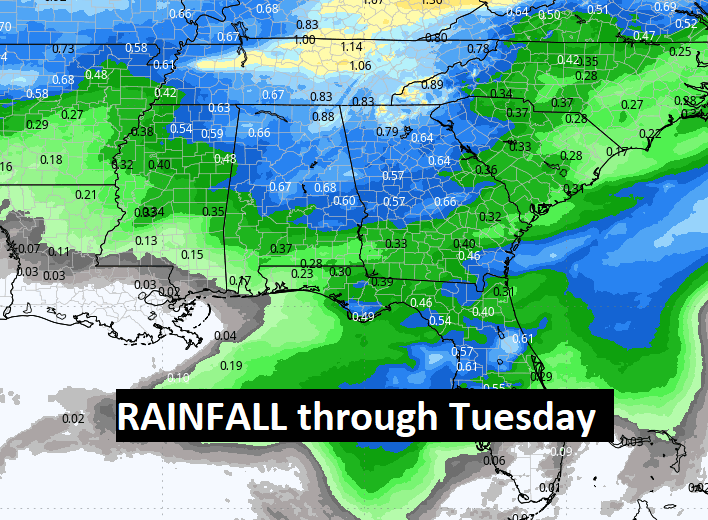
We’re DRY through Monday. Here’s a look at the expected rainfall on Tuesday with that next front.
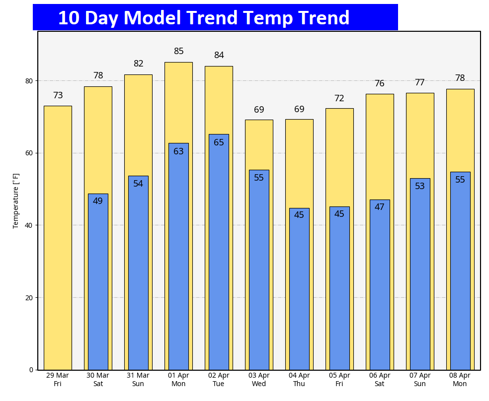
Here’s the 10 day temperature trend. Warm through Tuesday. A bit of a temperature set-back middle of next week.
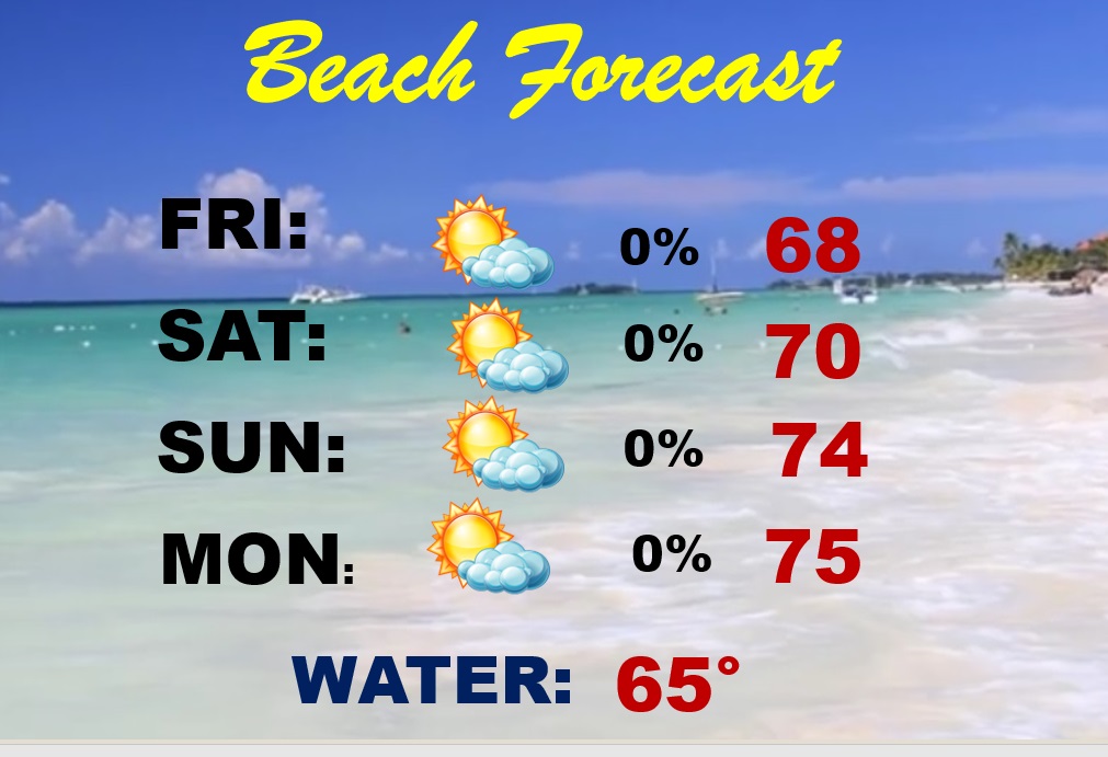
BEACH FORECAST: It’s a beautiful Easter Weekend forecast for the Beaches from Gulf Shores to Panama City. A little cool today due to an onshore breeze off the cooler Gulf Water. HIGH RIP CURRENT risk today and Moderate Saturday and Sunday. There was a drowning in Panama City Wednesday. A Spring Breaker drowned with a red flag flying.
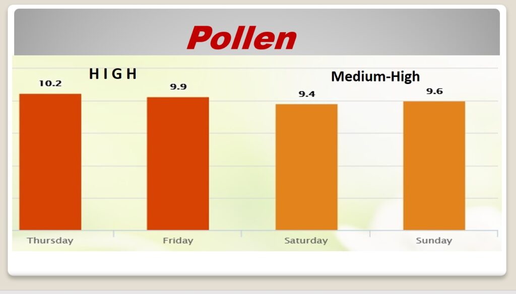
POLLEN: Here’s a look at the next 4 days. Still looking tough,
Thanks for reading the blog. There will be another complete Blog update and video forecast discussion tomorrow morning. This morning, everything is normal including LIVE on the Radio from 6 to 9AM on NewsTalk 93.1 – WACV. Have a great day.
–Rich