
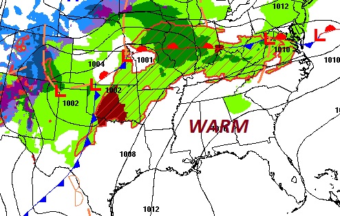
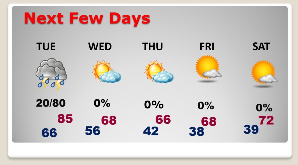
Good morning! Welcome to April! We have been enjoying an extended string of warm, storm-free, dry days, but today is the last day. Changes are on the way as a cold front sweeps through the state tomorrow afternoon and evening. Showers and thunderstorms are back on the menu ahead of the front by Tuesday evening. Some of the storms will be strong, possibly severe. Most of the state is under a Marginal (Level 1) Severe Risk. But, the greatest threat is across the northern counties. Behind the front, much cooler air will funnel into Alabama. Highs will only be in the 60’s Wednesday through Friday. We’ll fall to the upper 30’s by Thursday and Friday night. Several dry/storm-free days will follow. Here’s my brief forecast discussion.
.
TODAY: Could be some spotty morning drizzle, early,otherwise Mostly cloudy and quite warm for the first day of April today. High in the mid 80’s. Southwest wind 6 to 12. Cloudy and dry this evening and tonight. Very mild. Low 66.
.
NEXT FEW DAYS: An approaching cold front on Tuesday is our next weather maker, bringing in a round of showers and thunderstorms. by evening. Behind the front, much cooler air will funnel into Alabama. Highs will only be in the 60’s Wednesday through Friday. We’ll fall to the upper 30’s by Thursday and Friday night. Looks like we’ll be back to the lower 70’s by Saturday.
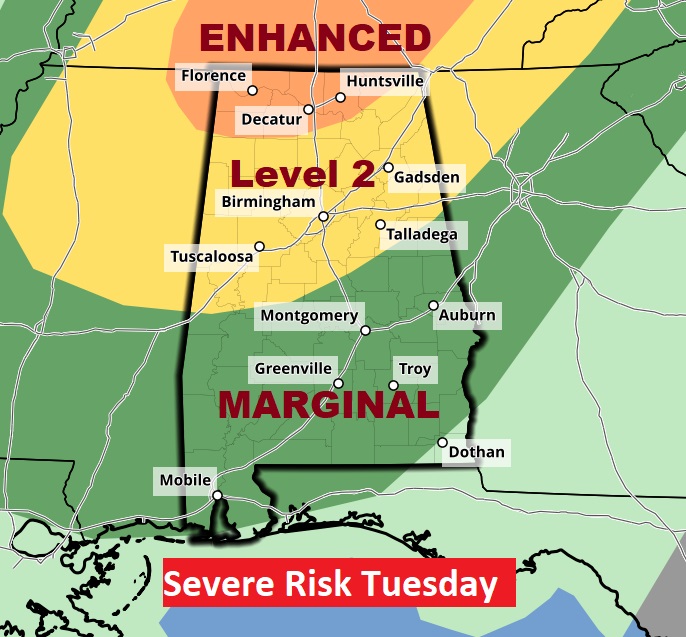
From the Storm Prediction Center: Most of us are in a Level 1 Marginal Severe Risk. But, the risk increases across north Alabama. There’s even a Level 3 Enhanced risk near the Tennessee line. While damaging winds are the main threat , however tornadoes can’t be ruled out, especially across the northern counties.
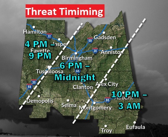
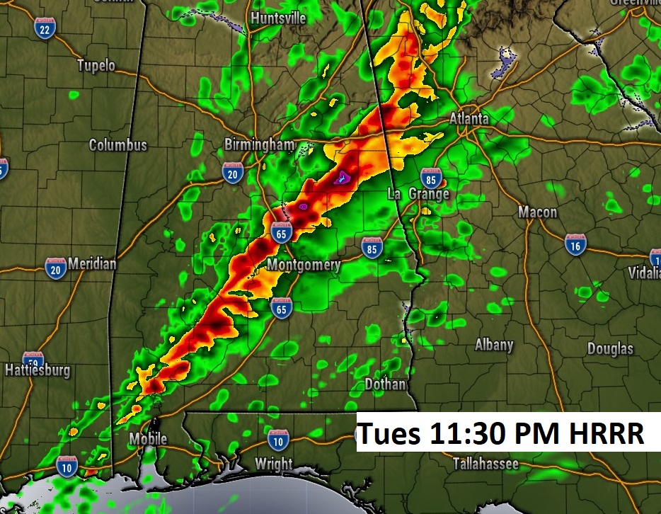
Here’s one hi-res model showing a strong line of storms moving across central AL late Tuesday night. Don’t take the time literally.
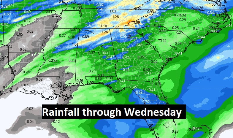
Rainfall amounts will be on the low side for most of us. Heaviest rain will be across the north.
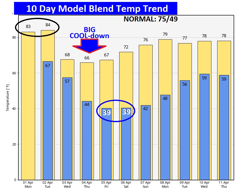
Here’s the 10 day temperature trend. The warmth is going away. Expect a Big temperature “set-back” this week. Coldest lows will be Thursday night and Friday night.
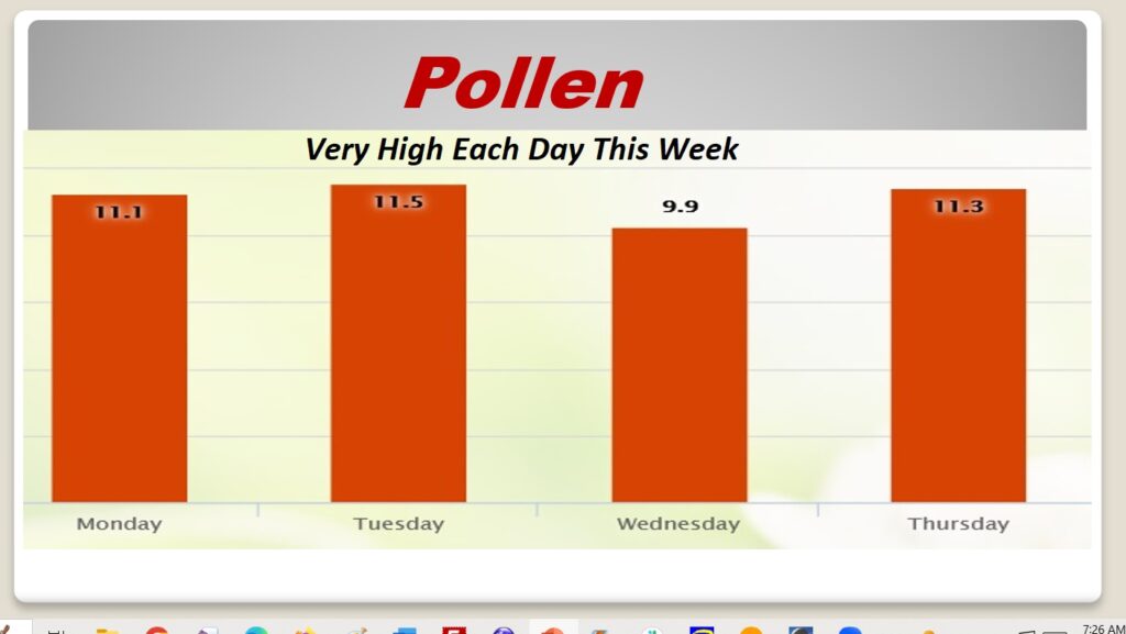
POLLEN: Here’s a look at the next 4 days. The news is NOT good this week.
Thanks for reading the Blog this morning. Today is a travel day for me as I head to the National Tropical Weather Conference, South Padre Island, Texas. There may only be a very abbreviated blog on Tuesday morning.
Bear with me, as I try to produce at least some brief blog updates in the week ahead. In my business, the learning process never ends. We may be in for quite an active hurricane season this year. Have a nice April Fools Day!
–Rich