
Important 7:45 SPC UPDATE:
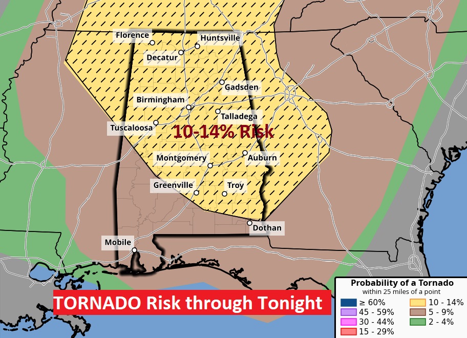
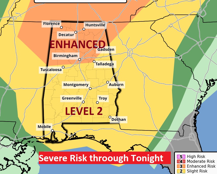
Unfortunately the risk level has increased to Level 3 for much of central/south Alabama through Tonight. There is an ENHANCED 10-14% tornado risk in that hatched area. Certainly an escalation of concern.
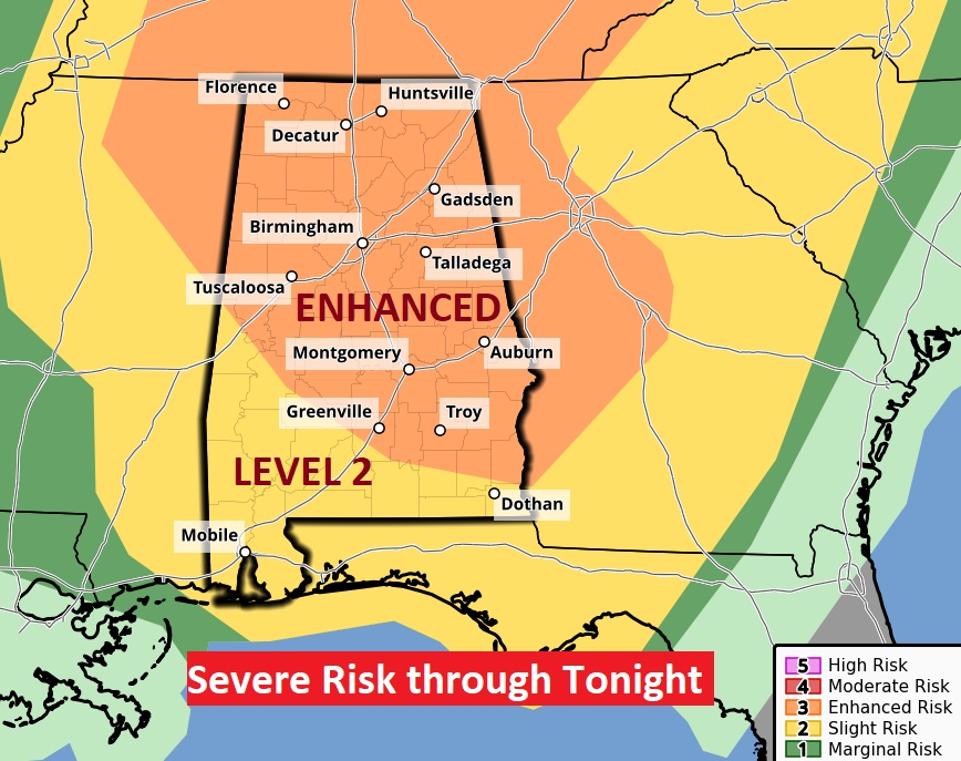
Good morning! Get ready for a big change as a cold front approaches. Some of the storms will be strong, possibly severe by tonight. Most of the state is in a Level 2 Severe Risk. All modes of severe weather is possible, including tornadoes. But, the greatest threat is across the northern counties, with an Enhanced Level 3 Risk from Birmingham northward.. Behind the front, much cooler air will funnel into Alabama. Highs will only be in the 60’s Wednesday through Friday. We’ll fall to the upper 30’s by Thursday and Friday night. Several dry/storm-free days will follow. Here’s my brief forecast discussion.
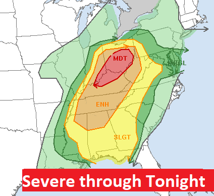
SEVERE WEATHER THREAT: There will be significant severe weather threat in the United Sates today from Lake Erie to the Gulf coast. The most significant threat of tornadoes & severe weather will be in Ohio. They will see the strongest threat in that state since 2011. Level 4 out of 5. But even the Level 3 ENHANCED risk extends as far south as south as the I-20 corridor in Alabama. More on today’s severe threat in Alabama below.
.
TODAY: Mostly cloudy, breezy and warm. High 85. South winds 5 to 15 and gusty to 20+ mph. Showers and storms tonight. Some storms could be strong possibly severe. Windy tonight. Low 58.
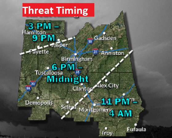
From the Storm Prediction Center: Since yesterday…our severe weather risk has been upgraded to a Level 2 Risk. Damaging winds are the main threat, but isolated tornadoes are certainly possible. But, the risk increases across north Alabama. There’s even a Level 3 Enhanced risk near and north pf the I-20 corridor. The strongest tornado threat will be in the Enhanced Level 3 out of 5 Risk area across the north. The threat begins late this afternoon across the northwest counties and sweeps across the state this evening and tonight.
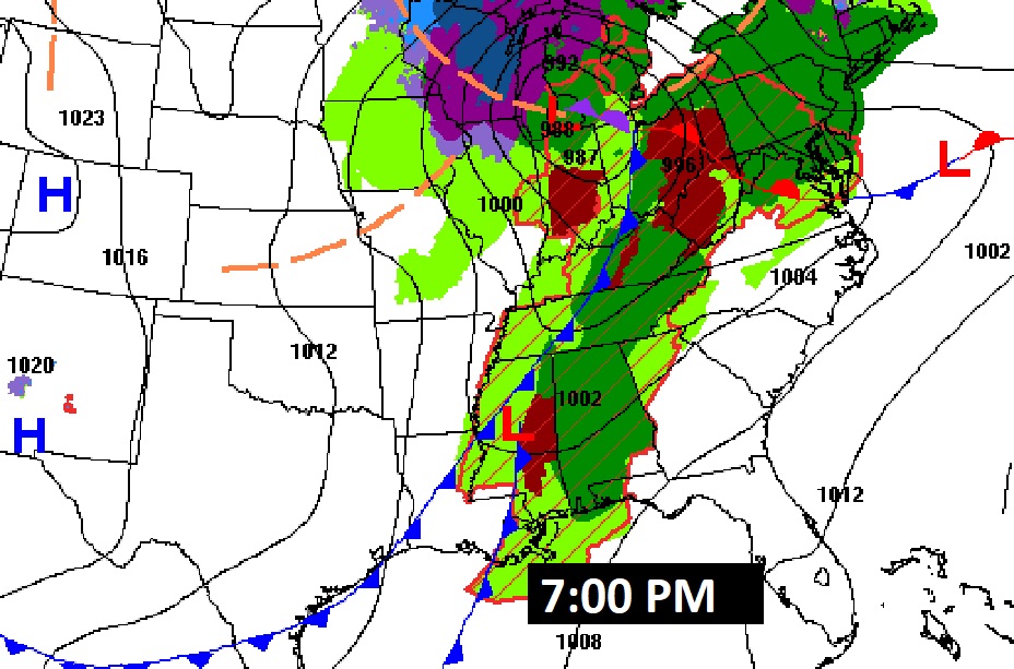
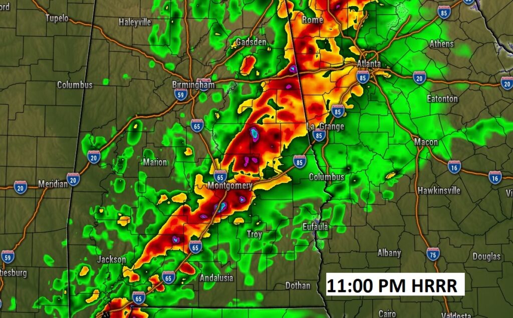
FUTURE RADAR clearly shows this movement of the potent line of strong/severe storms as it sweeps across the state this evening and tonight. Stay weather aware our weather app will instantly alert you to watches and warnings. It’s free in the app store. Search Rich Thomas weather in the app store.


.
NEXT FEW DAYS: Behind the cold front, much cooler air will funnel into Alabama. Highs will only be in the 60’s Wednesday through Friday. We’ll fall to the upper 30’s by Thursday and Friday night. Looks like we’ll be back to the lower 70’s by Saturday.

Here’s the 10 day temperature trend. Expect a series of cool days and cold nights through Friday night. A warm-up begins thisw weekend.

POLLEN: Another very tough week.

Thanks for reading the Blog this morning. I’m on the road this week at the National Tropical Weather Conference, South Padre Island, Texas. There will be a very abbreviated blogs each morning, and perhaps just a little later than normal.
Bear with me. In my business, the learning process never ends. We may be in for quite an active hurricane season this year. Have a nice day!
–Rich