
Good morning! Today’s the Big solar eclipse day. Will the clouds cooperate this afternoon between 12:40 and 3:17 pm? While the forecast is “iffy”.. Clouds will hide the sun at times. But, I’m cautiously optimistic that we’ll get some good peaks at the Eclipse. Meanwhile, the threat for a few spotty showers will begin in the overnight hours tonight. And, widely scattered showers are possible Tuesday. But, the main event is Wednesday. Widespread rain and thunderstorms especially from the afternoon and increasing Wednesday evening/night.. Locally very heavy rainfall amounts. Flooding possible. Severe weather threat, too. Level 2 Severe threat for most of us, especially Wednesday evening and Wednesday night. There could be a few leftover showers 1st half of the day Thursday. Nice weather returns Friday Saturday. Here’s my brief forecast discussion.
TODAY: A sun/cloud mix. Warmer today. High 84.. South wind at 6 to 12 mph. Mostly cloudy tonight. Dry through the evening. Risk of spotty showers return in the overnight hours. Low 61.
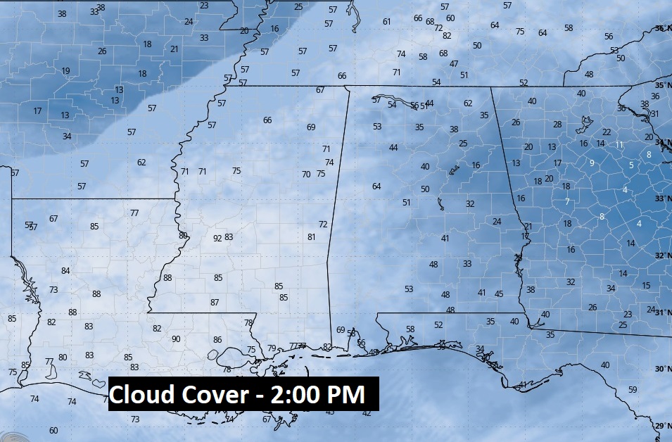
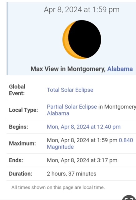
I’m cautiously optimistic the clouds cooperate this afternoon for the Eclipse. Yes, there will be a sun/cloud mix, but I think there’s a good chance we’ll be some good peaks. Here’s a couple of hip-res model depiction of the potential cloud coverage near the peak of the eclipse at 1:59 PM. It shows about 41% coverage over Montgomery at 2PM.
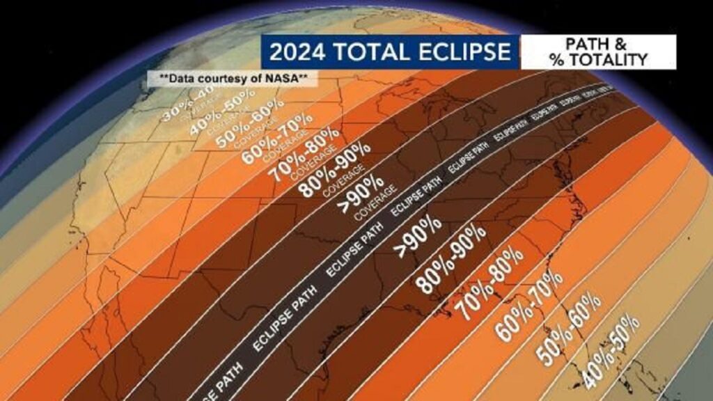
Here’s the Eclipse viewing map and a breakdown of the key eclipse times centered on Montgomery from 12:40 PM to 3:17 PM. Two hours and 37 minutes, with the peak at 1:59 PM….86% coverage locally. Good luck to all of us.
.
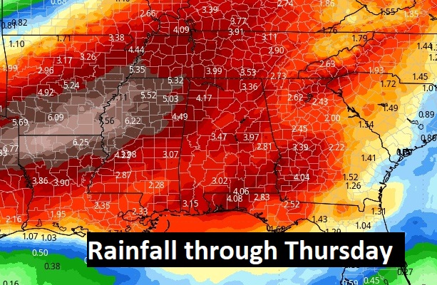
NEXT FEW DAYS: Widely scattered showers are possible Tuesday. High in the mid 70’s. But, the main event is Wednesday. Widespread rain and thunderstorms. Locally very heavy rainfall amounts. Flooding possible. Severe weather threat, too. There could be a few leftover showers 1st half of the day Thursday. Nice weather returns Friday Saturday.
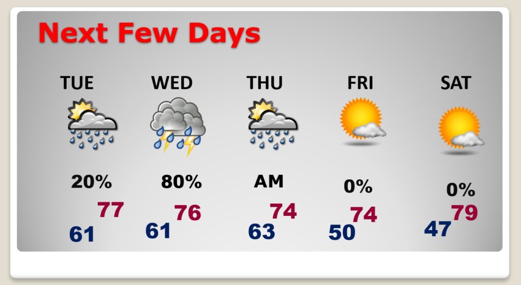
Rainfall amounts could be quite excessive. 4-6” amounts could be common. Some models are heavier that.
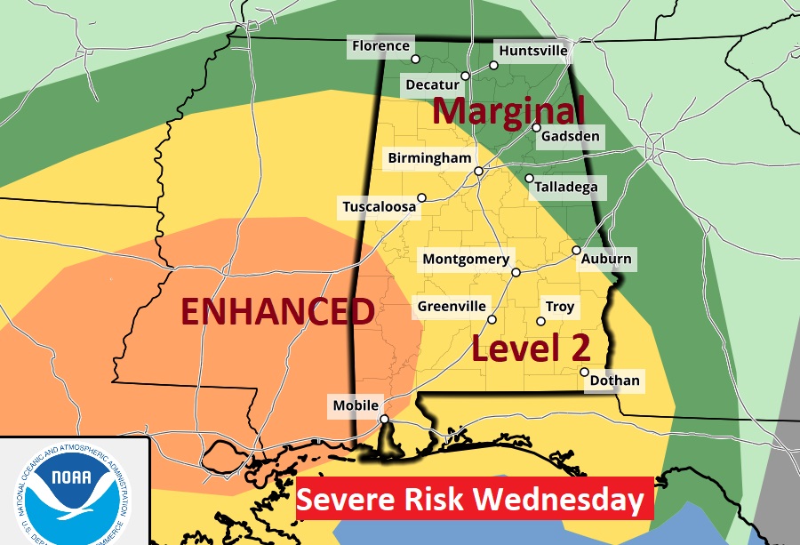
From the Storm Prediction Center” The Day 3 outlook for Wednesday/Wednesday night has been upgraded to a Level 2 risk across much central and south Alabama and an Enhanced risk from extreme SW Alabama in through Mississippi and Louisiana. All modes of severe weather are on the table including tornadoes.
.
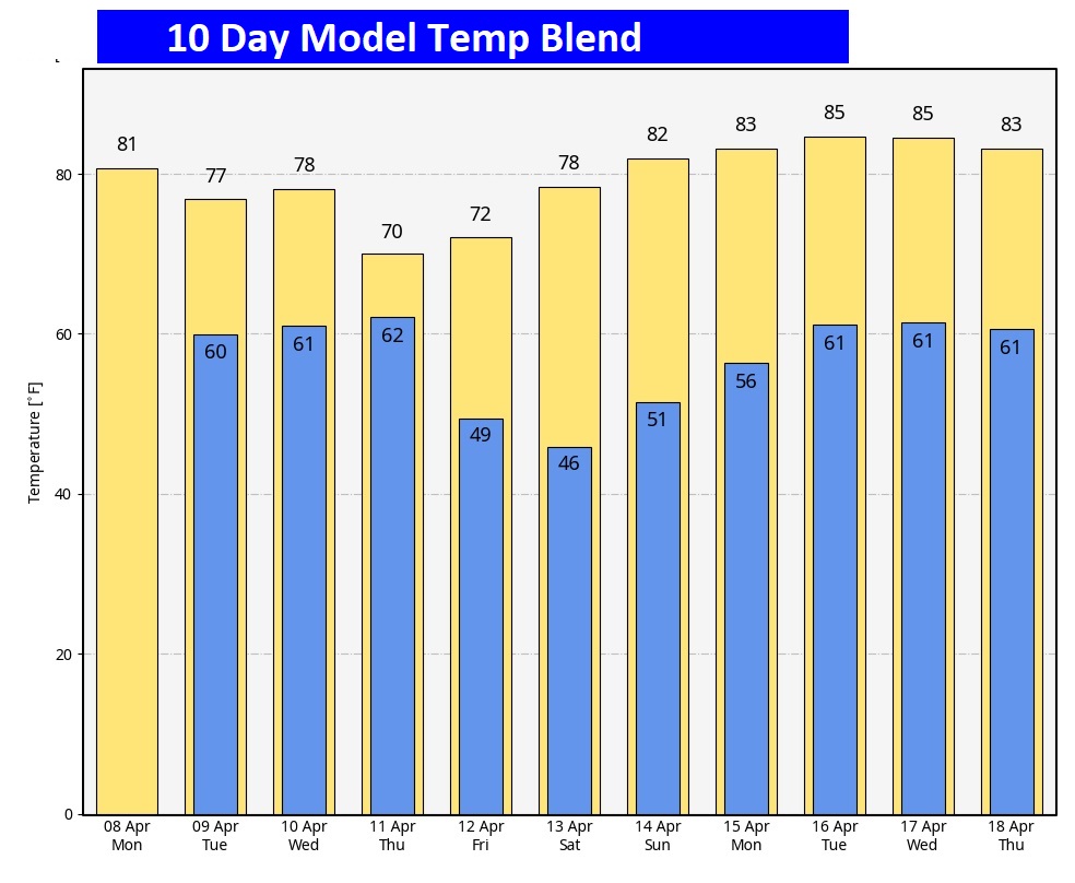
Here’s the 10 day temperature trend.
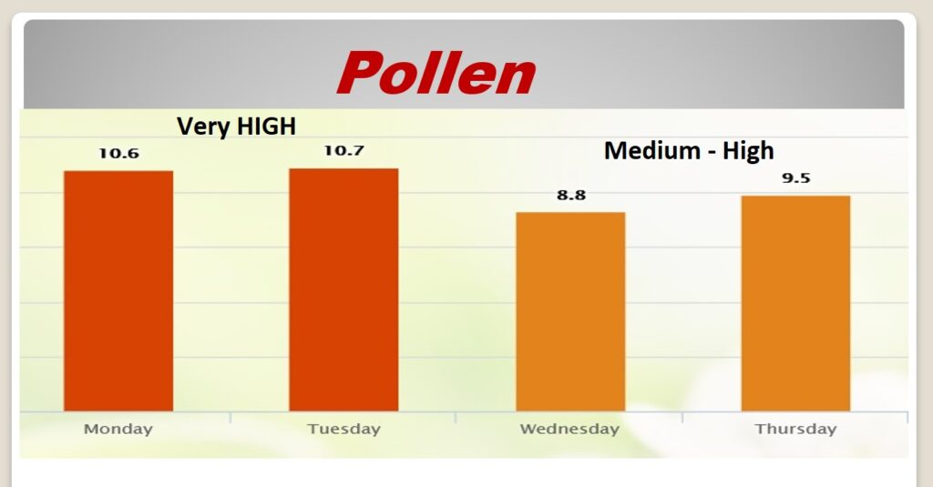
POLLEN: Here’s the forecast for the next 4 days..
SPECIAL Birthday today! FOUR YEARS ago today, the pandemic was still new. I had just lost Bailey to cancer a few weeks back. This is the day I met this guy at the Montgomery Humane Society! He may have been one then. So, we’re calling this is 5th Birthday..
H A P P Y BIRTHDAY C H A S E ! You’re a much bigger deal than a Total Solar Eclipse! I love you!

Thanks for reading the blog. There will be another complete Blog update and video forecast discussion tomorrow morning. This morning, everything is normal including LIVE on the Radio from 6 to 9AM on NewsTalk 93.1 – WACV. Have a nice Eclipse Monday!
–Rich