
11:00 AM
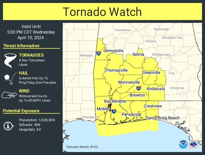
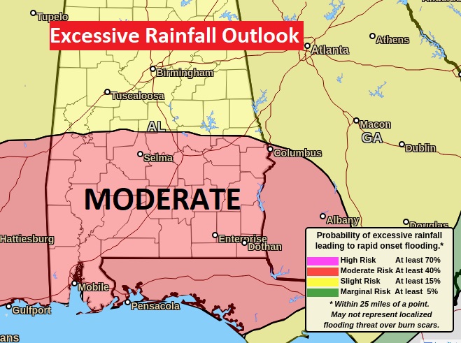
A Tornado Watch continues until 5pm for ALL of southwest Alabama. The watch extends as far north as Lowndes and Dallas counties and as far east at Crenshaw and Covington counties. Severe Thunderstorms with scattered damaging wind gusts to 80 mph are likely. A few tornadoes are likely. Hail up to ping pong size. PLUS—The Flood Watch continues. We are in a Moderate Risk on the Excessive Rainfall Outlook Our weather App will keep you on top of the action with instant push notifications. Go to the App store and search Rich Thomas Weather. Make sure your weather radios are plugged up and in the alert position. Stay weather aware
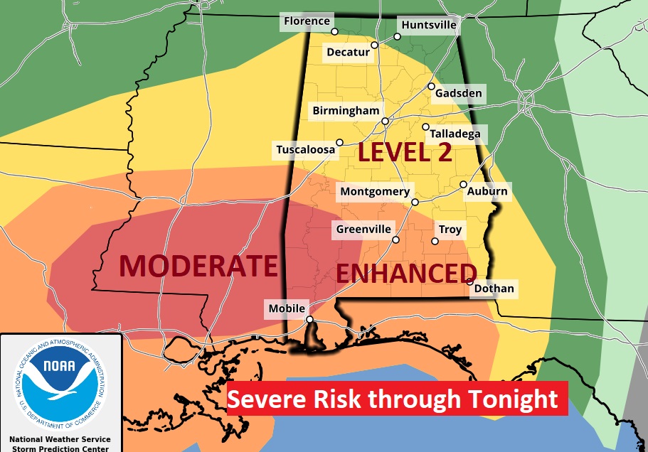
Good morning! A major multiple hazard storm system will swing through the Gulf South today and tonight. Locally very heavy rainfall amounts. Flooding is possible. There’s also rather significant Severe weather threat, too. SPC has a Level 3 Severe threat from for many of us. There’s even a Level 4 Moderate Risk across SW Alabama. There could be a few leftover showers on Thursday. Nice weather returns Friday and through the weekend. Here’s my brief forecast discussion.
TODAY: Widespread rain and thunderstorms by this afternoon and into this evening and tonight. Flood watch. Locally heavy rainfall. Some storms could be severe with damaging wind gusts. Tornadoes can’t be ruled out. Windy. SW wind 5 to 15 gusting to 25 mph. High upper 70’s. Low tonight 63.
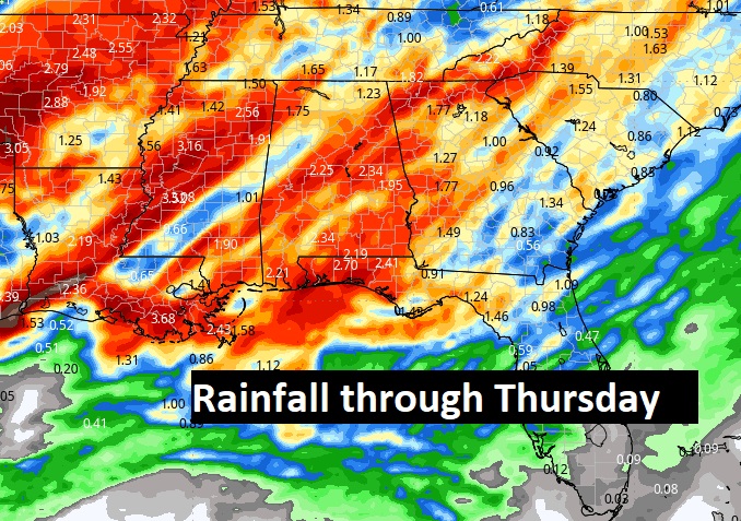
Rainfall amounts could be quite impressive. MODERATE Risk on the Excessive Rainfall Outlook. Easily 2-3”, locally more in spots. Flooding is possible.
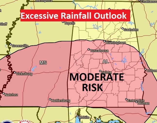
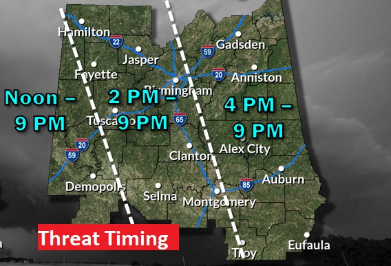
From the Storm Prediction Center” The Day 3 outlook for Wednesday/Wednesday night has been upgraded to a Level 3 risk for most of us.. There’s even a Level 4 Moderate Risk in SW Alabama’s . All modes of severe weather are on the table including tornadoes. The severe weather threat window begins in the afternoon and continues into Wednesday night.
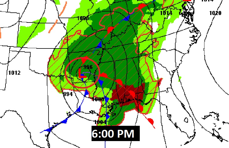
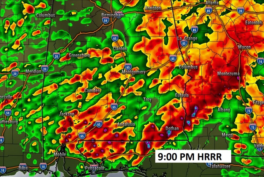
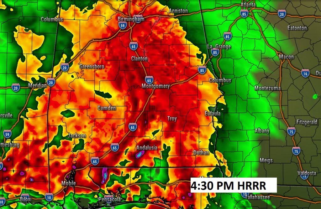
FUTURE RADAR shows the action starting this afternoon and continuing well into the evening and tonight.
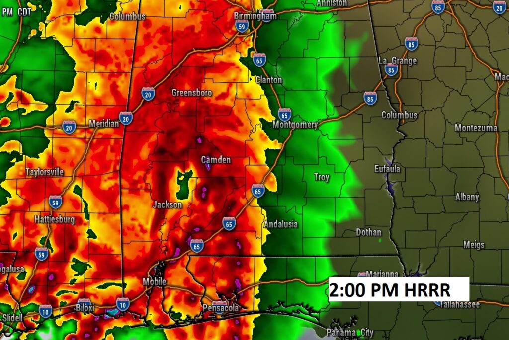
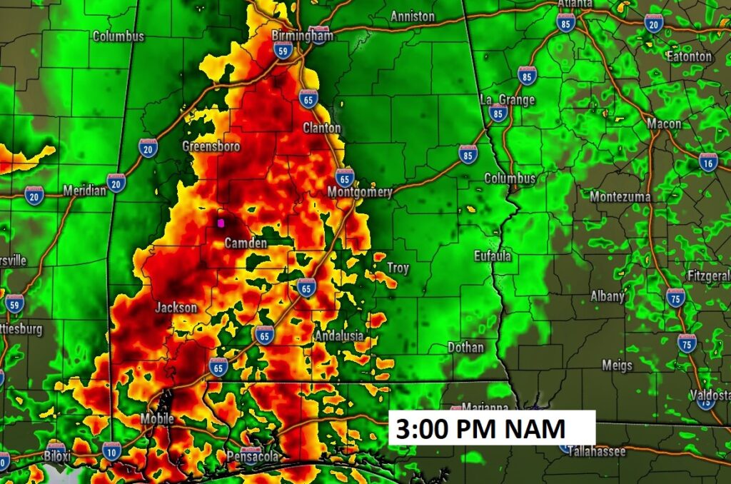
Various modes of severe of this severe weather threat leads to rather long threat window for many of us today.
.
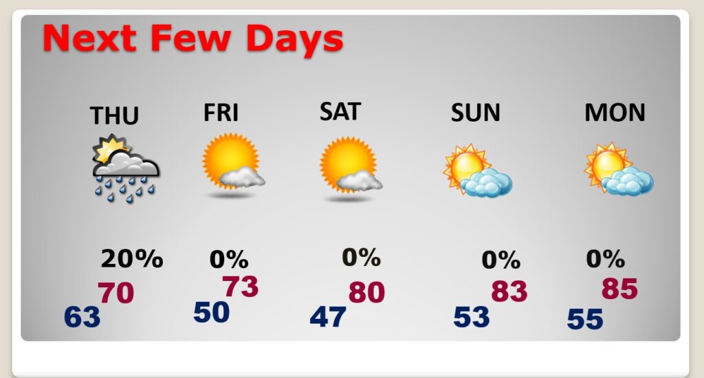
NEXT FEW DAYS: There will be leftover widely scattered showers Thursday. Nice weather returns Friday and through the weekend. Warm/comfortable weekend.
.
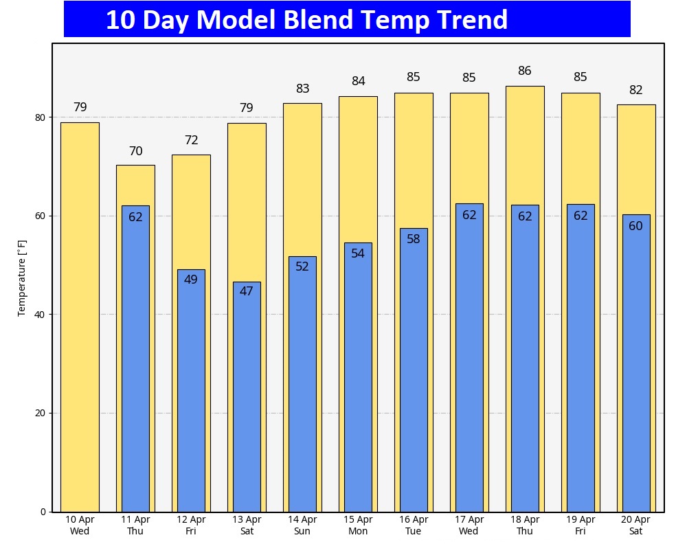
Here’s the 10 day temperature trend.
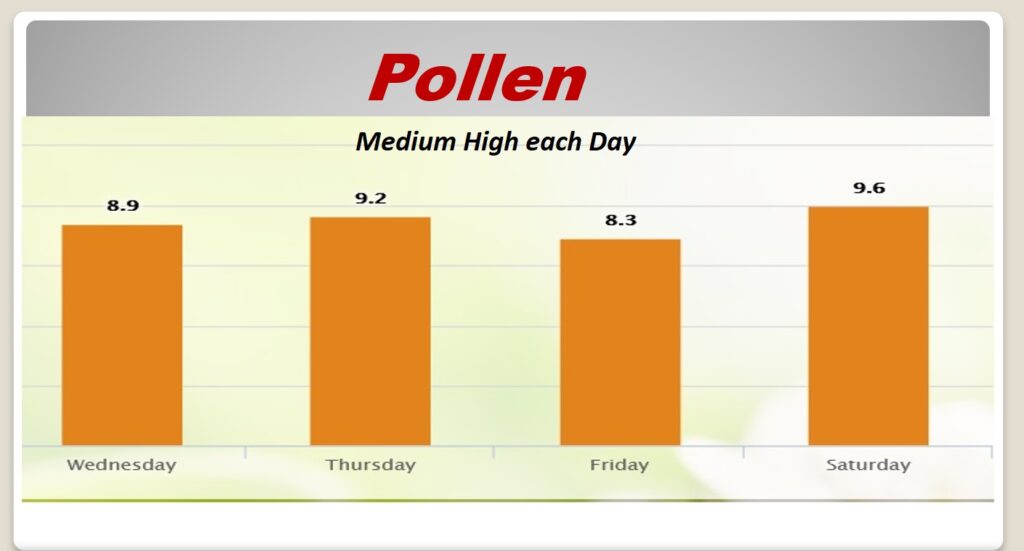
POLLEN: Here’s the forecast for the next 4 days. Medium high each day.
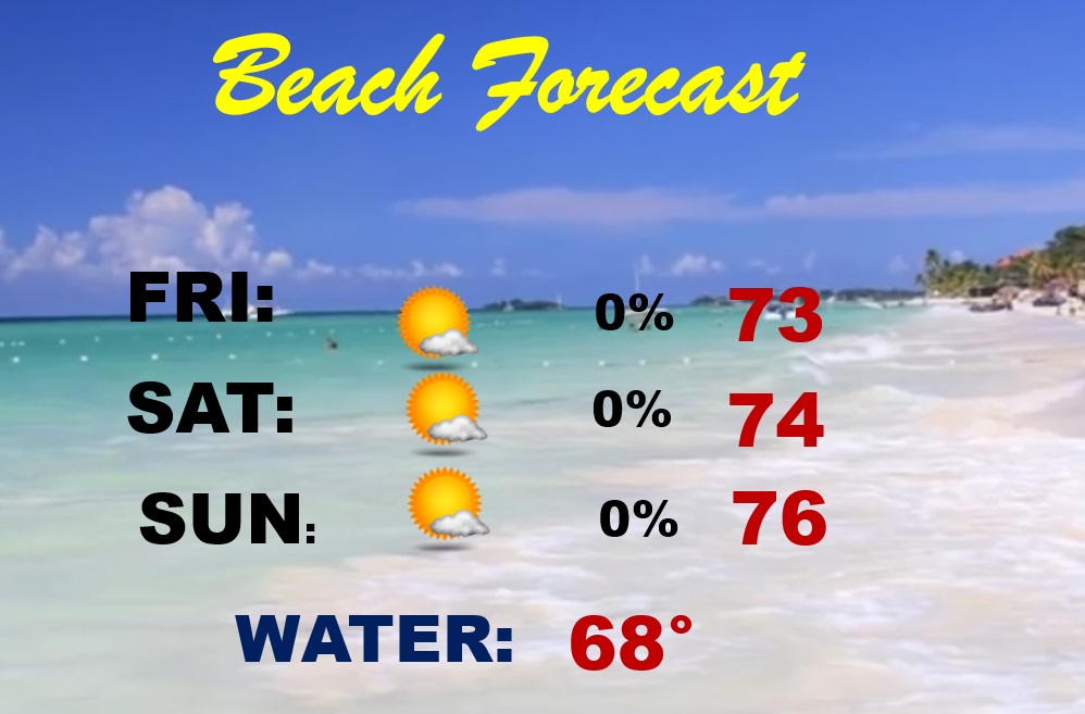
BEACH FORECAST: Looks like a really nice weekend Beach Forecast. Highs in the 70’s. Lots of sun. Gulf water still chilly at 68.
Thanks for reading the blog. There will be another complete Blog update and video forecast discussion tomorrow morning. This morning, everything is normal including LIVE on the Radio from 6 to 9AM on NewsTalk 93.1 – WACV. Stay weather aware!
–Rich