
Good morning! Our quiet storm-free, dry pattern continues. Today and tomorrow especially, highs will feel more like late May or early June. A weakening front will approach the area Wednesday, but for us, it looks a dry front. Widely scattered showers will hold off until Friday and Saturday and a better chance Sunday. Here’s my brief forecast discussion.
TODAY: Sunny & Warm. High 85. (Normal 78/52) South wind 5 to 10 mph. Increasing clouds tonight. Low 59.

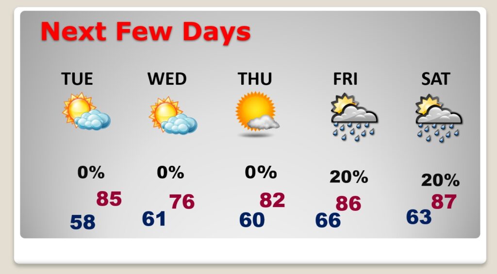
NEXT FEW DAYS: The quiet, above normal temperature pattern continues. Tuesday’s high 86. A weakening front will approach the area Wednesday, but for us, it looks a dry front. Widely scattered showers will hold off until Friday and Saturday. Better chance Sunday.
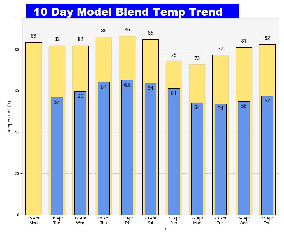
Here’s the 10 day temperature trend. Very nice…. No more cool-snaps.
POLLEN: Here’s the forecast for the next 4 days. The VERY high range continues each day.

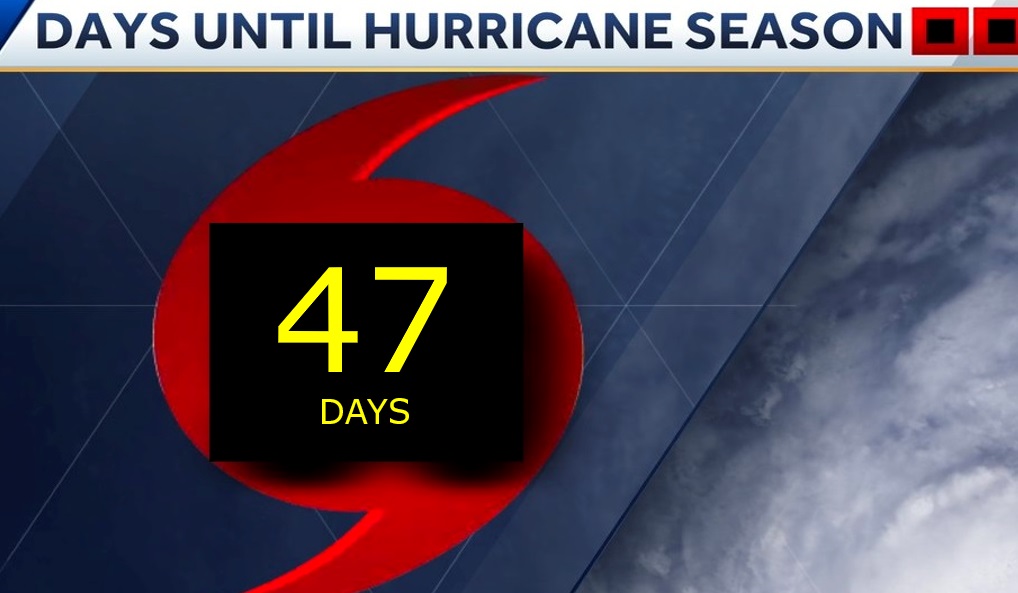
Not looking forward to Hurricane Season. It won’t be long.

This day in 2011… What’s called “The Forgotten Outbreak”. 5 dozen Alabama tornadoes. Thirteen strong tornadoes. Four dead in the Boone’s Chapel – Autuaga county EF-3 tornado. Only twelve days later was the April 27th Super Outbreak. 252 died in Alabama.


Thanks for reading the blog. There will be another complete Blog update and video forecast discussion tomorrow morning. This morning, everything is normal including LIVE on the Radio from 6 to 9AM on NewsTalk 93.1 – WACV. Have a nice day!
–Rich