
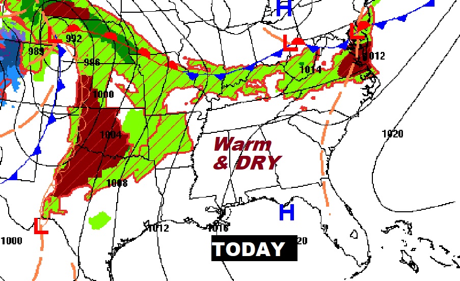
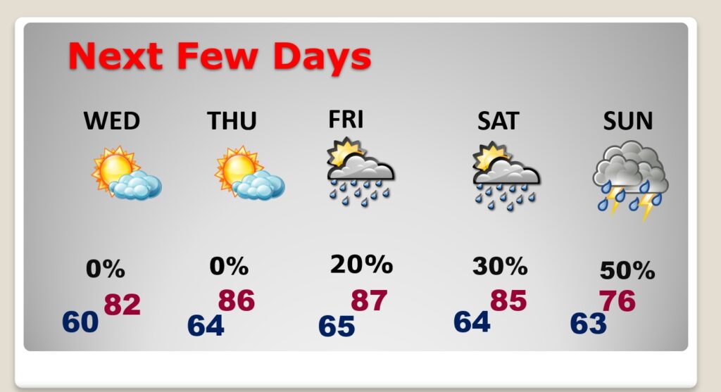
Good morning! Today should be another great day. Not as much sun, with considerable high cloudiness. But, another warm day in the middle 80’s. A weakening front will approach the area Wednesday, but for us, it looks a dry front. Widely scattered showers will hold off until possibly Saturday and a better chance of scattered showers and thunderstorms Sunday. Here’s my brief forecast discussion.
TODAY: Limited sunshine. Lots of high cloudiness. Warm for mid April. High in the middle 80’s. Mostly cloudy, mild tonight. Low 66.
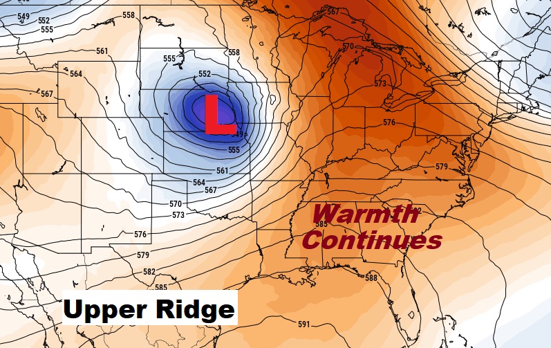
NEXT FEW DAYS: A weakening front will approach the area Wednesday, but for us, it looks a dry front. Widely scattered showers will hold off until Friday and Saturday. Scattered showers & thunderstorms Sunday.
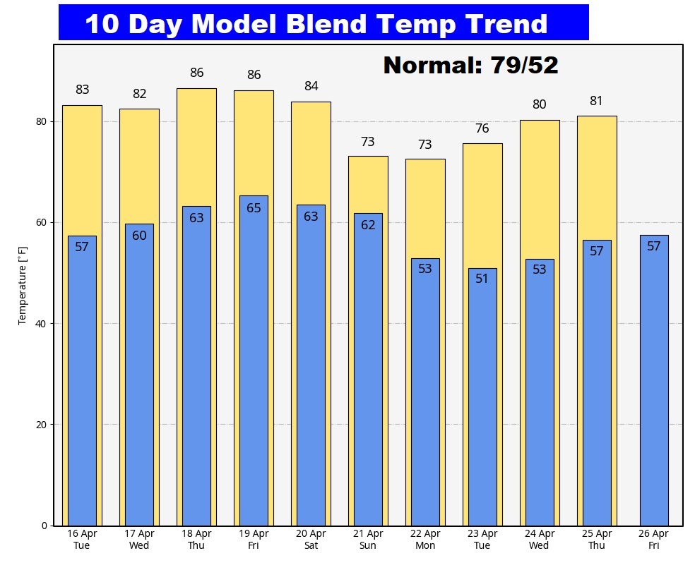
Here’s the 10 day temperature trend.
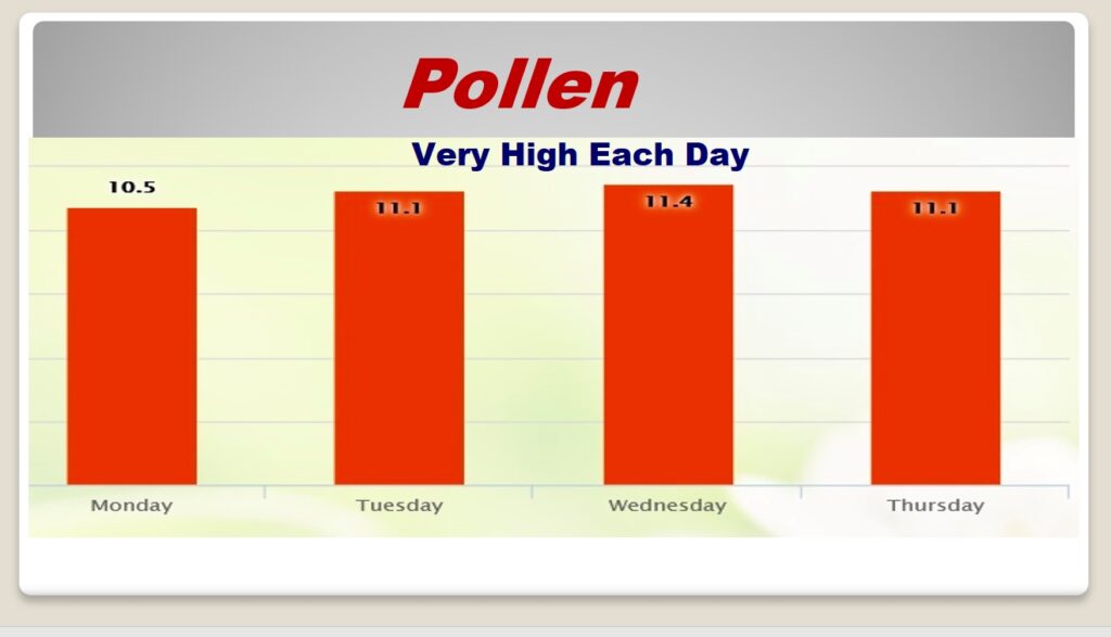
POLLEN: Here’s the forecast for the next 4 days. Tough week. Very high each of the next 4 days.
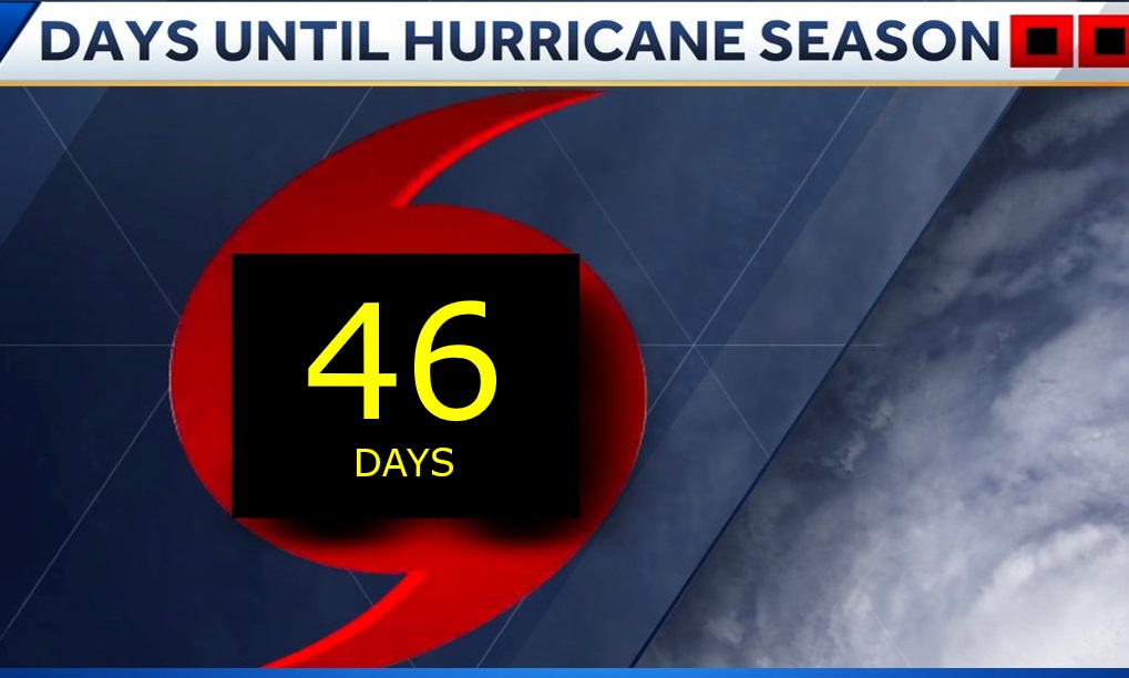
Hurricane season is not long away.
Thanks for reading the blog. There will be another complete Blog update and video forecast discussion tomorrow morning. This morning, everything is normal including LIVE on the Radio from 6 to 9AM on NewsTalk 93.1 – WACV. Have a nice day!
–Rich