
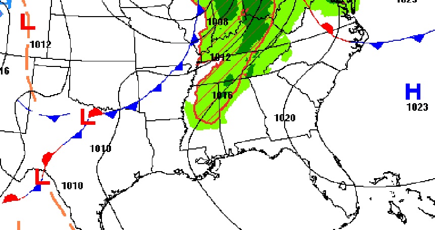
Good morning! A weakening front will approach the area the state today. Showers & storms will invade the northern counties, but for us, it looks a dry front. Widely scattered showers will hold off until possibly Friday & Saturday and a better chance of scattered showers and thunderstorms Sunday. Sunday will be much cooler. Here’s my brief forecast discussion.
TODAY: Mostly Cloudy through tonight. High 83. Southwest wind 5 to 10 mph. Low tonight 63.
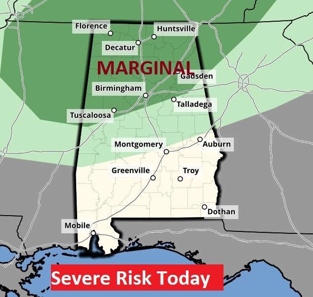
The weakening front approaching could touch off some strong storms in the northern counties. Marginal Severe Risk. Looks like it will be a dry front for us.
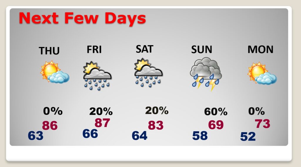
NEXT FEW DAYS: Thursday looks dry and warm.Widely scattered showers will hold off until possibly Friday & Saturday and a better chance of scattered showers and thunderstorms Sunday. The warmest day will be Friday with upper 80’s. Sunday will be much cooler. Highs in the lower 70’s.
Some of the storm Friday could be strong/severe. Marginal Risk

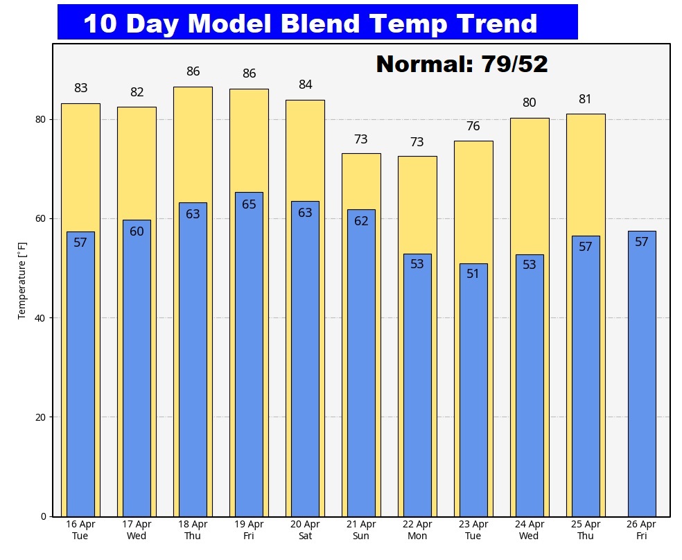
Here’s the 10 day temperature trend.
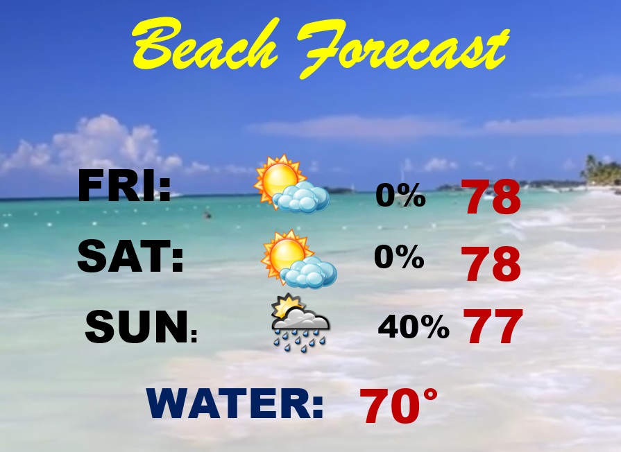
BEACH OUTLOOK: Friday and Saturday should be dry and comfortable. Scattered showers and thunderstorms return Sunday. Gukf water temperature is 70.
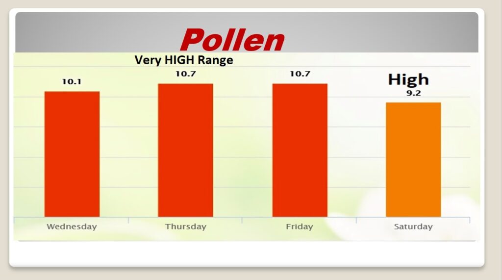
POLLEN: Here’s the forecast for the next 4 days.
Thanks for reading the blog. There will be another complete Blog update and video forecast discussion tomorrow morning. This morning, everything is normal including LIVE on the Radio from 6 to 9AM on NewsTalk 93.1 – WACV. Have a nice day!
–Rich