
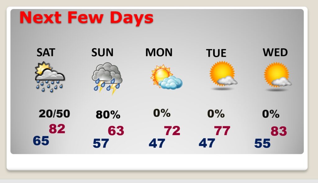
Good morning! Expect another very warm day today. Today’s high in the upper 80’s could flirt with the record of 89. Widely scattered showers will return to the radar screen today. Scattered showers Saturday. The best chance of showers and storms will be Sunday. Sunday will be much cooler with highs only in the lower 60’s. Sunshine will return Monday. Temperatures will recover next week. Here’s my brief forecast discussion.
TODAY: Limited sunshine. Widely scattered showers and thunderstorms by afternoon/evening. High in the upper 80’s. (Normal high 79) (Record high is 89 from 2006) Mild tonight. Low 66.
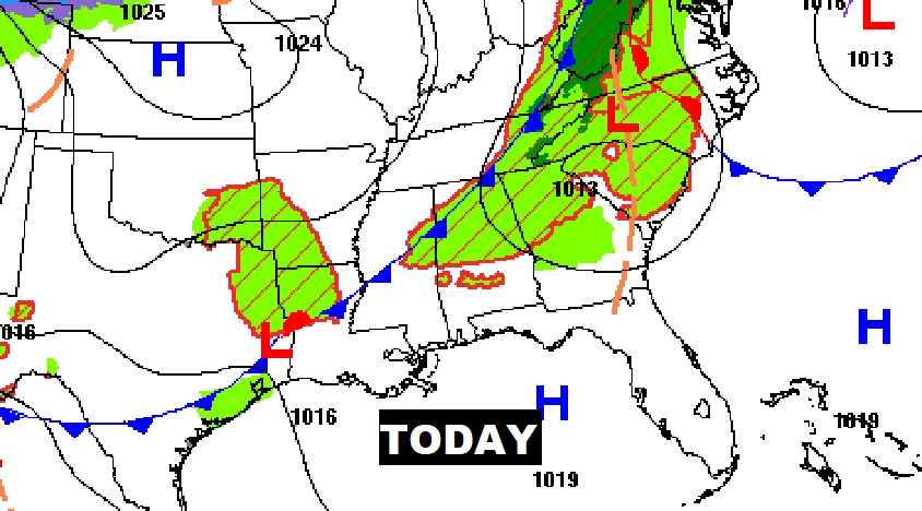
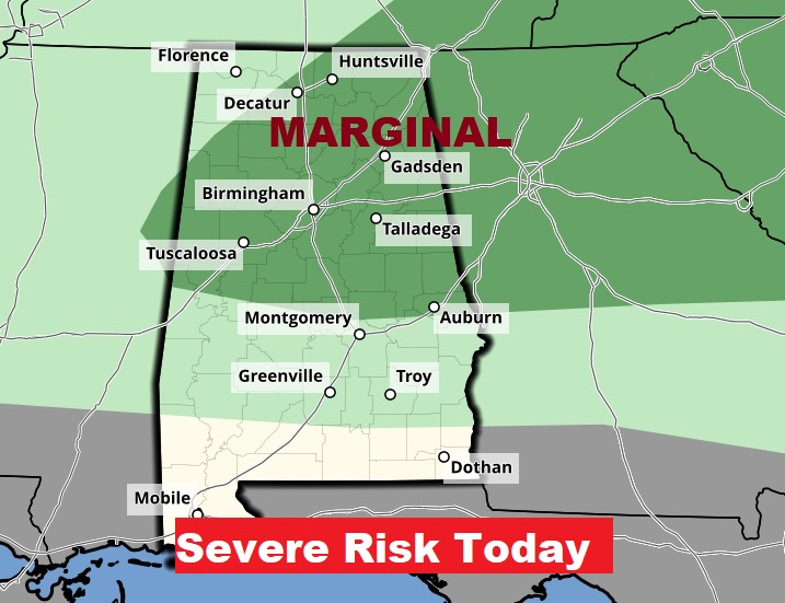
A frontal system will head south and approach the state this afternoon. Could there be a few stronger storms across the northern counties? I’m sold on that idea.
.
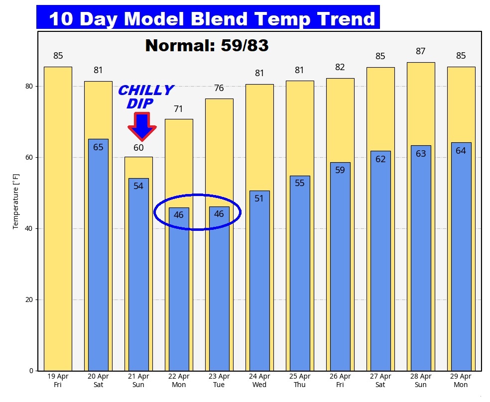
NEXT FEW DAYS: Scattered showers Saturday. The best chance of showers and storms will be Saturday night and Sunday. Saturday’s high 84. Sunday will be much cooler with highs only in the lower 60’s. Chilly mornings in the 40s Monday and Tuesday. Temperatures will recover next week as sunshine returns. Low 80’s return Wednesday.
Here’s the set up for a wet and chilly Sunday.

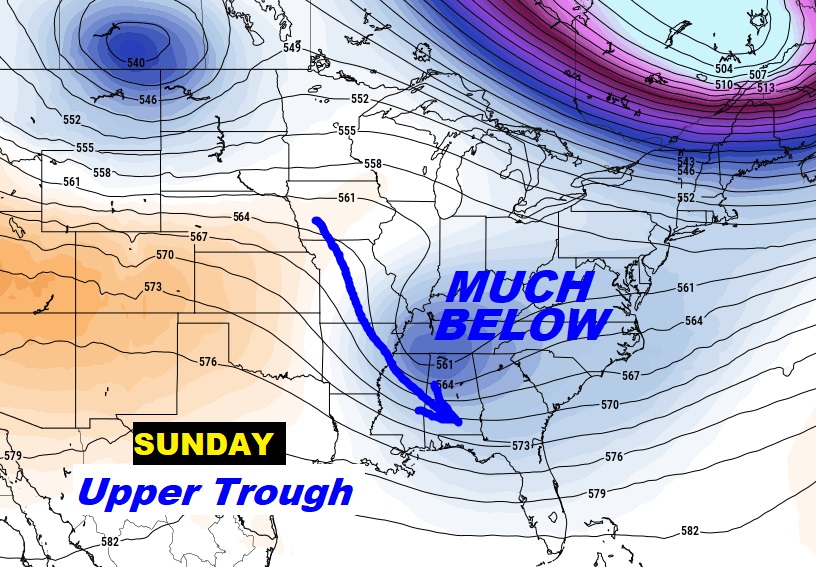
Rainfall amounts in our part of Alabama are not expected to be heavy.

Here’s the 10 day temperature trend. Brief big chill Sunday. Chilly mornings in the 40s Monday and Tuesday.
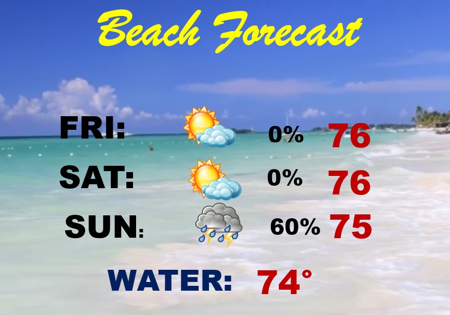
BEACH OUTLOOK: Today and Saturday should be dry and warm . Scattered showers and thunderstorms return Sunday. Gulf water temperature has warmed to 74. HIGH Rip Current Risk today through Sunday.
Thanks for reading the blog. There will be another complete Blog update and video forecast discussion tomorrow morning. This morning, everything is normal including LIVE on the Radio from 6 to 9AM on NewsTalk 93.1 – WACV. Have a nice day!
–Rich