
Good morning! Expect another very warm day today. Today’s high in the low to mid 80’s. Scattered showers and possibly a thundershower or two today. A better chance of scattered showers and storms tonight. Showers and storms become likely Sunday. Sunday will be much cooler with highs only near 60. Overnight lows will fall to the 40’s Sunday and Monday night. Sunshine will return Monday. Temperatures will recover next week. We’ll be 80 or above again by Wednesday and Thursday.
TODAY: Another warm day. High 82. Scattered showers, and maybe a few thunderstorms especially by afternoon/evening. Belter chance of scattered showers and storms tonight. Winds: Northwest 5 to 10 mph. Low tonight 57.
The weekend weather maker: Low pressure “waves” will move along a south Alabama front.
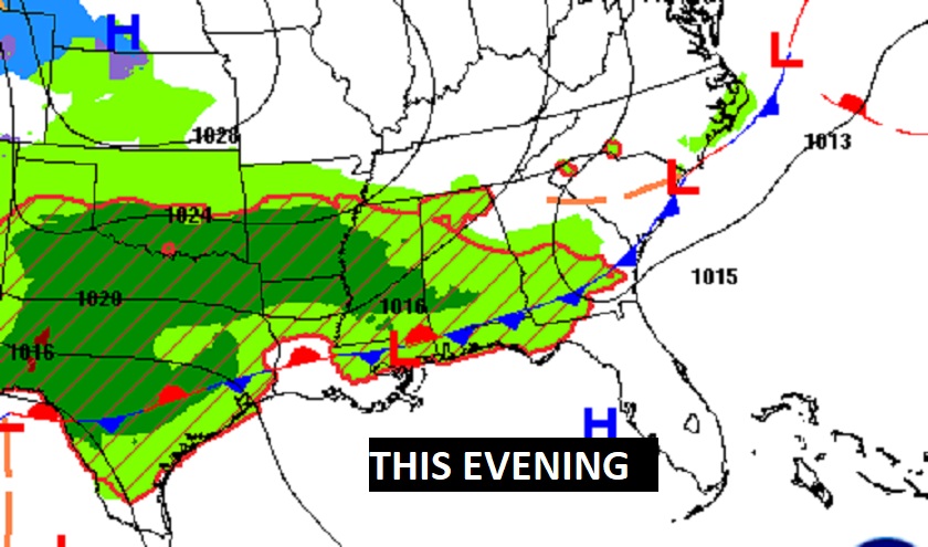
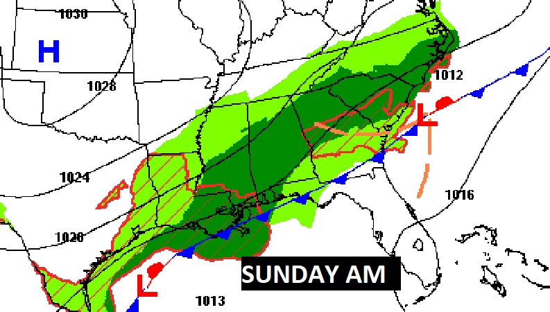
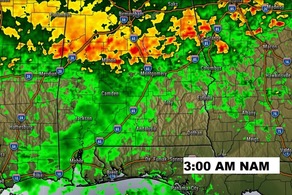
FUTURE RADAR: Showers and storms will be most numerous by late today, tonight and Sunday.
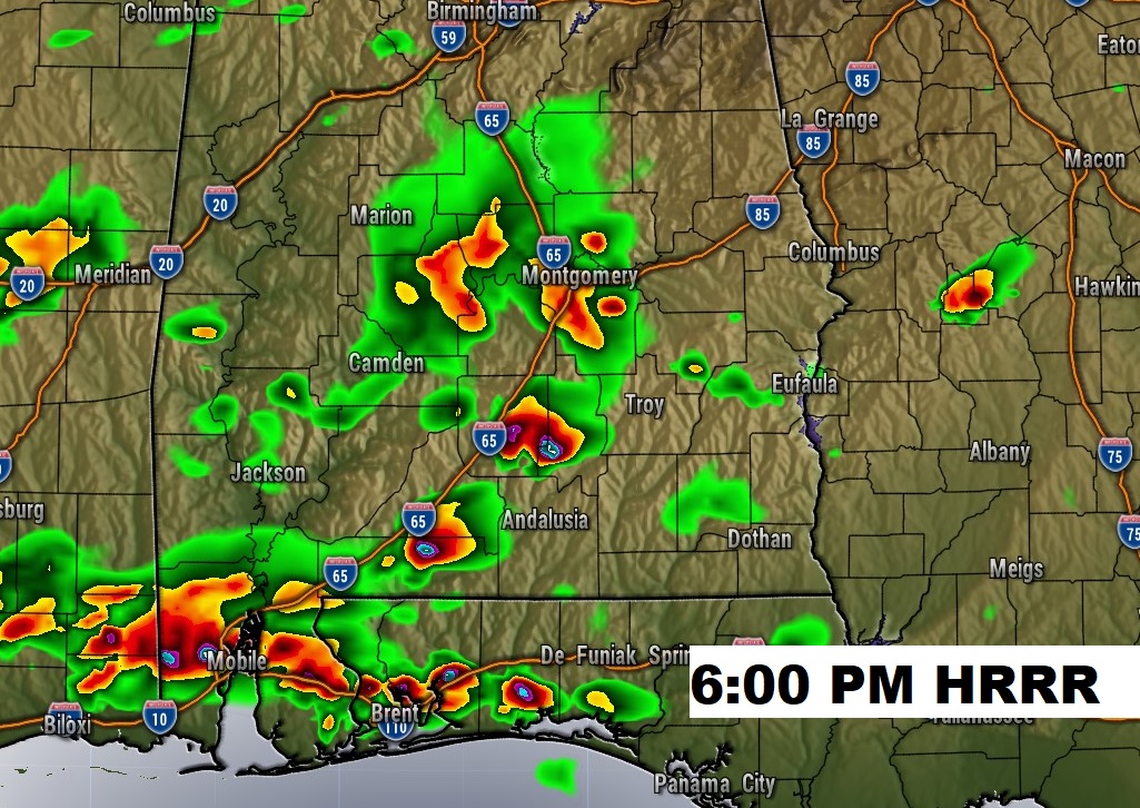
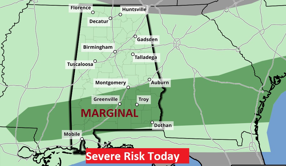
A few storms could approach severe limits in south Alabama. Marginal Risk.
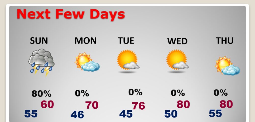
NEXT FEW DAYS: The best chance of showers and storms will be tonight and Sunday. Sunday will be much cooler with highs only in the lower 60’s. Chilly mornings in the 40s Monday and Tuesday. Temperatures will recover next week as sunshine returns. Low 80’s return by Wednesday and Thursday.
.
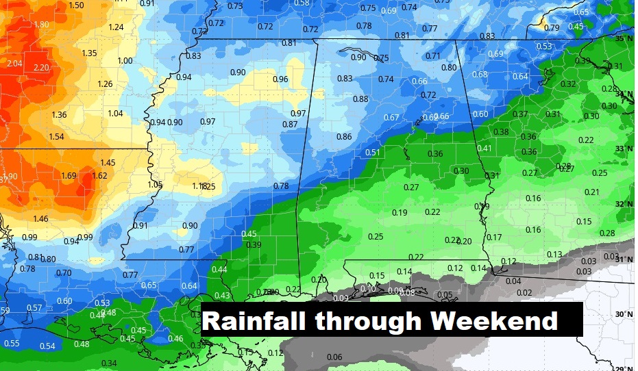
Rainfall amounts will be heaviest across the northern half of the state.
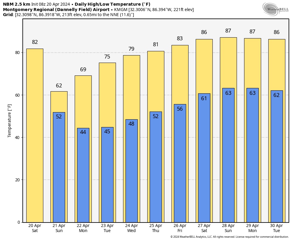
Here’s the 10 day temperature trend. Brief big chill Sunday. Chilly mornings in the 40s Monday and Tuesday. Mid-week warming.
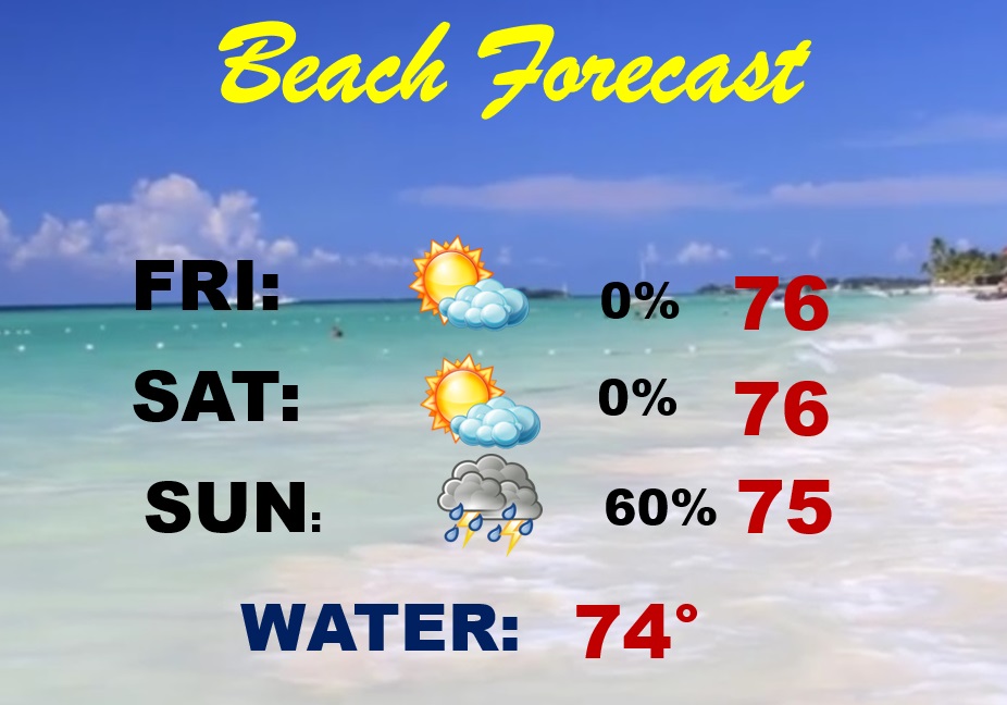
BEACH OUTLOOK: Today should be dry and warm . Scattered showers and thunderstorms return Sunday. Gulf water temperature has warmed to 74. HIGH Rip Current Risk through Monday.
Thanks for reading the blog. The next scheduled blog will be Monday morning, Have a nice weekend!
–Rich