
Good morning! After some great weekend weather, our warm pattern continues as we start this new week. A weakening approaching front will bring s risk of some spotty showers/storms as early as this afternoon, with a somewhat better chance tonight and first half of the day Tuesday. Looking ahead, the month of May will begin on a very warm note as temperatures tease the 90 degree mark Wednesday and Thursday. Another small chance of showers and storms will return Friday. Here’s my brief forecast discussion.
TODAY: Expect a very warm day, with a sun and cloud mix. High 86. Risk of some widely scattered showers, maybe a thunderstorm or two during the afternoon hours, but more likely tonight. South winds 15 to 15 gusting to 20 mph. Scattered showers and thunderstorms tonight, Low tonight 64. (Normal 81/56)
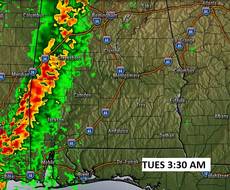
FUTURE RADAR: The better rain chances arrive in the wee hours of tomorrow morning and through at least mid-day Tuesday, Rain chances will decrease by late Tuesday.

NEXT FEW DAYS: Scattered showers and thunderstorms first half of the day Tuesday. Mostly sunny Tuesday afternoon. The month of May will begin on a very warm note as temperatures tease the 90 degree mark Wednesday and Thursday. Another small chance of showers and storms will return Friday and Saturday. Widely scattered.

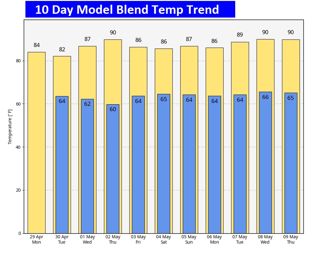
Here’s the 10 day temperature trend. A very warm series of fdays as May begins.
Thanks for reading the blog. There will be another complete Blog update and video forecast discussion tomorrow morning. This morning, everything is normal including LIVE on the Radio from 6 to 9AM on NewsTalk 93.1 – WACV. Have a nice day!
–Rich